![](/images/other/stat-length.png)
![Tocht Stappen Théziers - Domazan et le Castelas - Théziers - Photo](https://media.geolcdn.com/t/1900/400/ext.pjpeg?maxdim=2&url=https%3A%2F%2Fservices.sitytrail.com%2FGeolivesWS%2FDownloadMedia.ashx%3FTrailID%3D317563%26Media%3D16821_6.jpg)
Domazan et le Castelas - Théziers
tracegps
Gebruiker
![Lengte](/images/other/stat-length.png)
![Max. hoogte](https://static1.geolcdn.com/siteimages/upload/files/1508320355ic_sort_altitude_max_24dp.png)
![Positief hoogteverschil](https://static1.geolcdn.com/siteimages/upload/files/1508320355ic_sort_den_pos_24dp.png)
![Km-Effort](/images/other/stat-length.png)
![Min. hoogte](https://static1.geolcdn.com/siteimages/upload/files/1508320355ic_sort_altitude_min_24dp.png)
![Negatief hoogteverschil](https://static1.geolcdn.com/siteimages/upload/files/1508320355ic_sort_den_neg_24dp.png)
![Boucle](https://static1.geolcdn.com/siteimages/upload/files/16400158638029165_repeat_loop_refresh_sync_direction_icon.png)
![Stappen](https://static1.geolcdn.com/sitytour/trail-icons/101.png)
5h00
Moeilijkheid : Moeilijk
![Scan deze QR-code om de tocht te openen in de SityTrail-applicatie](https://capi.geolives.com/qq0zvz2zws4bq2lad0pu/sitytour/trails/317563/qr.png?size=200)
Gratisgps-wandelapplicatie
Over ons
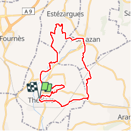
Tocht Stappen van 18,2 km beschikbaar op Occitanië, Gard, Théziers. Deze tocht wordt voorgesteld door tracegps.
Beschrijving
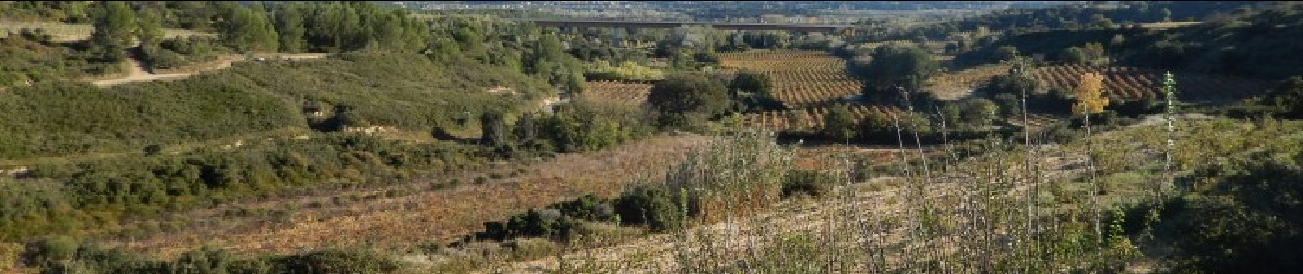
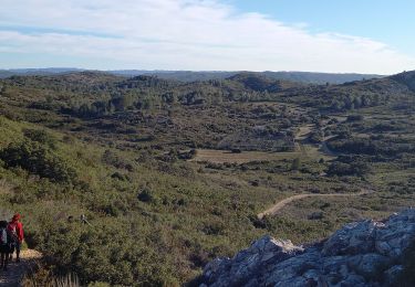
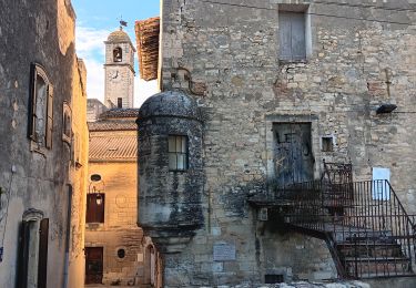
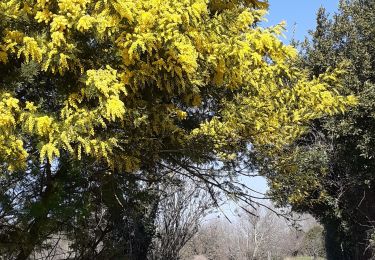
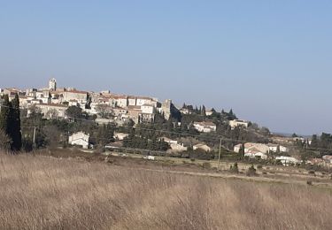
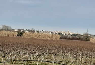
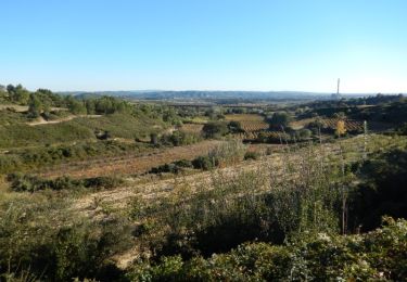
Du parking en haut du village de Théziers, partir vers l'église et descendre la Rue des Escaliers Prolongés. Traverser l’Avenue de la Gare et poursuivre parmi les vignes. Prendre le GR à droite jusqu’a la D19, la couper et suivre un bon chemin sablonneux. Au carrefour en "Y", monter dans la garrigue à droite pour atteindre un promontoire, belle vue sur Aramon et la vallée du Rhône. Longer les vignes et descendre par une sente jusqu'à un bon chemin. Passer sous le viaduc TGV, parvenir à un col et descendre à Domazan. Visiter puis se diriger vers Estezargues, très beau vignoble, avant de retourner vers Thézier. Monter au Castelas, aller voir la Chapelle St Amand, avant de retourner au parking par le GR. Autre départ possible de la place de Domazan. Visite possible des caves et caveaux de Domazan et Estézargues. Quelques portages en VTT. Bonne rando.
Plaatsbepaling
Opmerkingen
Wandeltochten in de omgeving
![Tocht Stappen Aramon - Les Castillones - Photo](https://media.geolcdn.com/t/375/260/ed06a468-8718-46c2-85f4-099025efba3e.jpg&format=jpg&maxdim=2)
![Stappen Stappen](https://static1.geolcdn.com/sitytour/trail-icons/101.png)
![Tocht Stappen Remoulins - remoulins by night - Photo](https://media.geolcdn.com/t/375/260/2d0bb882-ddf6-4872-bb3c-3db0a3975dfb.jpg&format=jpg&maxdim=2)
![Stappen Stappen](https://static1.geolcdn.com/sitytour/trail-icons/101.png)
Stappen
![](/images/other/stat-length.png)
![](https://static1.geolcdn.com/siteimages/upload/files/16400158638029165_repeat_loop_refresh_sync_direction_icon.png)
![Tocht Stappen Aramon - aramon - les castillonnes - Photo](https://media.geolcdn.com/t/375/260/631556ce-9f18-4093-a88d-7e024a6992af.jpg&format=jpg&maxdim=2)
![Stappen Stappen](https://static1.geolcdn.com/sitytour/trail-icons/101.png)
Stappen
![](/images/other/stat-length.png)
![](https://static1.geolcdn.com/siteimages/upload/files/16400158638029165_repeat_loop_refresh_sync_direction_icon.png)
![Tocht Stappen Remoulins - Remoulins aqueducs - Photo](https://media.geolcdn.com/t/375/260/c3868c64-c85d-48f5-855f-368d2754ff70.jpg&format=jpg&maxdim=2)
![Stappen Stappen](https://static1.geolcdn.com/sitytour/trail-icons/101.png)
Stappen
![](/images/other/stat-length.png)
![](https://static1.geolcdn.com/siteimages/upload/files/16400158638029165_repeat_loop_refresh_sync_direction_icon.png)
![Tocht Stappen Remoulins - REMOULINS Léproserie de Castillon du Gard - Photo](https://media.geolcdn.com/t/375/260/adf5390a-4e1c-4815-ba5f-4fe915b31cb9.jpg&format=jpg&maxdim=2)
![Stappen Stappen](https://static1.geolcdn.com/sitytour/trail-icons/101.png)
Stappen
![](/images/other/stat-length.png)
![](https://static1.geolcdn.com/siteimages/upload/files/16400158638029165_repeat_loop_refresh_sync_direction_icon.png)
![Tocht Stappen Théziers - Trace rando Théziers - Fosses de Fournès - Photo](https://media.geolcdn.com/t/375/260/ext.jpg?maxdim=2&url=https%3A%2F%2Fstatic1.geolcdn.com%2Fsiteimages%2Fupload%2Ffiles%2F1553511878bg_sport_marche.png)
![Stappen Stappen](https://static1.geolcdn.com/sitytour/trail-icons/101.png)
Stappen
![](/images/other/stat-length.png)
![](https://static1.geolcdn.com/siteimages/upload/files/16400158638029165_repeat_loop_refresh_sync_direction_icon.png)
![Tocht Stappen Théziers - THEZIERS Le Castellas - Photo](https://media.geolcdn.com/t/375/260/1931c0f3-f5e4-4dd7-be42-dfb6720c7507.jpg&format=jpg&maxdim=2)
![Stappen Stappen](https://static1.geolcdn.com/sitytour/trail-icons/101.png)
Stappen
![](/images/other/stat-length.png)
![](https://static1.geolcdn.com/siteimages/upload/files/16400158638029165_repeat_loop_refresh_sync_direction_icon.png)
![Tocht Stappen Montfrin - Montfrin chapelle St Amand - Photo](https://media.geolcdn.com/t/375/260/8c47ddaf-43e8-4d7c-b93e-e652676ef26b.jpg&format=jpg&maxdim=2)
![Stappen Stappen](https://static1.geolcdn.com/sitytour/trail-icons/101.png)
Stappen
![](/images/other/stat-length.png)
![](https://static1.geolcdn.com/siteimages/upload/files/16400158638029165_repeat_loop_refresh_sync_direction_icon.png)
![Tocht Mountainbike Théziers - Domazan et le Castelas - Théziers - Photo](https://media.geolcdn.com/t/375/260/ext.jpg?maxdim=2&url=https%3A%2F%2Fservices.sitytrail.com%2FGeolivesWS%2FDownloadMedia.ashx%3FTrailID%3D317564%26Media%3D16821_6.jpg)
![Mountainbike Mountainbike](https://static1.geolcdn.com/sitytour/trail-icons/202.png)
Mountainbike
![](/images/other/stat-length.png)
![](https://static1.geolcdn.com/siteimages/upload/files/16400158638029165_repeat_loop_refresh_sync_direction_icon.png)