![](/images/other/stat-length.png)
![Tocht Stappen Bayons - Baudinard - Lac des Monges - Crête du Raus - Photo](https://media.geolcdn.com/t/1900/400/ext.pjpeg?maxdim=2&url=https%3A%2F%2Fservices.sitytrail.com%2FGeolivesWS%2FDownloadMedia.ashx%3FTrailID%3D317537%26Media%3D16780_6.jpg)
Baudinard - Lac des Monges - Crête du Raus
tracegps
Gebruiker
![Lengte](/images/other/stat-length.png)
![Max. hoogte](https://static1.geolcdn.com/siteimages/upload/files/1508320355ic_sort_altitude_max_24dp.png)
![Positief hoogteverschil](https://static1.geolcdn.com/siteimages/upload/files/1508320355ic_sort_den_pos_24dp.png)
![Km-Effort](/images/other/stat-length.png)
![Min. hoogte](https://static1.geolcdn.com/siteimages/upload/files/1508320355ic_sort_altitude_min_24dp.png)
![Negatief hoogteverschil](https://static1.geolcdn.com/siteimages/upload/files/1508320355ic_sort_den_neg_24dp.png)
![Boucle](https://static1.geolcdn.com/siteimages/upload/files/16400158638029165_repeat_loop_refresh_sync_direction_icon.png)
![Stappen](https://static1.geolcdn.com/sitytour/trail-icons/101.png)
5h30
Moeilijkheid : Medium
![Scan deze QR-code om de tocht te openen in de SityTrail-applicatie](https://capi.geolives.com/qq0zvz2zws4bq2lad0pu/sitytour/trails/317537/qr.png?size=200)
Gratisgps-wandelapplicatie
Over ons
Tocht Stappen van 15,8 km beschikbaar op Provence-Alpes-Côte d'Azur, Alpes-de-Haute-Provence, Bayons. Deze tocht wordt voorgesteld door tracegps.
Beschrijving
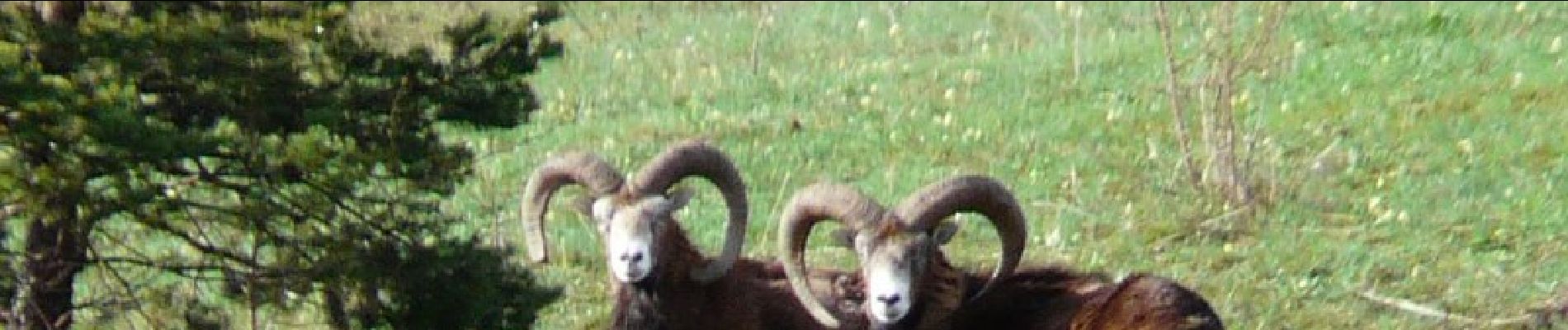
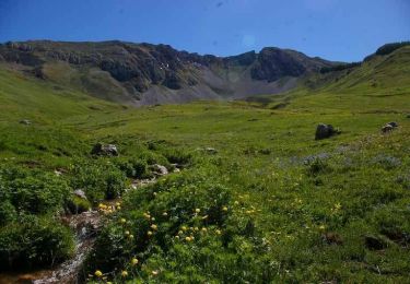
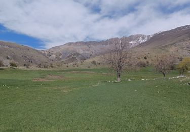
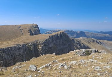
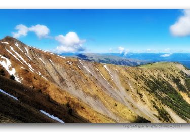
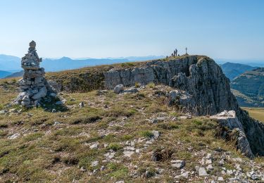
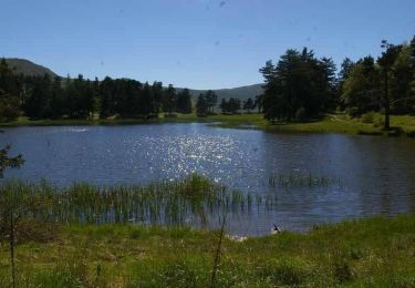
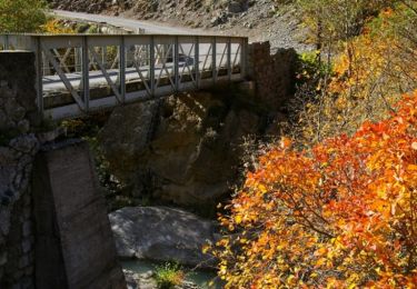
De Reynier prendre la piste qui mène à Baudinard, sur environ 5km. Se garer au mieux au plus près de l'embranchement de la Sapie. De là, traverser Baudinard, prendre le sentier fléché Lac des Monges où on arrive en 1 heure après un raidillon. Du lac prendre la piste en direction de Monges jusqu'au bout où on prend un sentier sympa sous les mélèzes qui nous mène à la Crête du Raus. On peut pousser en un aller-retour jusqu'au sommet des Monges (200m de D et 4 km A/R en plus). Du signal à la crête de Raus, descendre le fil, superbe vue panoramique, jusqu'au col de la Sapie. On descend à vue à travers des alpages vers une ruine et un enclos que l'on traverse. On trouve le sentier de retour plus ou moins balisé en rouge, qui nous mène au point de départ via piste et route selon l'endroit où on a laissé la voiture.
Plaatsbepaling
Opmerkingen
Wandeltochten in de omgeving
![Tocht Stappen Authon - 20180912_Monges_Authon_Boucle_Sommet Coste belle - Photo](https://media.geolcdn.com/t/375/260/ext.jpg?maxdim=2&url=https%3A%2F%2Fservices.sitytrail.com%2FGeolivesWS%2FDownloadMedia.ashx%3FTrailID%3D1038487%26Media%3D0586817d-9cc9-405c-aa4b-393c8043fb42.jpg)
![Stappen Stappen](https://static1.geolcdn.com/sitytour/trail-icons/101.png)
Stappen
![](/images/other/stat-length.png)
![](https://static1.geolcdn.com/siteimages/upload/files/16400158638029165_repeat_loop_refresh_sync_direction_icon.png)
![Tocht Stappen Bayons - Le sommet des Monges - Bayons - Photo](https://media.geolcdn.com/t/375/260/ext.jpg?maxdim=2&url=https%3A%2F%2Fservices.sitytrail.com%2FGeolivesWS%2FDownloadMedia.ashx%3FTrailID%3D112809%26Media%3D12488_5.jpg)
![Stappen Stappen](https://static1.geolcdn.com/sitytour/trail-icons/101.png)
Stappen
![](/images/other/stat-length.png)
![](https://static1.geolcdn.com/siteimages/upload/files/16400158638029165_repeat_loop_refresh_sync_direction_icon.png)
![Tocht Stappen Authon - AUTHON . COL DE LA SAPIE .CRETE DU CLOT DES MARTHES . CABAN DE CHINE N - Photo](https://media.geolcdn.com/t/375/260/1a094800-6822-4f02-a313-8060ac76a0c2.jpg&format=jpg&maxdim=2)
![Stappen Stappen](https://static1.geolcdn.com/sitytour/trail-icons/101.png)
Stappen
![](/images/other/stat-length.png)
![](https://static1.geolcdn.com/siteimages/upload/files/16400158638029165_repeat_loop_refresh_sync_direction_icon.png)
![Tocht Te voet Authon - SityTrail - Les Monges au départ de Authon - Photo](https://media.geolcdn.com/t/375/260/dd7c9a01-878d-406c-bd6f-593236ad6bc5.jpg&format=jpg&maxdim=2)
![Te voet Te voet](https://static1.geolcdn.com/sitytour/trail-icons/100.png)
Te voet
![](/images/other/stat-length.png)
![](https://static1.geolcdn.com/siteimages/upload/files/16400158638029165_repeat_loop_refresh_sync_direction_icon.png)
![Tocht Stappen Bayons - Clot Ginoux via Grande Gineste - Photo](https://media.geolcdn.com/t/375/260/686dad5f-5401-490b-9858-e10d2bf7bdfe.jpg&format=jpg&maxdim=2)
![Stappen Stappen](https://static1.geolcdn.com/sitytour/trail-icons/101.png)
Stappen
![](/images/other/stat-length.png)
![](https://static1.geolcdn.com/siteimages/upload/files/16400158638029165_repeat_loop_refresh_sync_direction_icon.png)
![Tocht Stappen Authon - Sommet des Monges - Photo](https://media.geolcdn.com/t/375/260/41a53558-5b6a-4583-8a88-03fc12a3cd91.jpg&format=jpg&maxdim=2)
![Stappen Stappen](https://static1.geolcdn.com/sitytour/trail-icons/101.png)
Stappen
![](/images/other/stat-length.png)
![](https://static1.geolcdn.com/siteimages/upload/files/16400158638029165_repeat_loop_refresh_sync_direction_icon.png)
![Tocht Stappen Bayons - Move - Photo](https://media.geolcdn.com/t/375/260/ext.jpg?maxdim=2&url=https%3A%2F%2Fstatic1.geolcdn.com%2Fsiteimages%2Fupload%2Ffiles%2F1553511878bg_sport_marche.png)
![Stappen Stappen](https://static1.geolcdn.com/sitytour/trail-icons/101.png)
Stappen
![](/images/other/stat-length.png)
![](https://static1.geolcdn.com/siteimages/upload/files/16400158638029165_repeat_loop_refresh_sync_direction_icon.png)
![Tocht Stappen Bayons - L'Oratoire - Bayons (Esparron la Bâtie) - Photo](https://media.geolcdn.com/t/375/260/ext.jpg?maxdim=2&url=https%3A%2F%2Fservices.sitytrail.com%2FGeolivesWS%2FDownloadMedia.ashx%3FTrailID%3D112810%26Media%3D12497_4.jpg)
![Stappen Stappen](https://static1.geolcdn.com/sitytour/trail-icons/101.png)
Stappen
![](/images/other/stat-length.png)
![](https://static1.geolcdn.com/siteimages/upload/files/16400158638029165_repeat_loop_refresh_sync_direction_icon.png)
![Tocht Stappen Bayons - Le Tour du Puy - Reynier - Photo](https://media.geolcdn.com/t/375/260/ext.jpg?maxdim=2&url=https%3A%2F%2Fservices.sitytrail.com%2FGeolivesWS%2FDownloadMedia.ashx%3FTrailID%3D112792%26Media%3D12412_4.jpg)
![Stappen Stappen](https://static1.geolcdn.com/sitytour/trail-icons/101.png)
Stappen
![](/images/other/stat-length.png)
![](https://static1.geolcdn.com/siteimages/upload/files/16400158638029165_repeat_loop_refresh_sync_direction_icon.png)