![](/images/other/stat-length.png)
![Tocht Paard Saint-Rivoal - Autour de St Rivoal par le lac du Drennec - Photo](https://media.geolcdn.com/t/1900/400/ext.pjpeg?maxdim=2&url=https%3A%2F%2Fservices.sitytrail.com%2FGeolivesWS%2FDownloadMedia.ashx%3FTrailID%3D317263%26Media%3D16448_6.jpg)
Autour de St Rivoal par le lac du Drennec
tracegps
Gebruiker
![Lengte](/images/other/stat-length.png)
![Max. hoogte](https://static1.geolcdn.com/siteimages/upload/files/1508320355ic_sort_altitude_max_24dp.png)
![Positief hoogteverschil](https://static1.geolcdn.com/siteimages/upload/files/1508320355ic_sort_den_pos_24dp.png)
![Km-Effort](/images/other/stat-length.png)
![Min. hoogte](https://static1.geolcdn.com/siteimages/upload/files/1508320355ic_sort_altitude_min_24dp.png)
![Negatief hoogteverschil](https://static1.geolcdn.com/siteimages/upload/files/1508320355ic_sort_den_neg_24dp.png)
![Boucle](https://static1.geolcdn.com/siteimages/upload/files/16400158638029165_repeat_loop_refresh_sync_direction_icon.png)
![Paard](https://static1.geolcdn.com/sitytour/trail-icons/300.png)
5h00
Moeilijkheid : Moeilijk
![Scan deze QR-code om de tocht te openen in de SityTrail-applicatie](https://capi.geolives.com/qq0zvz2zws4bq2lad0pu/sitytour/trails/317263/qr.png?size=200)
Gratisgps-wandelapplicatie
Over ons
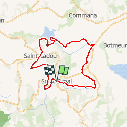
Tocht Paard van 30 km beschikbaar op Bretagne, Finistère, Saint-Rivoal. Deze tocht wordt voorgesteld door tracegps.
Beschrijving
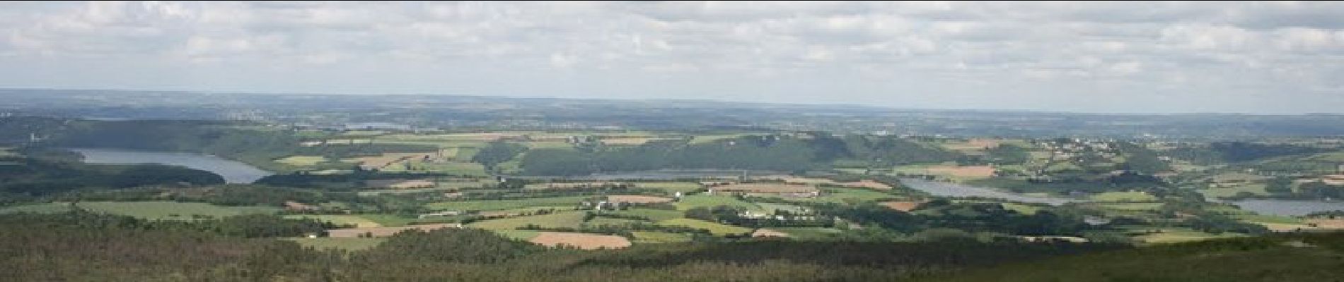
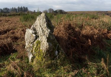
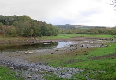
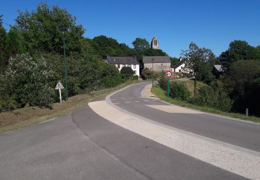
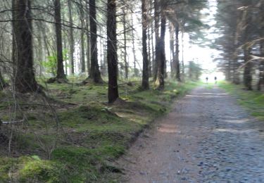
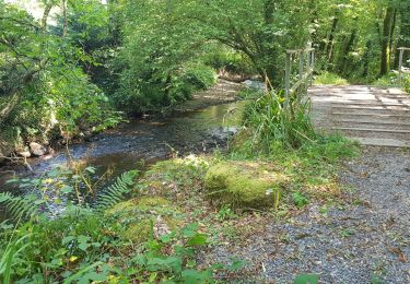
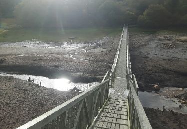
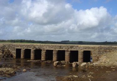
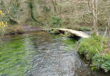
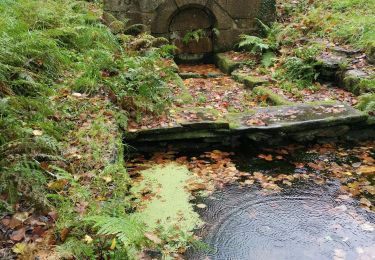
Une belle journée à cheval en perspective au cœur des Monts d'Arrée avec une boucle à partir de St Rivoal via le lac du Drennec. Des paysages magnifiques avec notamment la route des crêtes et le célèbre point de vue à la chapelle St Michel de Braspart. Un circuit un peu éprouvant pour les chevaux. Possibilité de faire une pause au lac du Drennec. Possibilité aussi de faire une étape au gîte de St Rivoal et de repartir le lendemain pour d'autres aventures dans les Monts d'Arrée à partir de St Rivoal.
Plaatsbepaling
Opmerkingen
Wandeltochten in de omgeving
![Tocht Te voet Saint-Rivoal - Landes et Tourbières - Photo](https://media.geolcdn.com/t/375/260/c5b98d78-e599-4d6a-ae17-467d21882015.jpeg&format=jpg&maxdim=2)
![Te voet Te voet](https://static1.geolcdn.com/sitytour/trail-icons/100.png)
Te voet
![](/images/other/stat-length.png)
![](https://static1.geolcdn.com/siteimages/upload/files/16400158638029165_repeat_loop_refresh_sync_direction_icon.png)
![Tocht Te voet Commana - Tour du Lac du Drennec - Photo](https://media.geolcdn.com/t/375/260/217e9b5b-dfd1-47dd-bef6-7dae7db515fe.jpeg&format=jpg&maxdim=2)
![Te voet Te voet](https://static1.geolcdn.com/sitytour/trail-icons/100.png)
Te voet
![](/images/other/stat-length.png)
![](https://static1.geolcdn.com/siteimages/upload/files/16400158638029165_repeat_loop_refresh_sync_direction_icon.png)
![Tocht Te voet Botmeur - Brasparts Circuit des landes et tourbières - Photo](https://media.geolcdn.com/t/375/260/98159458-f3c1-4612-bed6-39d858fe0671.jpeg&format=jpg&maxdim=2)
![Te voet Te voet](https://static1.geolcdn.com/sitytour/trail-icons/100.png)
Te voet
![](/images/other/stat-length.png)
![](https://static1.geolcdn.com/siteimages/upload/files/16400158638029165_repeat_loop_refresh_sync_direction_icon.png)
![Stappen Stappen](https://static1.geolcdn.com/sitytour/trail-icons/101.png)
Stappen
![](/images/other/stat-length.png)
![](https://static1.geolcdn.com/siteimages/upload/files/16400158638029165_repeat_loop_refresh_sync_direction_icon.png)
![Tocht Stappen Saint-Rivoal - GR_37_FA_12_St-Rivoal_Loperec_20200811 - Photo](https://media.geolcdn.com/t/375/260/f5ace299-8c7f-44c6-82e9-6da866129eef.jpg&format=jpg&maxdim=2)
![Stappen Stappen](https://static1.geolcdn.com/sitytour/trail-icons/101.png)
Stappen
![](/images/other/stat-length.png)
![](https://static1.geolcdn.com/siteimages/upload/files/16400158638029165_repeat_loop_refresh_sync_direction_icon.png)
![Tocht Stappen Sizun - Tour du lac du Drennec - Photo](https://media.geolcdn.com/t/375/260/ext.jpg?maxdim=2&url=https%3A%2F%2Fservices.sitytrail.com%2FGeolivesWS%2FDownloadMedia.ashx%3FTrailID%3D656775%26Media%3Dfix__20161106144537.jpg)
![Stappen Stappen](https://static1.geolcdn.com/sitytour/trail-icons/101.png)
Stappen
![](/images/other/stat-length.png)
![](https://static1.geolcdn.com/siteimages/upload/files/16400158638029165_repeat_loop_refresh_sync_direction_icon.png)
![Tocht Stappen Sizun - St Cadou et le Lac du Drennec - Sizun - Photo](https://media.geolcdn.com/t/375/260/ext.jpg?maxdim=2&url=https%3A%2F%2Fservices.sitytrail.com%2FGeolivesWS%2FDownloadMedia.ashx%3FTrailID%3D173020%26Media%3D14524_5.jpg)
![Stappen Stappen](https://static1.geolcdn.com/sitytour/trail-icons/101.png)
Stappen
![](/images/other/stat-length.png)
![](https://static1.geolcdn.com/siteimages/upload/files/16400158638029165_repeat_loop_refresh_sync_direction_icon.png)
![Tocht Stappen Sizun - SAINT CADOU - Photo](https://media.geolcdn.com/t/375/260/fef4f49b-990f-4a0a-b8a9-f239bc0349c0.jpg&format=jpg&maxdim=2)
![Stappen Stappen](https://static1.geolcdn.com/sitytour/trail-icons/101.png)
![Tocht Stappen Sizun - st cadou les carrieres - Photo](https://media.geolcdn.com/t/375/260/5d7228d4-6a1f-4a10-b8d6-e1a199ab0f3f.jpg&format=jpg&maxdim=2)
![Stappen Stappen](https://static1.geolcdn.com/sitytour/trail-icons/101.png)
Stappen
![](/images/other/stat-length.png)
![](https://static1.geolcdn.com/siteimages/upload/files/16400158638029165_repeat_loop_refresh_sync_direction_icon.png)