![](/images/other/stat-length.png)
![Tocht Stappen Réaup-Lisse - Lisse, aux portes de la forêt Landaise - Photo](https://media.geolcdn.com/t/1900/400/ext.pjpeg?maxdim=2&url=https%3A%2F%2Fservices.sitytrail.com%2FGeolivesWS%2FDownloadMedia.ashx%3FTrailID%3D317242%26Media%3D16424_4.jpg)
Lisse, aux portes de la forêt Landaise
tracegps
Gebruiker
![Lengte](/images/other/stat-length.png)
Lengte
17,9 km
![Max. hoogte](https://static1.geolcdn.com/siteimages/upload/files/1508320355ic_sort_altitude_max_24dp.png)
Max. hoogte
171 m
![Positief hoogteverschil](https://static1.geolcdn.com/siteimages/upload/files/1508320355ic_sort_den_pos_24dp.png)
Positief hoogteverschil
314 m
![Km-Effort](/images/other/stat-length.png)
Km-Effort
22 km
![Min. hoogte](https://static1.geolcdn.com/siteimages/upload/files/1508320355ic_sort_altitude_min_24dp.png)
Min. hoogte
54 m
![Negatief hoogteverschil](https://static1.geolcdn.com/siteimages/upload/files/1508320355ic_sort_den_neg_24dp.png)
Negatief hoogteverschil
315 m
![Boucle](https://static1.geolcdn.com/siteimages/upload/files/16400158638029165_repeat_loop_refresh_sync_direction_icon.png)
Boucle
Ja
Datum van aanmaak :
2014-12-10 00:00:00.0
Laatste wijziging :
2014-12-10 00:00:00.0
![Stappen](https://static1.geolcdn.com/sitytour/trail-icons/101.png)
4h40
Moeilijkheid : Moeilijk
![Scan deze QR-code om de tocht te openen in de SityTrail-applicatie](https://capi.geolives.com/qq0zvz2zws4bq2lad0pu/sitytour/trails/317242/qr.png?size=200)
Gratisgps-wandelapplicatie
Over ons
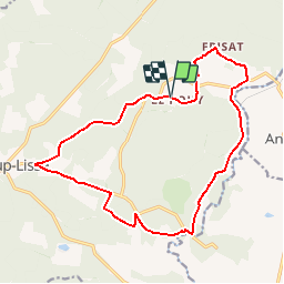
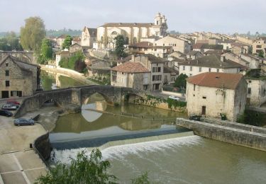
Tocht Stappen van 17,9 km beschikbaar op Nieuw-Aquitanië, Lot-et-Garonne, Réaup-Lisse. Deze tocht wordt voorgesteld door tracegps.
Beschrijving
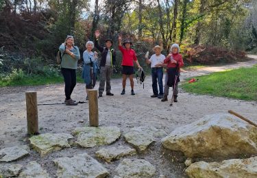
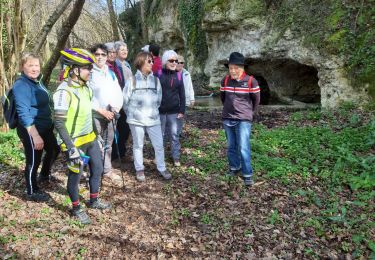
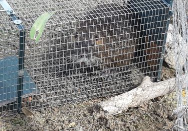
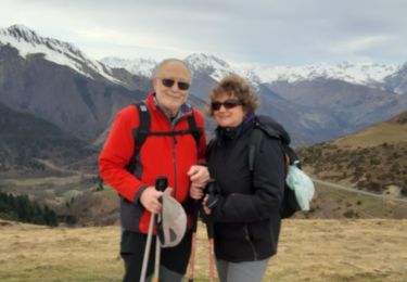
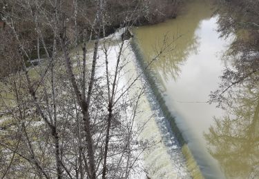
De Lisse, mairie annexe de Réaup, aux hameaux du Rey et de Pichanet, découvrez les marges de la plus grande forêt d’Europe, bordée par la Gélise. Téléchargez la fiche de cette randonnée sur le site du Tourisme du Lot et Garonne.
Plaatsbepaling
Land:
France
Regio :
Nieuw-Aquitanië
Departement/Provincie :
Lot-et-Garonne
Gemeente :
Réaup-Lisse
Locatie:
Unknown
Vertrek:(Dec)
Vertrek:(UTM)
279086 ; 4887403 (31T) N.
Opmerkingen
Wandeltochten in de omgeving
![Tocht Stappen Barbaste - Cauderoue et Ste-Catherine, les pieds dans la Gélise - Pays d'Albret - Photo](https://media.geolcdn.com/t/375/260/ext.jpg?maxdim=2&url=https%3A%2F%2Fservices.sitytrail.com%2FGeolivesWS%2FDownloadMedia.ashx%3FTrailID%3D111589%26Media%3D7720_1.jpg)
![Stappen Stappen](https://static1.geolcdn.com/sitytour/trail-icons/101.png)
Cauderoue et Ste-Catherine, les pieds dans la Gélise - Pays d'Albret
Stappen
Medium
(1)
Barbaste,
Nieuw-Aquitanië,
Lot-et-Garonne,
France
![](/images/other/stat-length.png)
6,8 km | 8,5 km-effort
2h 0min
![](https://static1.geolcdn.com/siteimages/upload/files/16400158638029165_repeat_loop_refresh_sync_direction_icon.png)
Ja
![Tocht Stappen Réaup-Lisse - Reaup mounicar - Photo](https://media.geolcdn.com/t/375/260/ac4c919e-74de-4535-9d56-5ca381ca3549.jpg&format=jpg&maxdim=2)
![Stappen Stappen](https://static1.geolcdn.com/sitytour/trail-icons/101.png)
Reaup mounicar
Stappen
Gemakkelijk
Réaup-Lisse,
Nieuw-Aquitanië,
Lot-et-Garonne,
France
![](/images/other/stat-length.png)
7,8 km | 9,2 km-effort
2h 18min
![](https://static1.geolcdn.com/siteimages/upload/files/16400158638029165_repeat_loop_refresh_sync_direction_icon.png)
Ja
![Tocht Stappen Barbaste - Cauderoue Ste Catherine Cauderoue - Photo](https://media.geolcdn.com/t/375/260/1868e338-dba3-43b0-8353-0fbee2d1d768.jpg&format=jpg&maxdim=2)
![Stappen Stappen](https://static1.geolcdn.com/sitytour/trail-icons/101.png)
Cauderoue Ste Catherine Cauderoue
Stappen
Gemakkelijk
Barbaste,
Nieuw-Aquitanië,
Lot-et-Garonne,
France
![](/images/other/stat-length.png)
6,4 km | 8,3 km-effort
2h 6min
![](https://static1.geolcdn.com/siteimages/upload/files/16400158638029165_repeat_loop_refresh_sync_direction_icon.png)
Ja
![Tocht Stappen Barbaste - le Beas Barbaste - Photo](https://media.geolcdn.com/t/375/260/a29e6797-dd67-4a93-a5df-c8587a2185d5.jpg&format=jpg&maxdim=2)
![Stappen Stappen](https://static1.geolcdn.com/sitytour/trail-icons/101.png)
le Beas Barbaste
Stappen
Gemakkelijk
Barbaste,
Nieuw-Aquitanië,
Lot-et-Garonne,
France
![](/images/other/stat-length.png)
9,5 km | 11,1 km-effort
2h 35min
![](https://static1.geolcdn.com/siteimages/upload/files/16400158638029165_repeat_loop_refresh_sync_direction_icon.png)
Neen
![Tocht Stappen Andiran - circuit Andiran forêt du Padoue Andiran - Photo](https://media.geolcdn.com/t/375/260/8975ab31-a5d1-4e0c-aed8-bd0c268b237b.jpg&format=jpg&maxdim=2)
![Stappen Stappen](https://static1.geolcdn.com/sitytour/trail-icons/101.png)
circuit Andiran forêt du Padoue Andiran
Stappen
Gemakkelijk
Andiran,
Nieuw-Aquitanië,
Lot-et-Garonne,
France
![](/images/other/stat-length.png)
8,9 km | 11,1 km-effort
2h 26min
![](https://static1.geolcdn.com/siteimages/upload/files/16400158638029165_repeat_loop_refresh_sync_direction_icon.png)
Ja
![Tocht Stappen Réaup-Lisse - col d'Azet - Photo](https://media.geolcdn.com/t/375/260/cc31ea4e-d861-4881-894d-737ed004b9ac.jpg&format=jpg&maxdim=2)
![Stappen Stappen](https://static1.geolcdn.com/sitytour/trail-icons/101.png)
col d'Azet
Stappen
Gemakkelijk
Réaup-Lisse,
Nieuw-Aquitanië,
Lot-et-Garonne,
France
![](/images/other/stat-length.png)
165 km | 278 km-effort
4h 35min
![](https://static1.geolcdn.com/siteimages/upload/files/16400158638029165_repeat_loop_refresh_sync_direction_icon.png)
Neen
![Tocht Stappen Barbaste - Cauderoue Barbaste boucle - Photo](https://media.geolcdn.com/t/375/260/26e17849-7d53-4b78-b4d9-37eb8316139d.jpg&format=jpg&maxdim=2)
![Stappen Stappen](https://static1.geolcdn.com/sitytour/trail-icons/101.png)
Cauderoue Barbaste boucle
Stappen
Heel gemakkelijk
Barbaste,
Nieuw-Aquitanië,
Lot-et-Garonne,
France
![](/images/other/stat-length.png)
8 km | 10,2 km-effort
2h 9min
![](https://static1.geolcdn.com/siteimages/upload/files/16400158638029165_repeat_loop_refresh_sync_direction_icon.png)
Ja
![Tocht Stappen Réaup-Lisse - La Sabliere Andiran la sablière - Photo](https://media.geolcdn.com/t/375/260/2ad808ec-4c80-410e-913c-250fc09ee87d.jpg&format=jpg&maxdim=2)
![Stappen Stappen](https://static1.geolcdn.com/sitytour/trail-icons/101.png)
La Sabliere Andiran la sablière
Stappen
Heel gemakkelijk
Réaup-Lisse,
Nieuw-Aquitanië,
Lot-et-Garonne,
France
![](/images/other/stat-length.png)
5,6 km | 7 km-effort
1h 35min
![](https://static1.geolcdn.com/siteimages/upload/files/16400158638029165_repeat_loop_refresh_sync_direction_icon.png)
Ja
![Tocht Mountainbike Mézin - De Mézin à Nérac avec le petit train touristique - Photo](https://media.geolcdn.com/t/375/260/ext.jpg?maxdim=2&url=https%3A%2F%2Fservices.sitytrail.com%2FGeolivesWS%2FDownloadMedia.ashx%3FTrailID%3D317756%26Media%3D17065_5.jpg)
![Mountainbike Mountainbike](https://static1.geolcdn.com/sitytour/trail-icons/202.png)
De Mézin à Nérac avec le petit train touristique
Mountainbike
Medium
Mézin,
Nieuw-Aquitanië,
Lot-et-Garonne,
France
![](/images/other/stat-length.png)
19,5 km | 23 km-effort
2h 30min
![](https://static1.geolcdn.com/siteimages/upload/files/16400158638029165_repeat_loop_refresh_sync_direction_icon.png)
Neen