Tocht Te voet Bazian - Le grand tour de Bazian - Photo

Le grand tour de Bazian

 PESCADOU31
PESCADOU31

Gebruiker

© OpenStreetMap contributors
Lengte
Lengte
16,1 km
Max. hoogte
Max. hoogte
236 m
Positief hoogteverschil
300 m
Km-Effort
Km-Effort  
20 km
Min. hoogte
Min. hoogte
138 m
Negatief hoogteverschil
300 m
Boucle
Boucle
Ja
Datum van aanmaak :
2022-03-18 17:34:48.452
Laatste wijziging :
2022-04-24 17:10:41.54

(0 Bericht)

Te voet
Te voet
3h46
Moeilijkheid : Gemakkelijk

Scan deze QR-code om de tocht te openen in de SityTrail-applicatie

Gratisgps-wandelapplicatie

Logo SityTrail SityTrail

IGN / Geografische instituten

SityTrail uit de App Store downloaden SityTrail uit Google Play downloaden

Logo SityTrail SityTrail World

De wereld gaat voor u open

SityTrail uit de App Store downloaden SityTrail uit Google Play downloaden SityTrail op Huawei AppGallery downloaden

Over ons

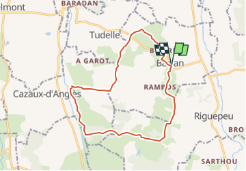
Tocht Te voet van 16,1 km beschikbaar op Occitanië, Gers, Bazian. Deze tocht wordt voorgesteld door PESCADOU31.

Beschrijving

balade le long des lignes de cretes autour de Bazian
l'un des villages les mieux restauré de Gascogne

Hoogteprofiel

Plaatsbepaling

Land:
France
Regio :
Occitanië
Departement/Provincie :
Gers
Gemeente :
Bazian
Locatie:
Unknown
Vertrek:(Dec)
Vertrek:(UTM)
284180 ; 4838556 (31T) N.

Wandeltochten in de omgeving

Tocht Stappen Riguepeu - Riguepeu PR 2 - Photo
Stappen
Beukenhorst

Stappen

Heel gemakkelijk
Riguepeu, Occitanië, Gers, France
9,5 km | 11,5 km-effort
3h 36min
Ja


Sluiten
Mijn abonnementen