


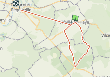

47 km | 56 km-effort


Gebruiker


Gratisgps-wandelapplicatie
 SityTrail
IGN / Geografische instituten
SityTrail World
De wereld gaat voor u open
Tocht Stappen van 13,6 km beschikbaar op Grand Est, Meurthe-et-Moselle, Viéville-en-Haye. Deze tocht wordt voorgesteld door kikkko.
Balisé rond bleu
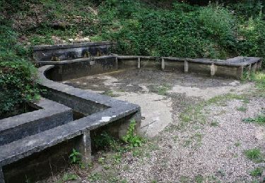
fontaine des 4 Goulots
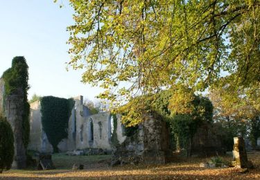
Abris de la guerre

Mountainbike

Fiets
Fiets

Fiets
Stappen
Stappen

Mountainbike

Stappen
Mountainbike