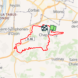
![](/images/other/stat-length.png)
![Tocht Mountainbike Chaponnay - Boucle VTT autour de Chaponnay - Photo](https://media.geolcdn.com/t/1900/400/ext.pjpeg?maxdim=2&url=https%3A%2F%2Fservices.sitytrail.com%2FGeolivesWS%2FDownloadMedia.ashx%3FTrailID%3D316958%26Media%3D16078_6.jpg)
Boucle VTT autour de Chaponnay
tracegps
Gebruiker
![Lengte](/images/other/stat-length.png)
![Max. hoogte](https://static1.geolcdn.com/siteimages/upload/files/1508320355ic_sort_altitude_max_24dp.png)
![Positief hoogteverschil](https://static1.geolcdn.com/siteimages/upload/files/1508320355ic_sort_den_pos_24dp.png)
![Km-Effort](/images/other/stat-length.png)
![Min. hoogte](https://static1.geolcdn.com/siteimages/upload/files/1508320355ic_sort_altitude_min_24dp.png)
![Negatief hoogteverschil](https://static1.geolcdn.com/siteimages/upload/files/1508320355ic_sort_den_neg_24dp.png)
![Boucle](https://static1.geolcdn.com/siteimages/upload/files/16400158638029165_repeat_loop_refresh_sync_direction_icon.png)
![Mountainbike](https://static1.geolcdn.com/sitytour/trail-icons/202.png)
2h30
Moeilijkheid : Moeilijk
![Scan deze QR-code om de tocht te openen in de SityTrail-applicatie](https://capi.geolives.com/qq0zvz2zws4bq2lad0pu/sitytour/trails/316958/qr.png?size=200)
Gratisgps-wandelapplicatie
Over ons
Tocht Mountainbike van 29 km beschikbaar op Auvergne-Rhône-Alpes, Rhône, Chaponnay. Deze tocht wordt voorgesteld door tracegps.
Beschrijving
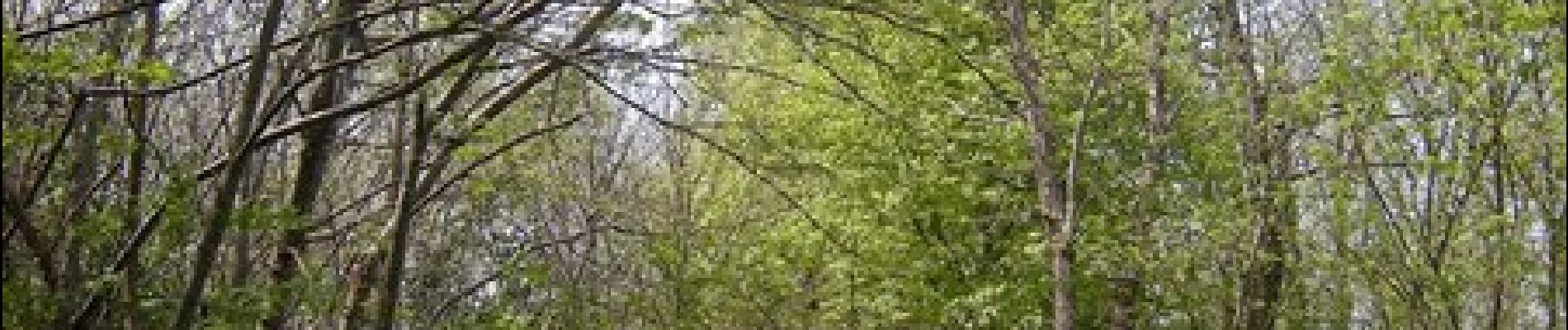
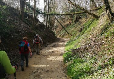
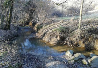
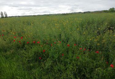
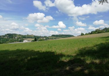
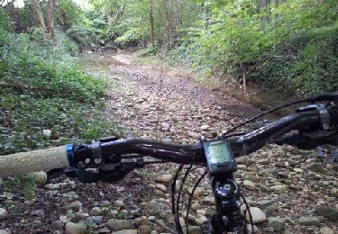
Boucle avec chemins en terre, route bitumées, gravillons, en partie roulante, et chemins terre-boue (suivant la météo...) recouverts de feuilles et gros galets moins roulants surtout dans les parties boisées. Quelques descentes du VTT pour franchir quelques portions, mais assez agréable dans l'ensemble, avec quelques vues surplombant Lyon Est, bref, sympa.. Départ de la mairie de Chaponnay.
Plaatsbepaling
Opmerkingen
Wandeltochten in de omgeving
![Tocht Stappen Marennes - 69 marennes-villette-V2-17km-420m - Photo](https://media.geolcdn.com/t/375/260/25f97240-4655-4bff-897e-e00f442ce49e.jpg&format=jpg&maxdim=2)
![Stappen Stappen](https://static1.geolcdn.com/sitytour/trail-icons/101.png)
Stappen
![](/images/other/stat-length.png)
![](https://static1.geolcdn.com/siteimages/upload/files/16400158638029165_repeat_loop_refresh_sync_direction_icon.png)
![Tocht Mountainbike Chaponnay - Chaponnay - Valencin - Photo](https://media.geolcdn.com/t/375/260/ext.jpg?maxdim=2&url=https%3A%2F%2Fstatic1.geolcdn.com%2Fsiteimages%2Fupload%2Ffiles%2F1524743154velo.jpg)
![Mountainbike Mountainbike](https://static1.geolcdn.com/sitytour/trail-icons/202.png)
Mountainbike
![](/images/other/stat-length.png)
![](https://static1.geolcdn.com/siteimages/upload/files/16400158638029165_repeat_loop_refresh_sync_direction_icon.png)
![Tocht Te voet Feyzin - Sentier des Alouettes - Photo](https://media.geolcdn.com/t/375/260/196abbf9-cf3c-423e-8745-e82f535258da.jpeg&format=jpg&maxdim=2)
![Te voet Te voet](https://static1.geolcdn.com/sitytour/trail-icons/100.png)
Te voet
![](/images/other/stat-length.png)
![](https://static1.geolcdn.com/siteimages/upload/files/16400158638029165_repeat_loop_refresh_sync_direction_icon.png)
![Tocht Stappen Saint-Pierre-de-Chandieu - 69-st-pierre-de-chandieu-boucle-ozon-9km - Photo](https://media.geolcdn.com/t/375/260/893760dc-b1b9-4ee1-98cb-443ac33d3041.jpg&format=jpg&maxdim=2)
![Stappen Stappen](https://static1.geolcdn.com/sitytour/trail-icons/101.png)
Stappen
![](/images/other/stat-length.png)
![](https://static1.geolcdn.com/siteimages/upload/files/16400158638029165_repeat_loop_refresh_sync_direction_icon.png)
![Tocht Stappen Chaponnay - 69-chaponnay-a-luzinay-20KM-430m-sensH-mai21 - Photo](https://media.geolcdn.com/t/375/260/b9109f10-61ca-47fa-8b0f-ffddb86e6f59.jpg&format=jpg&maxdim=2)
![Stappen Stappen](https://static1.geolcdn.com/sitytour/trail-icons/101.png)
Stappen
![](/images/other/stat-length.png)
![](https://static1.geolcdn.com/siteimages/upload/files/16400158638029165_repeat_loop_refresh_sync_direction_icon.png)
![Tocht Mountainbike Corbas - Corbas bois de st jean - Photo](https://media.geolcdn.com/t/375/260/ce84024e-6114-4bc0-bf26-193adabf40f8.jpg&format=jpg&maxdim=2)
![Mountainbike Mountainbike](https://static1.geolcdn.com/sitytour/trail-icons/202.png)
Mountainbike
![](/images/other/stat-length.png)
![](https://static1.geolcdn.com/siteimages/upload/files/16400158638029165_repeat_loop_refresh_sync_direction_icon.png)
![Tocht Stappen Toussieu - 69 Toussieu poypes 2 vallons 21km 420m - Photo](https://media.geolcdn.com/t/375/260/9791a08c-19f2-4a10-84d0-f188f7daef8a.jpg&format=jpg&maxdim=2)
![Stappen Stappen](https://static1.geolcdn.com/sitytour/trail-icons/101.png)
Stappen
![](/images/other/stat-length.png)
![](https://static1.geolcdn.com/siteimages/upload/files/16400158638029165_repeat_loop_refresh_sync_direction_icon.png)
![Tocht Mountainbike Saint-Pierre-de-Chandieu - autour de la ferme de savoye vers luzinay - Photo](https://media.geolcdn.com/t/375/260/ext.jpg?maxdim=2&url=https%3A%2F%2Fservices.sitytrail.com%2FGeolivesWS%2FDownloadMedia.ashx%3FTrailID%3D85531%26Media%3D20110918172032.jpeg)
![Mountainbike Mountainbike](https://static1.geolcdn.com/sitytour/trail-icons/202.png)
Mountainbike
![](/images/other/stat-length.png)
![](https://static1.geolcdn.com/siteimages/upload/files/16400158638029165_repeat_loop_refresh_sync_direction_icon.png)
![Tocht Mountainbike Chaponnay - Chaponnay marennes villette - Photo](https://media.geolcdn.com/t/375/260/ext.jpg?maxdim=2&url=https%3A%2F%2Fstatic1.geolcdn.com%2Fsiteimages%2Fupload%2Ffiles%2F1524743154velo.jpg)
![Mountainbike Mountainbike](https://static1.geolcdn.com/sitytour/trail-icons/202.png)
Mountainbike
![](/images/other/stat-length.png)
![](https://static1.geolcdn.com/siteimages/upload/files/16400158638029165_repeat_loop_refresh_sync_direction_icon.png)