![](/images/other/stat-length.png)
![Tocht Stappen Lannéanou - Tour de Lannéanou - Photo](https://media.geolcdn.com/t/1900/400/ext.pjpeg?maxdim=2&url=https%3A%2F%2Fservices.sitytrail.com%2FGeolivesWS%2FDownloadMedia.ashx%3FTrailID%3D316914%26Media%3D16013_3.jpg)
Tour de Lannéanou
tracegps
Gebruiker
![Lengte](/images/other/stat-length.png)
Lengte
14,8 km
![Max. hoogte](https://static1.geolcdn.com/siteimages/upload/files/1508320355ic_sort_altitude_max_24dp.png)
Max. hoogte
283 m
![Positief hoogteverschil](https://static1.geolcdn.com/siteimages/upload/files/1508320355ic_sort_den_pos_24dp.png)
Positief hoogteverschil
302 m
![Km-Effort](/images/other/stat-length.png)
Km-Effort
18,8 km
![Min. hoogte](https://static1.geolcdn.com/siteimages/upload/files/1508320355ic_sort_altitude_min_24dp.png)
Min. hoogte
187 m
![Negatief hoogteverschil](https://static1.geolcdn.com/siteimages/upload/files/1508320355ic_sort_den_neg_24dp.png)
Negatief hoogteverschil
295 m
![Boucle](https://static1.geolcdn.com/siteimages/upload/files/16400158638029165_repeat_loop_refresh_sync_direction_icon.png)
Boucle
Ja
Datum van aanmaak :
2014-12-10 00:00:00.0
Laatste wijziging :
2014-12-10 00:00:00.0
![Stappen](https://static1.geolcdn.com/sitytour/trail-icons/101.png)
3h40
Moeilijkheid : Moeilijk
![Scan deze QR-code om de tocht te openen in de SityTrail-applicatie](https://capi.geolives.com/qq0zvz2zws4bq2lad0pu/sitytour/trails/316914/qr.png?size=200)
Gratisgps-wandelapplicatie
Over ons
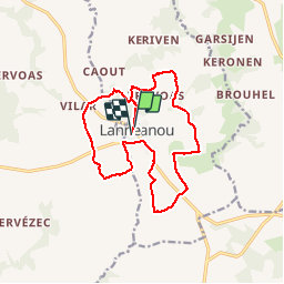
Tocht Stappen van 14,8 km beschikbaar op Bretagne, Finistère, Lannéanou. Deze tocht wordt voorgesteld door tracegps.
Beschrijving
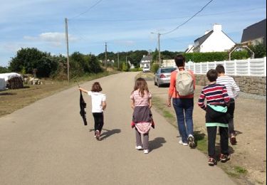
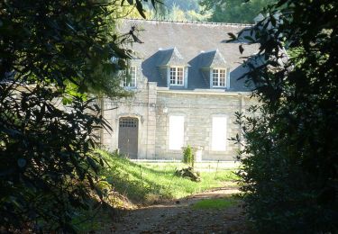
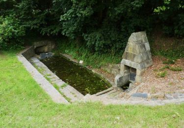
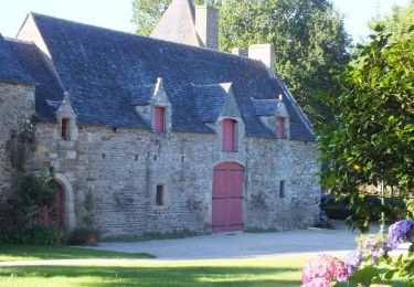
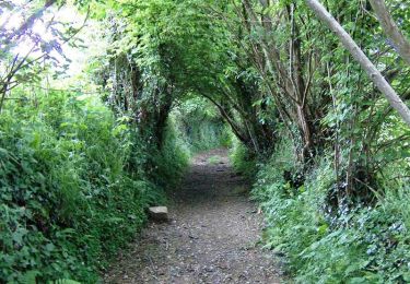
Circuit autour de Lannéanou. Vues sur les Monts d'Arrée, landes, bocages, chemin creux..... Une grande partie du circuit correspond à la rando "Sentier de Bleuniou Kaer" du topoguide PR "Le Pays de Morlaix à pied".
Plaatsbepaling
Land:
France
Regio :
Bretagne
Departement/Provincie :
Finistère
Gemeente :
Lannéanou
Locatie:
Unknown
Vertrek:(Dec)
Vertrek:(UTM)
450300 ; 5370928 (30U) N.
Opmerkingen
Wandeltochten in de omgeving
![Tocht Stappen Plougonven - 1er septembre plougonven - Photo](https://media.geolcdn.com/t/375/260/ext.jpg?maxdim=2&url=https%3A%2F%2Fservices.sitytrail.com%2FGeolivesWS%2FDownloadMedia.ashx%3FTrailID%3D218222%26Media%3D20130901133100.jpg)
![Stappen Stappen](https://static1.geolcdn.com/sitytour/trail-icons/101.png)
1er septembre plougonven
Stappen
Gemakkelijk
Plougonven,
Bretagne,
Finistère,
France
![](/images/other/stat-length.png)
10,4 km | 12 km-effort
3h 53min
![](https://static1.geolcdn.com/siteimages/upload/files/16400158638029165_repeat_loop_refresh_sync_direction_icon.png)
Ja
![Tocht Stappen Botsorhel - Sentiers buissonniers à Botsorhel - Photo](https://media.geolcdn.com/t/375/260/ext.jpg?maxdim=2&url=https%3A%2F%2Fservices.sitytrail.com%2FGeolivesWS%2FDownloadMedia.ashx%3FTrailID%3D191648%26Media%3D15299_6.jpg)
![Stappen Stappen](https://static1.geolcdn.com/sitytour/trail-icons/101.png)
Sentiers buissonniers à Botsorhel
Stappen
Moeilijk
(1)
Botsorhel,
Bretagne,
Finistère,
France
![](/images/other/stat-length.png)
14,2 km | 18,5 km-effort
4h 30min
![](https://static1.geolcdn.com/siteimages/upload/files/16400158638029165_repeat_loop_refresh_sync_direction_icon.png)
Ja
![Tocht Stappen Plougonven - Autour de Plougonven - Photo](https://media.geolcdn.com/t/375/260/ext.jpg?maxdim=2&url=https%3A%2F%2Fservices.sitytrail.com%2FGeolivesWS%2FDownloadMedia.ashx%3FTrailID%3D112682%26Media%3D11474_5.jpg)
![Stappen Stappen](https://static1.geolcdn.com/sitytour/trail-icons/101.png)
Autour de Plougonven
Stappen
Gemakkelijk
Plougonven,
Bretagne,
Finistère,
France
![](/images/other/stat-length.png)
4,1 km | 4,8 km-effort
1h 0min
![](https://static1.geolcdn.com/siteimages/upload/files/16400158638029165_repeat_loop_refresh_sync_direction_icon.png)
Ja
![Tocht Te voet Botsorhel - Botshorel Morlaix - Photo](https://media.geolcdn.com/t/375/260/ext.jpg?maxdim=2&url=https%3A%2F%2Fstatic1.geolcdn.com%2Fsiteimages%2Fupload%2Ffiles%2F1545311037marcheuse_200dpi.jpg)
![Te voet Te voet](https://static1.geolcdn.com/sitytour/trail-icons/100.png)
Botshorel Morlaix
Te voet
Moeilijk
Botsorhel,
Bretagne,
Finistère,
France
![](/images/other/stat-length.png)
29 km | 35 km-effort
8h 3min
![](https://static1.geolcdn.com/siteimages/upload/files/16400158638029165_repeat_loop_refresh_sync_direction_icon.png)
Neen
![Tocht Te voet Botsorhel - 2022-04-02_21h02m45_SityTrail - 3150665 - et5xbotsorhelxmorlaix - Photo](https://media.geolcdn.com/t/375/260/ext.jpg?maxdim=2&url=https%3A%2F%2Fstatic1.geolcdn.com%2Fsiteimages%2Fupload%2Ffiles%2F1545311037marcheuse_200dpi.jpg)
![Te voet Te voet](https://static1.geolcdn.com/sitytour/trail-icons/100.png)
2022-04-02_21h02m45_SityTrail - 3150665 - et5xbotsorhelxmorlaix
Te voet
Moeilijk
Botsorhel,
Bretagne,
Finistère,
France
![](/images/other/stat-length.png)
30 km | 36 km-effort
8h 10min
![](https://static1.geolcdn.com/siteimages/upload/files/16400158638029165_repeat_loop_refresh_sync_direction_icon.png)
Neen
![Tocht Stappen Plougonven - Gaspern en Plougonven - Photo](https://media.geolcdn.com/t/375/260/ext.jpg?maxdim=2&url=https%3A%2F%2Fservices.sitytrail.com%2FGeolivesWS%2FDownloadMedia.ashx%3FTrailID%3D191370%26Media%3D14938_2.jpg)
![Stappen Stappen](https://static1.geolcdn.com/sitytour/trail-icons/101.png)
Gaspern en Plougonven
Stappen
Medium
Plougonven,
Bretagne,
Finistère,
France
![](/images/other/stat-length.png)
13,2 km | 16,1 km-effort
3h 30min
![](https://static1.geolcdn.com/siteimages/upload/files/16400158638029165_repeat_loop_refresh_sync_direction_icon.png)
Ja
![Tocht Mountainbike Plougonven - Espace VTT-FFC Morlaix Monts d'Arrée, circuit n°9 de Plougonven - Photo](https://media.geolcdn.com/t/375/260/ext.jpg?maxdim=2&url=https%3A%2F%2Fservices.sitytrail.com%2FGeolivesWS%2FDownloadMedia.ashx%3FTrailID%3D101608%26Media%3D1795_2.jpg)
![Mountainbike Mountainbike](https://static1.geolcdn.com/sitytour/trail-icons/202.png)
Espace VTT-FFC Morlaix Monts d'Arrée, circuit n°9 de Plougonven
Mountainbike
Gemakkelijk
(1)
Plougonven,
Bretagne,
Finistère,
France
![](/images/other/stat-length.png)
11,6 km | 14,4 km-effort
1h 0min
![](https://static1.geolcdn.com/siteimages/upload/files/16400158638029165_repeat_loop_refresh_sync_direction_icon.png)
Ja
![Tocht Stappen Plougonven - Espace VTT-FFC Morlaix Monts d'Arrée, circuit n°9 de Plougonven - Photo](https://media.geolcdn.com/t/375/260/ext.jpg?maxdim=2&url=https%3A%2F%2Fservices.sitytrail.com%2FGeolivesWS%2FDownloadMedia.ashx%3FTrailID%3D101607%26Media%3D1795_2.jpg)
![Stappen Stappen](https://static1.geolcdn.com/sitytour/trail-icons/101.png)
Espace VTT-FFC Morlaix Monts d'Arrée, circuit n°9 de Plougonven
Stappen
Medium
Plougonven,
Bretagne,
Finistère,
France
![](/images/other/stat-length.png)
11,6 km | 14,4 km-effort
2h 0min
![](https://static1.geolcdn.com/siteimages/upload/files/16400158638029165_repeat_loop_refresh_sync_direction_icon.png)
Ja
![Tocht Stappen Botsorhel - 29_Botsorhel - Photo](https://media.geolcdn.com/t/375/260/ext.jpg?maxdim=2&url=https%3A%2F%2Fstatic1.geolcdn.com%2Fsiteimages%2Fupload%2Ffiles%2F1553511878bg_sport_marche.png)
![Stappen Stappen](https://static1.geolcdn.com/sitytour/trail-icons/101.png)
29_Botsorhel
Stappen
Medium
Botsorhel,
Bretagne,
Finistère,
France
![](/images/other/stat-length.png)
14,3 km | 18,6 km-effort
3h 22min
![](https://static1.geolcdn.com/siteimages/upload/files/16400158638029165_repeat_loop_refresh_sync_direction_icon.png)
Ja