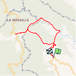
![](/images/other/stat-length.png)
![Tocht Stappen Saint-Joseph - Forêt de Rabuchon - Photo](https://media.geolcdn.com/t/1900/400/ext.pjpeg?maxdim=2&url=https%3A%2F%2Fservices.sitytrail.com%2FGeolivesWS%2FDownloadMedia.ashx%3FTrailID%3D316815%26Media%3D10634_4.jpg)
Forêt de Rabuchon
tracegps
Gebruiker
![Lengte](/images/other/stat-length.png)
![Max. hoogte](https://static1.geolcdn.com/siteimages/upload/files/1508320355ic_sort_altitude_max_24dp.png)
![Positief hoogteverschil](https://static1.geolcdn.com/siteimages/upload/files/1508320355ic_sort_den_pos_24dp.png)
![Km-Effort](/images/other/stat-length.png)
![Min. hoogte](https://static1.geolcdn.com/siteimages/upload/files/1508320355ic_sort_altitude_min_24dp.png)
![Negatief hoogteverschil](https://static1.geolcdn.com/siteimages/upload/files/1508320355ic_sort_den_neg_24dp.png)
![Boucle](https://static1.geolcdn.com/siteimages/upload/files/16400158638029165_repeat_loop_refresh_sync_direction_icon.png)
![Stappen](https://static1.geolcdn.com/sitytour/trail-icons/101.png)
4h00
Moeilijkheid : Medium
![Scan deze QR-code om de tocht te openen in de SityTrail-applicatie](https://capi.geolives.com/qq0zvz2zws4bq2lad0pu/sitytour/trails/316815/qr.png?size=200)
Gratisgps-wandelapplicatie
Over ons
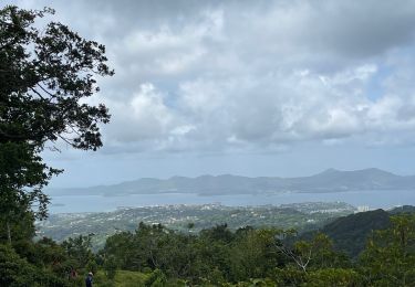
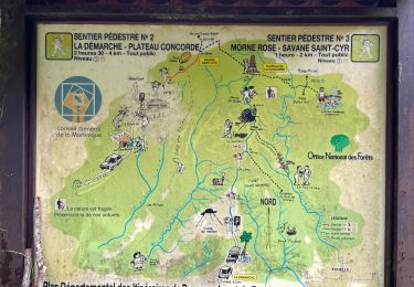
Tocht Stappen van 12 km beschikbaar op Martinique, Onbekend, Saint-Joseph. Deze tocht wordt voorgesteld door tracegps.
Beschrijving
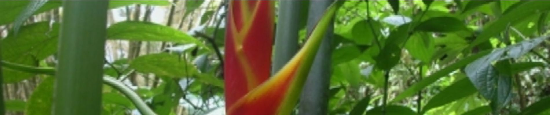
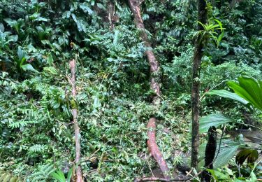
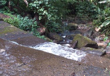
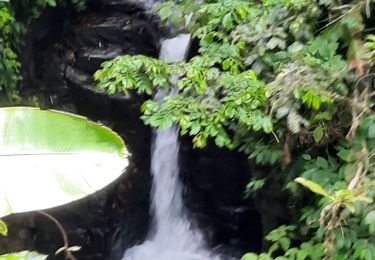
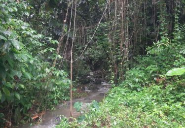
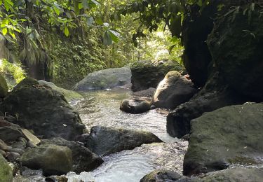
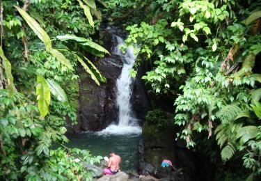
Très bon parcours pour la randonnée et surtout bon entrainement pour le trail. Je l'utilise régulièrement car c'est un terrain vallonné. La végétation est assez dense, et le terrain est assez glissant. Il y a aussi de la pente assez raide, mais pour faciliter l’ascension ils ont installés des marches. Bonne rando et course.
Plaatsbepaling
Opmerkingen
Wandeltochten in de omgeving
![Tocht sport Fort-de-France - Absalon vers Didier - Photo](https://media.geolcdn.com/t/375/260/adf8a0b9-d2e0-4a1f-aaf4-a96938158482.jpg&format=jpg&maxdim=2)
sport
![](/images/other/stat-length.png)
![](https://static1.geolcdn.com/siteimages/upload/files/16400158638029165_repeat_loop_refresh_sync_direction_icon.png)
![Tocht Stappen Fort-de-France - fond barron - Photo](https://media.geolcdn.com/t/375/260/e47fa9db-42eb-4eae-be0a-ef7b2c9eca79.jpg&format=jpg&maxdim=2)
![Stappen Stappen](https://static1.geolcdn.com/sitytour/trail-icons/101.png)
Stappen
![](/images/other/stat-length.png)
![](https://static1.geolcdn.com/siteimages/upload/files/16400158638029165_repeat_loop_refresh_sync_direction_icon.png)
![Tocht Stappen Fort-de-France - Absalon - Photo](https://media.geolcdn.com/t/375/260/878d5ce9-c2d9-41df-828d-f3fa710d1ba4.jpg&format=jpg&maxdim=2)
![Stappen Stappen](https://static1.geolcdn.com/sitytour/trail-icons/101.png)
Stappen
![](/images/other/stat-length.png)
![](https://static1.geolcdn.com/siteimages/upload/files/16400158638029165_repeat_loop_refresh_sync_direction_icon.png)
![Tocht Stappen Saint-Joseph - Marche de bouliķi vers le bourg de st Joseph. - Photo](https://media.geolcdn.com/t/375/260/77d9f075-e645-4623-82b2-1841b98ea18b.jpg&format=jpg&maxdim=2)
![Stappen Stappen](https://static1.geolcdn.com/sitytour/trail-icons/101.png)
Stappen
![](/images/other/stat-length.png)
![](https://static1.geolcdn.com/siteimages/upload/files/16400158638029165_repeat_loop_refresh_sync_direction_icon.png)
![Tocht sport Fort-de-France - Didier absalon - Photo](https://media.geolcdn.com/t/375/260/554aad06-3441-4127-b415-2ba108c5a5e9.jpg&format=jpg&maxdim=2)
sport
![](/images/other/stat-length.png)
![](https://static1.geolcdn.com/siteimages/upload/files/16400158638029165_repeat_loop_refresh_sync_direction_icon.png)
![Tocht sport Saint-Joseph - Boucle de rabuchon - Photo](https://media.geolcdn.com/t/375/260/73952a33-b4e2-4260-8c09-d51c749c2152.jpg&format=jpg&maxdim=2)
sport
![](/images/other/stat-length.png)
![](https://static1.geolcdn.com/siteimages/upload/files/16400158638029165_repeat_loop_refresh_sync_direction_icon.png)
![Tocht sport Schœlcher - La Démarche-Morne Rose - Photo](https://media.geolcdn.com/t/375/260/8da19298-0e95-4207-a668-881dde22c6c8.jpg&format=jpg&maxdim=2)
sport
![](/images/other/stat-length.png)
![](https://static1.geolcdn.com/siteimages/upload/files/16400158638029165_repeat_loop_refresh_sync_direction_icon.png)
![Tocht Stappen Saint-Joseph - Morne des Olives - Photo](https://media.geolcdn.com/t/375/260/d9e2423b-fbf5-4b74-82cb-94b57e3fb56f.jpg&format=jpg&maxdim=2)
![Stappen Stappen](https://static1.geolcdn.com/sitytour/trail-icons/101.png)
Stappen
![](/images/other/stat-length.png)
![](https://static1.geolcdn.com/siteimages/upload/files/16400158638029165_repeat_loop_refresh_sync_direction_icon.png)
![Tocht Stappen Fort-de-France - Circuit Absalon - Photo](https://media.geolcdn.com/t/375/260/caf6b968-ea56-4200-8f74-83c952609732.jpg&format=jpg&maxdim=2)
![Stappen Stappen](https://static1.geolcdn.com/sitytour/trail-icons/101.png)
Stappen
![](/images/other/stat-length.png)
![](https://static1.geolcdn.com/siteimages/upload/files/16400158638029165_repeat_loop_refresh_sync_direction_icon.png)