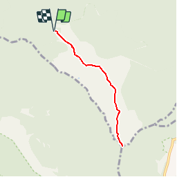
![](/images/other/stat-length.png)
![Tocht Stappen Saint-Denis - GR® R2 Du gîte au sommet de la Roche Ecrite - Photo](https://media.geolcdn.com/t/1900/400/ext.pjpeg?maxdim=2&url=https%3A%2F%2Fservices.sitytrail.com%2FGeolivesWS%2FDownloadMedia.ashx%3FTrailID%3D316689%26Media%3D3846_1.jpg)
GR® R2 Du gîte au sommet de la Roche Ecrite
tracegps
Gebruiker
![Lengte](/images/other/stat-length.png)
![Max. hoogte](https://static1.geolcdn.com/siteimages/upload/files/1508320355ic_sort_altitude_max_24dp.png)
![Positief hoogteverschil](https://static1.geolcdn.com/siteimages/upload/files/1508320355ic_sort_den_pos_24dp.png)
![Km-Effort](/images/other/stat-length.png)
![Min. hoogte](https://static1.geolcdn.com/siteimages/upload/files/1508320355ic_sort_altitude_min_24dp.png)
![Negatief hoogteverschil](https://static1.geolcdn.com/siteimages/upload/files/1508320355ic_sort_den_neg_24dp.png)
![Boucle](https://static1.geolcdn.com/siteimages/upload/files/16400158638029165_repeat_loop_refresh_sync_direction_icon.png)
![Stappen](https://static1.geolcdn.com/sitytour/trail-icons/101.png)
2h30
Moeilijkheid : Medium
![Scan deze QR-code om de tocht te openen in de SityTrail-applicatie](https://capi.geolives.com/qq0zvz2zws4bq2lad0pu/sitytour/trails/316689/qr.png?size=200)
Gratisgps-wandelapplicatie
Over ons
Tocht Stappen van 7,9 km beschikbaar op Réunion, Onbekend, Saint-Denis. Deze tocht wordt voorgesteld door tracegps.
Beschrijving
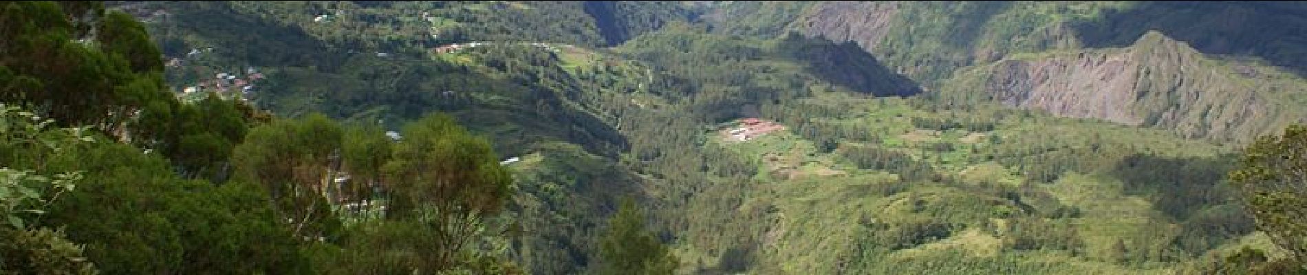
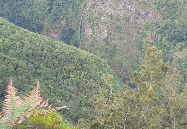
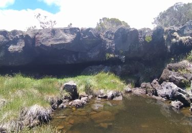
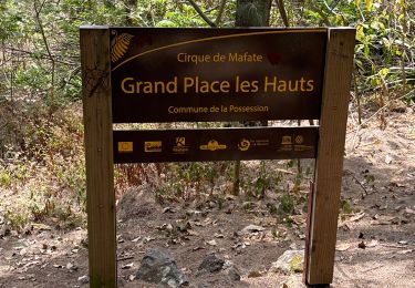
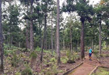
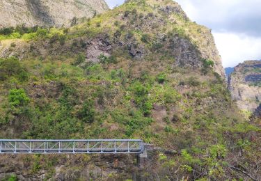
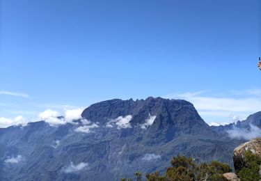
GR® R2 Du gîte au sommet de la Roche Ecrite. Aller retour vers le sommet de la Roche Ecrite, vue plongeante sur le cirque de Salazie et une partie de Mafate. Vous trouverez le descriptif détaillé de cette randonnée dans le Topo-guide® de la Fédération Française de la Randonnée Pédestre.
Plaatsbepaling
Opmerkingen
Wandeltochten in de omgeving
![Tocht Stappen Saint-Denis - Sentier Marmaille Morne de St François - Photo](https://media.geolcdn.com/t/375/260/168fc3a5-dd47-40c4-bc7f-6e7b5c0b10c6.jpg&format=jpg&maxdim=2)
![Stappen Stappen](https://static1.geolcdn.com/sitytour/trail-icons/101.png)
Stappen
![](/images/other/stat-length.png)
![](https://static1.geolcdn.com/siteimages/upload/files/16400158638029165_repeat_loop_refresh_sync_direction_icon.png)
![Tocht Stappen Saint-Denis - La Roche Écrite - Photo](https://media.geolcdn.com/t/375/260/c45ea0c3-60f9-402d-bb8e-33b6c31b240c.jpg&format=jpg&maxdim=2)
![Stappen Stappen](https://static1.geolcdn.com/sitytour/trail-icons/101.png)
Stappen
![](/images/other/stat-length.png)
![](https://static1.geolcdn.com/siteimages/upload/files/16400158638029165_repeat_loop_refresh_sync_direction_icon.png)
![Tocht sport La Possession - (J4)-Aurère - Mafate les Hauts (fait) - Photo](https://media.geolcdn.com/t/375/260/0d09f72b-41c2-4c29-9aac-6a60b6d1d150.jpg&format=jpg&maxdim=2)
sport
![](/images/other/stat-length.png)
![](https://static1.geolcdn.com/siteimages/upload/files/16400158638029165_repeat_loop_refresh_sync_direction_icon.png)
![Tocht sport Saint-Denis - (J2)-Gîte de la Roche Écrite - Dos d’Ane (fait) - Photo](https://media.geolcdn.com/t/375/260/6e842589-3635-43a7-a1bc-65c85b024c08.jpg&format=jpg&maxdim=2)
sport
![](/images/other/stat-length.png)
![](https://static1.geolcdn.com/siteimages/upload/files/16400158638029165_repeat_loop_refresh_sync_direction_icon.png)
![Tocht Stappen La Possession - jour 2 la Réunion - Photo](https://media.geolcdn.com/t/375/260/175ad4d1-b40a-4791-99a6-341427c8526e.jpg&format=jpg&maxdim=2)
![Stappen Stappen](https://static1.geolcdn.com/sitytour/trail-icons/101.png)
Stappen
![](/images/other/stat-length.png)
![](https://static1.geolcdn.com/siteimages/upload/files/16400158638029165_repeat_loop_refresh_sync_direction_icon.png)
![Tocht Stappen Saint-Denis - La Roche Écrite depuis Le Brûlé - Photo](https://media.geolcdn.com/t/375/260/8636ed34-6c45-4a72-b01a-3d1edcc8cc24.jpg&format=jpg&maxdim=2)
![Stappen Stappen](https://static1.geolcdn.com/sitytour/trail-icons/101.png)
Stappen
![](/images/other/stat-length.png)
![](https://static1.geolcdn.com/siteimages/upload/files/16400158638029165_repeat_loop_refresh_sync_direction_icon.png)
![Tocht Stappen La Possession - 27 octobre 2022 deux bras - Photo](https://media.geolcdn.com/t/375/260/856679f7-0054-41fb-b163-37467467288d.jpg&format=jpg&maxdim=2)
![Stappen Stappen](https://static1.geolcdn.com/sitytour/trail-icons/101.png)
Stappen
![](/images/other/stat-length.png)
![](https://static1.geolcdn.com/siteimages/upload/files/16400158638029165_repeat_loop_refresh_sync_direction_icon.png)
![Tocht Stappen Salazie - Le km vertical - Photo](https://media.geolcdn.com/t/375/260/125243b2-d794-403c-8ac0-5a23e190b80e.jpg&format=jpg&maxdim=2)
![Stappen Stappen](https://static1.geolcdn.com/sitytour/trail-icons/101.png)
Stappen
![](/images/other/stat-length.png)
![](https://static1.geolcdn.com/siteimages/upload/files/16400158638029165_repeat_loop_refresh_sync_direction_icon.png)
![Tocht Stappen Saint-Denis - Boucle de la plaine d'affouches - Photo](https://media.geolcdn.com/t/375/260/ext.jpg?maxdim=2&url=https%3A%2F%2Fservices.sitytrail.com%2FGeolivesWS%2FDownloadMedia.ashx%3FTrailID%3D869736%26Media%3Dfix__20171129124842.jpg)
![Stappen Stappen](https://static1.geolcdn.com/sitytour/trail-icons/101.png)
Stappen
![](/images/other/stat-length.png)
![](https://static1.geolcdn.com/siteimages/upload/files/16400158638029165_repeat_loop_refresh_sync_direction_icon.png)