


Myötätuulen reitti

SityTrail - itinéraires balisés pédestres
Tous les sentiers balisés d’Europe GUIDE+
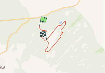

Lengte
6,1 km

Max. hoogte
32 m

Positief hoogteverschil
7 m
Km-Effort
6,2 km

Min. hoogte
26 m

Negatief hoogteverschil
10 m
Boucle
Neen

Markering
Datum van aanmaak :
2022-02-21 11:27:03.394
Laatste wijziging :
2022-03-09 04:04:56.75
1h24
Moeilijkheid : Gemakkelijk

Gratisgps-wandelapplicatie
 SityTrail
IGN / Geografische instituten
SityTrail World
De wereld gaat voor u open
Over ons
Tocht Te voet van 6,1 km beschikbaar op Onbekend, Noord-Oost-Botnië, Kalajoki. Deze tocht wordt voorgesteld door SityTrail - itinéraires balisés pédestres.
Plaatsbepaling
Land:
Finland
Regio :
Onbekend
Departement/Provincie :
Noord-Oost-Botnië
Gemeente :
Kalajoki
Locatie:
Unknown
Vertrek:(Dec)
Vertrek:(UTM)
355813 ; 7131184 (35W) N.
Opmerkingen
Wandeltochten in de omgeving