Tocht Te voet Kirkkonummi - Kotokierros - Photo

Tous les sentiers balisés d’Europe GUIDE+

© OpenStreetMap contributors
Lengte
Lengte
4,6 km
Max. hoogte
Max. hoogte
78 m
Positief hoogteverschil
56 m
Km-Effort
Km-Effort  
5,3 km
Min. hoogte
Min. hoogte
43 m
Negatief hoogteverschil
56 m
Boucle
Boucle
Ja
Markering
Markering
Datum van aanmaak :
2022-02-21 11:18:45.19
Laatste wijziging :
2022-03-09 03:05:43.1

(0 Bericht)

Te voet
Te voet
1h12
Moeilijkheid : Gemakkelijk

Scan deze QR-code om de tocht te openen in de SityTrail-applicatie

Gratisgps-wandelapplicatie

Logo SityTrail SityTrail

IGN / Geografische instituten

SityTrail uit de App Store downloaden SityTrail uit Google Play downloaden

Logo SityTrail SityTrail World

De wereld gaat voor u open

SityTrail uit de App Store downloaden SityTrail uit Google Play downloaden SityTrail op Huawei AppGallery downloaden

Over ons

Tocht Te voet van 4,6 km beschikbaar op Onbekend, Uusimaa, Kirkkonummi. Deze tocht wordt voorgesteld door SityTrail - itinéraires balisés pédestres.

Beschrijving

Symbol: Green diamond


Website: https://www.kirkkonummi.fi/meikon-luonnonsuojelualueet

Hoogteprofiel

Plaatsbepaling

Land:
Finland
Regio :
Onbekend
Departement/Provincie :
Uusimaa
Gemeente :
Kirkkonummi
Locatie:
Unknown
Vertrek:(UTM)
354179 ; 6670916 (35V) N.

Wandeltochten in de omgeving

Tocht Te voet Kirkkonummi - Meikonkierros - Photo
Te voet
GUIDE+

Te voet

Gemakkelijk
Kirkkonummi, Onbekend, Uusimaa, Finland
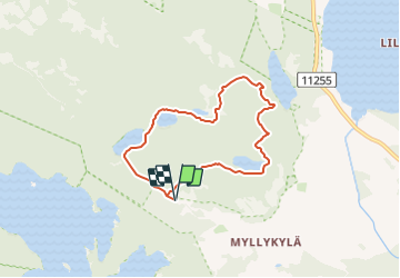
6,9 km | 8 km-effort
1h 48min
Ja
Tocht Te voet Kirkkonummi - Kuikankierros - Photo
Te voet
GUIDE+

Te voet

Gemakkelijk
Kirkkonummi, Onbekend, Uusimaa, Finland
3,1 km | 3,7 km-effort
49min
Ja


Sluiten
Mijn abonnementen