


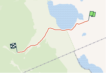

5,9 km | 9,3 km-effort


Tous les sentiers balisés d’Europe GUIDE+


Gratisgps-wandelapplicatie
 SityTrail
IGN / Geografische instituten
SityTrail World
De wereld gaat voor u open
Tocht Te voet van 4,2 km beschikbaar op Onbekend, Lapland, Enontekiö. Deze tocht wordt voorgesteld door SityTrail - itinéraires balisés pédestres.
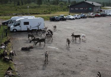
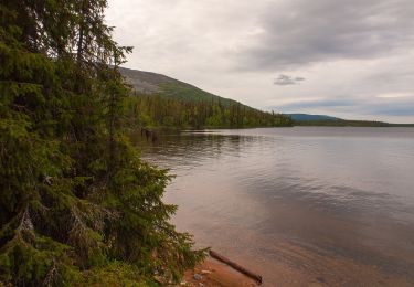
Pallas-Yllästunturi National Park has breathtaking views. Breathe the world's purest air and experience the vastness of the fell landscapes around you.
Website: https://nationalparks.fi/pallas-yllastunturi
Te voet
Te voet
Te voet