![](/images/other/stat-length.png)
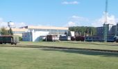
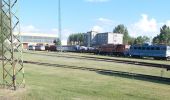
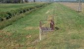
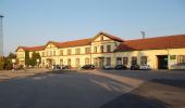
![Tocht Te voet Dombóvár - P■ - Photo](https://media.geolcdn.com/t/1900/400/c89e155b-74a9-4c8d-8ea9-b1e42c4f21d5.jpeg&format=pjpeg&maxdim=2)
P■
SityTrail - itinéraires balisés pédestres
Tous les sentiers balisés d’Europe GUIDE+
![Lengte](/images/other/stat-length.png)
Lengte
17,5 km
![Max. hoogte](https://static1.geolcdn.com/siteimages/upload/files/1508320355ic_sort_altitude_max_24dp.png)
Max. hoogte
283 m
![Positief hoogteverschil](https://static1.geolcdn.com/siteimages/upload/files/1508320355ic_sort_den_pos_24dp.png)
Positief hoogteverschil
264 m
![Km-Effort](/images/other/stat-length.png)
Km-Effort
20 km
![Min. hoogte](https://static1.geolcdn.com/siteimages/upload/files/1508320355ic_sort_altitude_min_24dp.png)
Min. hoogte
110 m
![Negatief hoogteverschil](https://static1.geolcdn.com/siteimages/upload/files/1508320355ic_sort_den_neg_24dp.png)
Negatief hoogteverschil
118 m
![Boucle](https://static1.geolcdn.com/siteimages/upload/files/16400158638029165_repeat_loop_refresh_sync_direction_icon.png)
Boucle
Neen
Markering
Datum van aanmaak :
2022-02-21 10:34:37.886
Laatste wijziging :
2022-03-08 21:58:20.213
![Te voet](https://static1.geolcdn.com/sitytour/trail-icons/100.png)
4h39
Moeilijkheid : Medium
![Scan deze QR-code om de tocht te openen in de SityTrail-applicatie](https://capi.geolives.com/qq0zvz2zws4bq2lad0pu/sitytour/trails/3138900/qr.png?size=200)
Gratisgps-wandelapplicatie
Over ons
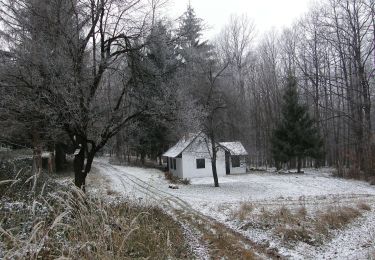
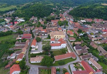
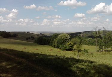
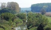
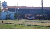
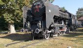
Tocht Te voet van 17,5 km beschikbaar op Transdanubië, Tolna megye, Dombóvár. Deze tocht wordt voorgesteld door SityTrail - itinéraires balisés pédestres.
Beschrijving
Trail created by Dombóvári Hangulat Szabadidő Sportegyesület.
Plaatsbepaling
Land:
Hungary
Regio :
Transdanubië
Departement/Provincie :
Tolna megye
Gemeente :
Dombóvár
Locatie:
Unknown
Vertrek:(Dec)
Vertrek:(UTM)
280690 ; 5139135 (34T) N.
Opmerkingen
Wandeltochten in de omgeving
![Tocht Te voet Nagyhajmás - S- Döbrököz - Nagyhajmás - Photo](https://media.geolcdn.com/t/375/260/c39b9cc8-2901-483e-b0d0-936e2fb3df93.jpeg&format=jpg&maxdim=2)
![Te voet Te voet](https://static1.geolcdn.com/sitytour/trail-icons/100.png)
S- Döbrököz - Nagyhajmás
Te voet
Gemakkelijk
Nagyhajmás,
Transdanubië,
Baranya megye,
Hungary
![](/images/other/stat-length.png)
8,5 km | 10,6 km-effort
2h 24min
![](https://static1.geolcdn.com/siteimages/upload/files/16400158638029165_repeat_loop_refresh_sync_direction_icon.png)
Neen
![Tocht Te voet Bodolyabér - Hunza Ecolodge Red Tour - Photo](https://media.geolcdn.com/t/375/260/49f686d2-c0f6-49f6-9ce9-68d473e884fd.jpeg&format=jpg&maxdim=2)
![Te voet Te voet](https://static1.geolcdn.com/sitytour/trail-icons/100.png)
Hunza Ecolodge Red Tour
Te voet
Gemakkelijk
Bodolyabér,
Transdanubië,
Baranya megye,
Hungary
![](/images/other/stat-length.png)
8,7 km | 12,3 km-effort
2h 48min
![](https://static1.geolcdn.com/siteimages/upload/files/16400158638029165_repeat_loop_refresh_sync_direction_icon.png)
Ja
![Tocht Te voet Baranyajenő - P3 (Baranyajenő-Hármashatár) - Photo](https://media.geolcdn.com/t/375/260/2660311a-a69b-47cc-9aeb-9305225186de.jpeg&format=jpg&maxdim=2)
![Te voet Te voet](https://static1.geolcdn.com/sitytour/trail-icons/100.png)
P3 (Baranyajenő-Hármashatár)
Te voet
Gemakkelijk
Baranyajenő,
Transdanubië,
Baranya megye,
Hungary
![](/images/other/stat-length.png)
3,7 km | 4,9 km-effort
1h 6min
![](https://static1.geolcdn.com/siteimages/upload/files/16400158638029165_repeat_loop_refresh_sync_direction_icon.png)
Neen
![Tocht Te voet Almamellék - P4# ( Szentlászló-Terecsenypuszta ) megszűnt szakasz - Photo](https://media.geolcdn.com/t/375/260/fbe5d5cc-2acd-41dc-9cb7-20d7d06b6d62.jpeg&format=jpg&maxdim=2)
![Te voet Te voet](https://static1.geolcdn.com/sitytour/trail-icons/100.png)
P4# ( Szentlászló-Terecsenypuszta ) megszűnt szakasz
Te voet
Gemakkelijk
Almamellék,
Transdanubië,
Baranya megye,
Hungary
![](/images/other/stat-length.png)
10,3 km | 13,2 km-effort
2h 59min
![](https://static1.geolcdn.com/siteimages/upload/files/16400158638029165_repeat_loop_refresh_sync_direction_icon.png)
Neen
![Tocht Te voet Döbrököz - P■ Döbrököz - Photo](https://media.geolcdn.com/t/375/260/c39b9cc8-2901-483e-b0d0-936e2fb3df93.jpeg&format=jpg&maxdim=2)
![Te voet Te voet](https://static1.geolcdn.com/sitytour/trail-icons/100.png)
P■ Döbrököz
Te voet
Gemakkelijk
Döbrököz,
Transdanubië,
Tolna megye,
Hungary
![](/images/other/stat-length.png)
3,5 km | 4,9 km-effort
1h 6min
![](https://static1.geolcdn.com/siteimages/upload/files/16400158638029165_repeat_loop_refresh_sync_direction_icon.png)
Neen
![Tocht Te voet Vásárosdombó - P+ Hat torony körtúra - Photo](https://media.geolcdn.com/t/375/260/96155325-6530-49e7-8143-341f331859f9.jpeg&format=jpg&maxdim=2)
![Te voet Te voet](https://static1.geolcdn.com/sitytour/trail-icons/100.png)
P+ Hat torony körtúra
Te voet
Moeilijk
Vásárosdombó,
Transdanubië,
Baranya megye,
Hungary
![](/images/other/stat-length.png)
30 km | 38 km-effort
8h 36min
![](https://static1.geolcdn.com/siteimages/upload/files/16400158638029165_repeat_loop_refresh_sync_direction_icon.png)
Neen
![Tocht Te voet Szászvár - S● Vörösfenyő kulcsosház – Balincai-kút – Gyilkos-tó – Z+ elágazás - Photo](https://media.geolcdn.com/t/375/260/78d9c20b-e7f3-489e-8f4b-995647df7dfb.jpeg&format=jpg&maxdim=2)
![Te voet Te voet](https://static1.geolcdn.com/sitytour/trail-icons/100.png)
S● Vörösfenyő kulcsosház – Balincai-kút – Gyilkos-tó – Z+ elágazás
Te voet
Gemakkelijk
Szászvár,
Transdanubië,
Baranya megye,
Hungary
![](/images/other/stat-length.png)
3,3 km | 4,8 km-effort
1h 5min
![](https://static1.geolcdn.com/siteimages/upload/files/16400158638029165_repeat_loop_refresh_sync_direction_icon.png)
Neen
![Tocht Te voet Hosszúhetény - Z▲ Szászvár – Kantár-hegy – Somlyó – Dobogó – Cigány-hegy – Kisújbánya - Photo](https://media.geolcdn.com/t/375/260/477345ec-fd82-43ad-bdf5-a13ccbf379e0.jpeg&format=jpg&maxdim=2)
![Te voet Te voet](https://static1.geolcdn.com/sitytour/trail-icons/100.png)
Z▲ Szászvár – Kantár-hegy – Somlyó – Dobogó – Cigány-hegy – Kisújbánya
Te voet
Gemakkelijk
Hosszúhetény,
Transdanubië,
Baranya megye,
Hungary
![](/images/other/stat-length.png)
8 km | 11,3 km-effort
2h 34min
![](https://static1.geolcdn.com/siteimages/upload/files/16400158638029165_repeat_loop_refresh_sync_direction_icon.png)
Neen
![Tocht Te voet Komló - S+ Jánosipuszta-Hidas - Photo](https://media.geolcdn.com/t/375/260/bd70c328-a415-4257-8f4d-e8bd76edff03.jpeg&format=jpg&maxdim=2)
![Te voet Te voet](https://static1.geolcdn.com/sitytour/trail-icons/100.png)
S+ Jánosipuszta-Hidas
Te voet
Zeer moeilijk
Komló,
Transdanubië,
Baranya megye,
Hungary
![](/images/other/stat-length.png)
35 km | 50 km-effort
11h 28min
![](https://static1.geolcdn.com/siteimages/upload/files/16400158638029165_repeat_loop_refresh_sync_direction_icon.png)
Neen