![](/images/other/stat-length.png)
![Tocht Te voet Budakeszi - P+ (Adyliget am. - Szilfa-tisztás - Budakeszi Vadaspark, bejárat) - Photo](https://media.geolcdn.com/t/1900/400/7836fbe3-9364-4446-8b2d-52f5943f582a.jpeg&format=pjpeg&maxdim=2)
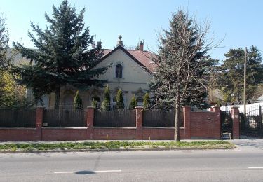
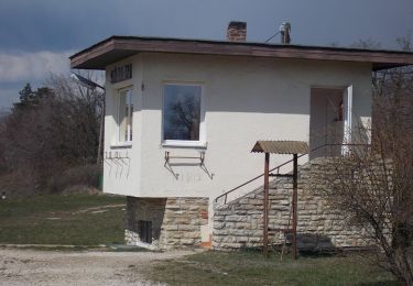
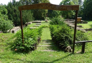
P+ (Adyliget am. - Szilfa-tisztás - Budakeszi Vadaspark, bejárat)
SityTrail - itinéraires balisés pédestres
Tous les sentiers balisés d’Europe GUIDE+
![Lengte](/images/other/stat-length.png)
Lengte
3 km
![Max. hoogte](https://static1.geolcdn.com/siteimages/upload/files/1508320355ic_sort_altitude_max_24dp.png)
Max. hoogte
344 m
![Positief hoogteverschil](https://static1.geolcdn.com/siteimages/upload/files/1508320355ic_sort_den_pos_24dp.png)
Positief hoogteverschil
70 m
![Km-Effort](/images/other/stat-length.png)
Km-Effort
3,9 km
![Min. hoogte](https://static1.geolcdn.com/siteimages/upload/files/1508320355ic_sort_altitude_min_24dp.png)
Min. hoogte
301 m
![Negatief hoogteverschil](https://static1.geolcdn.com/siteimages/upload/files/1508320355ic_sort_den_neg_24dp.png)
Negatief hoogteverschil
64 m
![Boucle](https://static1.geolcdn.com/siteimages/upload/files/16400158638029165_repeat_loop_refresh_sync_direction_icon.png)
Boucle
Neen
Markering
Datum van aanmaak :
2022-02-21 10:23:34.799
Laatste wijziging :
2022-03-08 18:45:54.434
![Te voet](https://static1.geolcdn.com/sitytour/trail-icons/100.png)
53m
Moeilijkheid : Gemakkelijk
![Scan deze QR-code om de tocht te openen in de SityTrail-applicatie](https://capi.geolives.com/qq0zvz2zws4bq2lad0pu/sitytour/trails/3138187/qr.png?size=200)
Gratisgps-wandelapplicatie
Over ons
Tocht Te voet van 3 km beschikbaar op Centraal-Hongarije, Pest megye, Budakeszi. Deze tocht wordt voorgesteld door SityTrail - itinéraires balisés pédestres.
Beschrijving
Trail created by BTSSZ.
Symbol: red cross
Plaatsbepaling
Land:
Hungary
Regio :
Centraal-Hongarije
Departement/Provincie :
Pest megye
Gemeente :
Budakeszi
Locatie:
Unknown
Vertrek:(Dec)
Vertrek:(UTM)
343909 ; 5265619 (34T) N.
Opmerkingen
Wandeltochten in de omgeving
![Tocht Te voet Onbekend - Normafa Kardioösvény (Normafa - János-hegy - Normafa) - Photo](https://media.geolcdn.com/t/375/260/a210dd18-a33c-4463-a3e0-26216e4297bb.jpeg&format=jpg&maxdim=2)
![Te voet Te voet](https://static1.geolcdn.com/sitytour/trail-icons/100.png)
Normafa Kardioösvény (Normafa - János-hegy - Normafa)
Te voet
Gemakkelijk
Onbekend,
Centraal-Hongarije,
Boedapest,
Hungary
![](/images/other/stat-length.png)
3 km | 3,6 km-effort
49min
![](https://static1.geolcdn.com/siteimages/upload/files/16400158638029165_repeat_loop_refresh_sync_direction_icon.png)
Neen
![Tocht Te voet Onbekend - Hárs-hegyi tanösvény (Szent Ferenc Kórház - Szépjuhászné - Szent Ferenc Kórház) - Photo](https://media.geolcdn.com/t/375/260/ef274c3a-3838-46c3-be36-1bb2cf221eb5.jpeg&format=jpg&maxdim=2)
![Te voet Te voet](https://static1.geolcdn.com/sitytour/trail-icons/100.png)
Hárs-hegyi tanösvény (Szent Ferenc Kórház - Szépjuhászné - Szent Ferenc Kórház)
Te voet
Gemakkelijk
Onbekend,
Centraal-Hongarije,
Boedapest,
Hungary
![](/images/other/stat-length.png)
4,7 km | 6,8 km-effort
1h 32min
![](https://static1.geolcdn.com/siteimages/upload/files/16400158638029165_repeat_loop_refresh_sync_direction_icon.png)
Neen
![Tocht Te voet Onbekend - K↺ (Felső-Szép-völgy, autóparkoló - Hármashatár-hegy - Felső-Szép-völgy, autóparkoló) - Photo](https://media.geolcdn.com/t/375/260/4a452529-679a-43e8-af0b-f1183be3b503.jpeg&format=jpg&maxdim=2)
![Te voet Te voet](https://static1.geolcdn.com/sitytour/trail-icons/100.png)
K↺ (Felső-Szép-völgy, autóparkoló - Hármashatár-hegy - Felső-Szép-völgy, autó...
Te voet
Gemakkelijk
Onbekend,
Centraal-Hongarije,
Boedapest,
Hungary
![](/images/other/stat-length.png)
3,1 km | 4,7 km-effort
1h 4min
![](https://static1.geolcdn.com/siteimages/upload/files/16400158638029165_repeat_loop_refresh_sync_direction_icon.png)
Ja
![Tocht Te voet Budakeszi - Z+ (Normafa - Budakeszi - Fekete-hegyek, tisztás) - Photo](https://media.geolcdn.com/t/375/260/a02267f8-1ee7-4b43-8007-3699d6c5003e.jpeg&format=jpg&maxdim=2)
![Te voet Te voet](https://static1.geolcdn.com/sitytour/trail-icons/100.png)
Z+ (Normafa - Budakeszi - Fekete-hegyek, tisztás)
Te voet
Gemakkelijk
Budakeszi,
Centraal-Hongarije,
Pest megye,
Hungary
![](/images/other/stat-length.png)
8,7 km | 12,2 km-effort
2h 47min
![](https://static1.geolcdn.com/siteimages/upload/files/16400158638029165_repeat_loop_refresh_sync_direction_icon.png)
Neen
![Tocht Te voet Onbekend - K↺ (Normafa, autóparkoló - Hármas-kút-tető - Normafa, autóparkoló) - Photo](https://media.geolcdn.com/t/375/260/3dafd83d-d06e-4529-9ff7-7fab2e22b458.jpeg&format=jpg&maxdim=2)
![Te voet Te voet](https://static1.geolcdn.com/sitytour/trail-icons/100.png)
K↺ (Normafa, autóparkoló - Hármas-kút-tető - Normafa, autóparkoló)
Te voet
Gemakkelijk
Onbekend,
Centraal-Hongarije,
Boedapest,
Hungary
![](/images/other/stat-length.png)
4,5 km | 5,7 km-effort
1h 17min
![](https://static1.geolcdn.com/siteimages/upload/files/16400158638029165_repeat_loop_refresh_sync_direction_icon.png)
Ja
![Tocht Te voet Budakeszi - SC (Budakeszi Vadaspark, kerítés - Budakeszi Vadaspark - Budakeszi Vadaspark, kerítés) - Photo](https://media.geolcdn.com/t/375/260/7836fbe3-9364-4446-8b2d-52f5943f582a.jpeg&format=jpg&maxdim=2)
![Te voet Te voet](https://static1.geolcdn.com/sitytour/trail-icons/100.png)
SC (Budakeszi Vadaspark, kerítés - Budakeszi Vadaspark - Budakeszi Vadaspark,...
Te voet
Gemakkelijk
Budakeszi,
Centraal-Hongarije,
Pest megye,
Hungary
![](/images/other/stat-length.png)
5,2 km | 7 km-effort
1h 35min
![](https://static1.geolcdn.com/siteimages/upload/files/16400158638029165_repeat_loop_refresh_sync_direction_icon.png)
Ja
![Tocht Te voet Onbekend - Z↺ Széchenyi-hegy - Photo](https://media.geolcdn.com/t/375/260/4c1fcd99-d361-4805-a5f5-a5e6fdb063ea.jpeg&format=jpg&maxdim=2)
![Te voet Te voet](https://static1.geolcdn.com/sitytour/trail-icons/100.png)
Z↺ Széchenyi-hegy
Te voet
Gemakkelijk
Onbekend,
Centraal-Hongarije,
Boedapest,
Hungary
![](/images/other/stat-length.png)
4,4 km | 6,3 km-effort
1h 25min
![](https://static1.geolcdn.com/siteimages/upload/files/16400158638029165_repeat_loop_refresh_sync_direction_icon.png)
Ja
![Tocht Te voet Onbekend - ZC (Tündér szikla) - Photo](https://media.geolcdn.com/t/375/260/bb19a74b-6de2-4277-9910-07cb7caaf6ae.jpeg&format=jpg&maxdim=2)
![Te voet Te voet](https://static1.geolcdn.com/sitytour/trail-icons/100.png)
ZC (Tündér szikla)
Te voet
Gemakkelijk
Onbekend,
Centraal-Hongarije,
Boedapest,
Hungary
![](/images/other/stat-length.png)
3,3 km | 4,9 km-effort
1h 7min
![](https://static1.geolcdn.com/siteimages/upload/files/16400158638029165_repeat_loop_refresh_sync_direction_icon.png)
Ja
![Tocht Te voet Páty - M (Meteor teljesítménytúrák) - Photo](https://media.geolcdn.com/t/375/260/b4237390-fb5c-411a-b64d-f34e5f1fb3f3.jpeg&format=jpg&maxdim=2)
![Te voet Te voet](https://static1.geolcdn.com/sitytour/trail-icons/100.png)
M (Meteor teljesítménytúrák)
Te voet
Gemakkelijk
Páty,
Centraal-Hongarije,
Pest megye,
Hungary
![](/images/other/stat-length.png)
9,6 km | 12 km-effort
2h 43min
![](https://static1.geolcdn.com/siteimages/upload/files/16400158638029165_repeat_loop_refresh_sync_direction_icon.png)
Neen