10,6 km | 12,9 km-effort
Circuit de Faux-en-Forêt
SityTrail - itinéraires balisés pédestres
Tous les sentiers balisés d’Europe GUIDE+
Lengte
11,3 km
Max. hoogte
291 m
Positief hoogteverschil
180 m
Km-Effort
13,7 km
Min. hoogte
225 m
Negatief hoogteverschil
180 m
Boucle
Ja
Markering
Datum van aanmaak :
2022-02-17 11:14:00.754
Laatste wijziging :
2022-03-03 23:52:59.905
3h07
Moeilijkheid : Gemakkelijk
Gratisgps-wandelapplicatie
Over ons
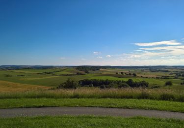
Tocht Te voet van 11,3 km beschikbaar op Grand Est, Moselle, Vittoncourt. Deze tocht wordt voorgesteld door SityTrail - itinéraires balisés pédestres.
Plaatsbepaling
Land:
France
Regio :
Grand Est
Departement/Provincie :
Moselle
Gemeente :
Vittoncourt
Locatie:
Unknown
Vertrek:(Dec)
Vertrek:(UTM)
315459 ; 5434866 (32U) N.
Opmerkingen
Wandeltochten in de omgeving
Circuit du Mont Saint-Pierre
Te voet
Gemakkelijk
Servigny-lès-Raville,
Grand Est,
Moselle,
France
2h 56min
Ja
Circuit de Vittoncourt-Arriance
Te voet
Medium
Arriance,
Grand Est,
Moselle,
France
18,9 km | 23 km-effort
5h 7min
Ja
Circuit de Walving
Te voet
Gemakkelijk
Elvange,
Grand Est,
Moselle,
France
13,7 km | 16,7 km-effort
3h 47min
Ja
Circuit de Chanville - Haut St Pierre
Te voet
Gemakkelijk
Hémilly,
Grand Est,
Moselle,
France
3,3 km | 4,2 km-effort
57min
Neen
Circuit LA FRONTIERE DES LANGUES
Te voet
Gemakkelijk
Mainvillers,
Grand Est,
Moselle,
France
8,6 km | 10 km-effort
2h 16min
Ja
Circuit L’ALLEE ST-PIERRE
Te voet
Gemakkelijk
Many,
Grand Est,
Moselle,
France
13,2 km | 15,7 km-effort
3h 34min
Ja
mt st pierre
Stappen
Heel gemakkelijk
Villers-Stoncourt,
Grand Est,
Moselle,
France
12,1 km | 14,6 km-effort
3h 5min
Neen
élevage. cepes
Trail
Heel gemakkelijk
Mainvillers,
Grand Est,
Moselle,
France
4,2 km | 5 km-effort
2h 11min
Ja