3,2 km | 5,1 km-effort
De la Cathédrale au chemin de la Coque et du Vila
SityTrail - itinéraires balisés pédestres
Tous les sentiers balisés d’Europe GUIDE+
Lengte
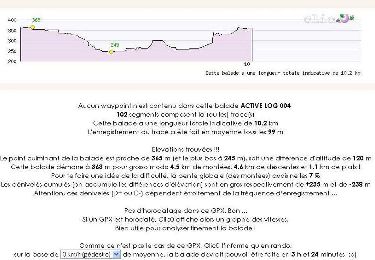
3,9 km
Max. hoogte
309 m
Positief hoogteverschil
105 m
Km-Effort
5,4 km
Min. hoogte
212 m
Negatief hoogteverschil
134 m
Boucle
Neen
Markering
Datum van aanmaak :
2022-02-17 11:03:09.519
Laatste wijziging :
2022-03-03 22:47:54.037
1h13
Moeilijkheid : Gemakkelijk
Gratisgps-wandelapplicatie
Over ons
Tocht Te voet van 3,9 km beschikbaar op Occitanië, Haute-Garonne, Rieux-Volvestre. Deze tocht wordt voorgesteld door SityTrail - itinéraires balisés pédestres.
Plaatsbepaling
Land:
France
Regio :
Occitanië
Departement/Provincie :
Haute-Garonne
Gemeente :
Rieux-Volvestre
Locatie:
Unknown
Vertrek:(Dec)
Vertrek:(UTM)
357081 ; 4790711 (31T) N.
Opmerkingen
Wandeltochten in de omgeving
Pissevinaigre
Te voet
Gemakkelijk
Rieux-Volvestre,
Occitanië,
Haute-Garonne,
France
6,3 km | 8,4 km-effort
1h 54min
Ja
Le chemin de Saint-Roc
Te voet
Gemakkelijk
Rieux-Volvestre,
Occitanië,
Haute-Garonne,
France
3,5 km | 4,8 km-effort
1h 5min
Neen
Latrape
Stappen
Gemakkelijk
Latrape,
Occitanië,
Haute-Garonne,
France
10,7 km | 14 km-effort
2h 41min
Ja
Belberaud 7km
Stappen
Heel gemakkelijk
Rieux-Volvestre,
Occitanië,
Haute-Garonne,
France
61 km | 80 km-effort
5h 22min
Neen
Rieux Plaine des Gaulois
Andere activiteiten
Gemakkelijk
Rieux-Volvestre,
Occitanië,
Haute-Garonne,
France
12,8 km | 15,1 km-effort
3h 21min
Ja
Carbonne abris
Stappen
Heel gemakkelijk
Carbonne,
Occitanië,
Haute-Garonne,
France
11,1 km | 13,3 km-effort
2h 25min
Ja
Boucle de Latrape
Stappen
Medium
Latrape,
Occitanië,
Haute-Garonne,
France
10,2 km | 12,8 km-effort
3h 0min
Ja
Du bourg médévial de Rieux Volvestre au village gaulois de St Julien
Lopen
Medium
Rieux-Volvestre,
Occitanië,
Haute-Garonne,
France
12,2 km | 14,3 km-effort
1h 0min
Ja