![](/images/other/stat-length.png)
![Tocht Te voet Friesach - Friesach-Deutschhauserberg-Runde - Photo](https://media.geolcdn.com/t/1900/400/0a50377b-aea3-472b-bedf-3b5b58b74d4c.jpeg&format=pjpeg&maxdim=2)
Friesach-Deutschhauserberg-Runde
SityTrail - itinéraires balisés pédestres
Tous les sentiers balisés d’Europe GUIDE+
![Lengte](/images/other/stat-length.png)
![Max. hoogte](https://static1.geolcdn.com/siteimages/upload/files/1508320355ic_sort_altitude_max_24dp.png)
![Positief hoogteverschil](https://static1.geolcdn.com/siteimages/upload/files/1508320355ic_sort_den_pos_24dp.png)
![Km-Effort](/images/other/stat-length.png)
![Min. hoogte](https://static1.geolcdn.com/siteimages/upload/files/1508320355ic_sort_altitude_min_24dp.png)
![Negatief hoogteverschil](https://static1.geolcdn.com/siteimages/upload/files/1508320355ic_sort_den_neg_24dp.png)
![Boucle](https://static1.geolcdn.com/siteimages/upload/files/16400158638029165_repeat_loop_refresh_sync_direction_icon.png)
![Te voet](https://static1.geolcdn.com/sitytour/trail-icons/100.png)
5h15
Moeilijkheid : Medium
![Scan deze QR-code om de tocht te openen in de SityTrail-applicatie](https://capi.geolives.com/qq0zvz2zws4bq2lad0pu/sitytour/trails/3129820/qr.png?size=200)
Gratisgps-wandelapplicatie
Over ons
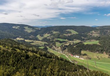
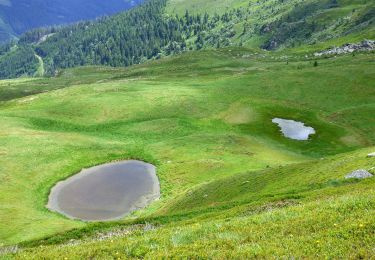
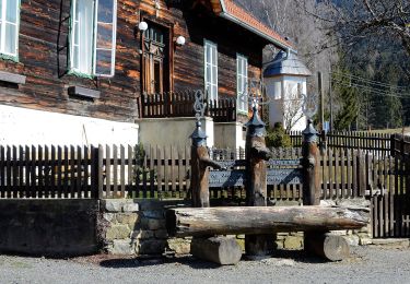
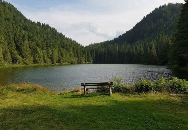
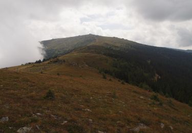
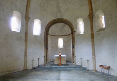
Tocht Te voet van 15,2 km beschikbaar op Karinthië, Bezirk Sankt Veit an der Glan, Friesach. Deze tocht wordt voorgesteld door SityTrail - itinéraires balisés pédestres.
Beschrijving
Trail created by ÖAV – Sektion Klagenfurt – Metnitztal – Friesacher Feld - Friesach-Deutschhauserberg-Runde https://www.outdooractive.com/de/route/wanderung/nockberge/friesach-deutschhauserberg-runde/25008106/.
Plaatsbepaling
Opmerkingen
Wandeltochten in de omgeving
![Tocht Te voet Frauenstein - Pulst-Sörg-Lorenziberg-Runde - Photo](https://media.geolcdn.com/t/375/260/de79d99f-df3f-4fa2-bcdb-261b2ed15353.jpeg&format=jpg&maxdim=2)
![Te voet Te voet](https://static1.geolcdn.com/sitytour/trail-icons/100.png)
Te voet
![](/images/other/stat-length.png)
![](https://static1.geolcdn.com/siteimages/upload/files/16400158638029165_repeat_loop_refresh_sync_direction_icon.png)
![Tocht Te voet Hüttenberg - Saualpen-Nordrunde - Photo](https://media.geolcdn.com/t/375/260/077f9a46-c65c-4128-9f0c-95f81e612863.jpeg&format=jpg&maxdim=2)
![Te voet Te voet](https://static1.geolcdn.com/sitytour/trail-icons/100.png)
Te voet
![](/images/other/stat-length.png)
![](https://static1.geolcdn.com/siteimages/upload/files/16400158638029165_repeat_loop_refresh_sync_direction_icon.png)
![Tocht Te voet Wolfsberg - Saualpen-Südrunde - Photo](https://media.geolcdn.com/t/375/260/077f9a46-c65c-4128-9f0c-95f81e612863.jpeg&format=jpg&maxdim=2)
![Te voet Te voet](https://static1.geolcdn.com/sitytour/trail-icons/100.png)
Te voet
![](/images/other/stat-length.png)
![](https://static1.geolcdn.com/siteimages/upload/files/16400158638029165_repeat_loop_refresh_sync_direction_icon.png)
![Tocht Te voet Eberstein - Eberstein's Sehenswürdigkeiten (Rundwanderung) - Photo](https://media.geolcdn.com/t/375/260/1bcdbfbd-5e67-4223-ae4d-e90f056fa883.jpeg&format=jpg&maxdim=2)
![Te voet Te voet](https://static1.geolcdn.com/sitytour/trail-icons/100.png)
Te voet
![](/images/other/stat-length.png)
![](https://static1.geolcdn.com/siteimages/upload/files/16400158638029165_repeat_loop_refresh_sync_direction_icon.png)
![Tocht Te voet Sankt Lambrecht - Wanderweg Nr. 14 - Photo](https://media.geolcdn.com/t/375/260/5c387c67-6ffe-4991-8cb6-10a3c60e4702.jpeg&format=jpg&maxdim=2)
![Te voet Te voet](https://static1.geolcdn.com/sitytour/trail-icons/100.png)
Te voet
![](/images/other/stat-length.png)
![](https://static1.geolcdn.com/siteimages/upload/files/16400158638029165_repeat_loop_refresh_sync_direction_icon.png)
![Tocht Te voet Hüttenberg - Geierkogelrunde - Photo](https://media.geolcdn.com/t/375/260/9679cc70-b524-4d1a-9180-de6ab1f5725e.jpeg&format=jpg&maxdim=2)
![Te voet Te voet](https://static1.geolcdn.com/sitytour/trail-icons/100.png)
Te voet
![](/images/other/stat-length.png)
![](https://static1.geolcdn.com/siteimages/upload/files/16400158638029165_repeat_loop_refresh_sync_direction_icon.png)
![Tocht Te voet Sankt Lambrecht - Mariazeller Gründerweg - Photo](https://media.geolcdn.com/t/375/260/66b8db57-d343-4a56-8859-0e86152b142d.jpeg&format=jpg&maxdim=2)
![Te voet Te voet](https://static1.geolcdn.com/sitytour/trail-icons/100.png)
Te voet
![](/images/other/stat-length.png)
![](https://static1.geolcdn.com/siteimages/upload/files/16400158638029165_repeat_loop_refresh_sync_direction_icon.png)
![Tocht Te voet Obdach - Wanderweg 23 - Photo](https://media.geolcdn.com/t/375/260/ext.jpg?maxdim=2&url=https%3A%2F%2Fstatic1.geolcdn.com%2Fsiteimages%2Fupload%2Ffiles%2F1545311037marcheuse_200dpi.jpg)
![Te voet Te voet](https://static1.geolcdn.com/sitytour/trail-icons/100.png)
Te voet
![](/images/other/stat-length.png)
![](https://static1.geolcdn.com/siteimages/upload/files/16400158638029165_repeat_loop_refresh_sync_direction_icon.png)
![Tocht Te voet Mühlen - Wanderweg 44 - Photo](https://media.geolcdn.com/t/375/260/ext.jpg?maxdim=2&url=https%3A%2F%2Fstatic1.geolcdn.com%2Fsiteimages%2Fupload%2Ffiles%2F1545311037marcheuse_200dpi.jpg)
![Te voet Te voet](https://static1.geolcdn.com/sitytour/trail-icons/100.png)
Te voet
![](/images/other/stat-length.png)
![](https://static1.geolcdn.com/siteimages/upload/files/16400158638029165_repeat_loop_refresh_sync_direction_icon.png)