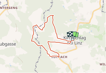
![](/images/other/stat-length.png)
![Tocht Te voet Kirchschlag bei Linz - Kirchschlag 2er - Photo](https://media.geolcdn.com/t/1900/400/b246ddb3-530e-427a-8a06-258dad3ce602.jpeg&format=pjpeg&maxdim=2)
Kirchschlag 2er
SityTrail - itinéraires balisés pédestres
Tous les sentiers balisés d’Europe GUIDE+
![Lengte](/images/other/stat-length.png)
![Max. hoogte](https://static1.geolcdn.com/siteimages/upload/files/1508320355ic_sort_altitude_max_24dp.png)
![Positief hoogteverschil](https://static1.geolcdn.com/siteimages/upload/files/1508320355ic_sort_den_pos_24dp.png)
![Km-Effort](/images/other/stat-length.png)
![Min. hoogte](https://static1.geolcdn.com/siteimages/upload/files/1508320355ic_sort_altitude_min_24dp.png)
![Negatief hoogteverschil](https://static1.geolcdn.com/siteimages/upload/files/1508320355ic_sort_den_neg_24dp.png)
![Boucle](https://static1.geolcdn.com/siteimages/upload/files/16400158638029165_repeat_loop_refresh_sync_direction_icon.png)
![Te voet](https://static1.geolcdn.com/sitytour/trail-icons/100.png)
2h21
Moeilijkheid : Gemakkelijk
![Scan deze QR-code om de tocht te openen in de SityTrail-applicatie](https://capi.geolives.com/qq0zvz2zws4bq2lad0pu/sitytour/trails/3128726/qr.png?size=200)
Gratisgps-wandelapplicatie
Over ons
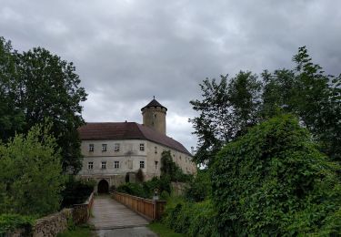
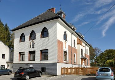
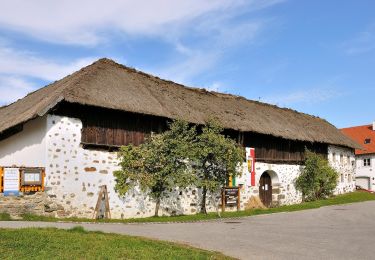
Tocht Te voet van 7,5 km beschikbaar op Opper-Oostenrijk, Bezirk Urfahr-Umgebung, Kirchschlag bei Linz. Deze tocht wordt voorgesteld door SityTrail - itinéraires balisés pédestres.
Beschrijving
Symbol: Violettes Schild mit Schawrzer Aufschrift "Kirschschlag" weißem Text "2er" und rotem hiweispfeil auf der rechten oder linken Seite
Plaatsbepaling
Opmerkingen
Wandeltochten in de omgeving
![Tocht Te voet Kirchschlag bei Linz - Speichmühle-Kirchschlag - Photo](https://media.geolcdn.com/t/375/260/347f3024-e410-4454-90c8-c8c5bfbe925d.jpeg&format=jpg&maxdim=2)
![Te voet Te voet](https://static1.geolcdn.com/sitytour/trail-icons/100.png)
Te voet
![](/images/other/stat-length.png)
![](https://static1.geolcdn.com/siteimages/upload/files/16400158638029165_repeat_loop_refresh_sync_direction_icon.png)
![Tocht Te voet Kirchschlag bei Linz - Kirchschlag 6er - Photo](https://media.geolcdn.com/t/375/260/89aeab92-5c1d-4f2d-86db-4abd9a2ec13e.jpeg&format=jpg&maxdim=2)
![Te voet Te voet](https://static1.geolcdn.com/sitytour/trail-icons/100.png)
Te voet
![](/images/other/stat-length.png)
![](https://static1.geolcdn.com/siteimages/upload/files/16400158638029165_repeat_loop_refresh_sync_direction_icon.png)
![Tocht Te voet Kirchschlag bei Linz - Kirchschlag 1er - Photo](https://media.geolcdn.com/t/375/260/62c3f557-6379-4375-918c-d3ba7d06727b.jpeg&format=jpg&maxdim=2)
![Te voet Te voet](https://static1.geolcdn.com/sitytour/trail-icons/100.png)
Te voet
![](/images/other/stat-length.png)
![](https://static1.geolcdn.com/siteimages/upload/files/16400158638029165_repeat_loop_refresh_sync_direction_icon.png)
![Tocht Te voet Kirchschlag bei Linz - Untergeng-Kirchschlag - Photo](https://media.geolcdn.com/t/375/260/34c105d1-90a2-464f-ba7f-d585ffbbf199.jpeg&format=jpg&maxdim=2)
![Te voet Te voet](https://static1.geolcdn.com/sitytour/trail-icons/100.png)
Te voet
![](/images/other/stat-length.png)
![](https://static1.geolcdn.com/siteimages/upload/files/16400158638029165_repeat_loop_refresh_sync_direction_icon.png)
![Tocht Te voet Hellmonsödt - AT-19 - Photo](https://media.geolcdn.com/t/375/260/02881a25-c23c-48f4-9933-335cb03edb79.jpeg&format=jpg&maxdim=2)
![Te voet Te voet](https://static1.geolcdn.com/sitytour/trail-icons/100.png)
Te voet
![](/images/other/stat-length.png)
![](https://static1.geolcdn.com/siteimages/upload/files/16400158638029165_repeat_loop_refresh_sync_direction_icon.png)
![Tocht Te voet Sonnberg im Mühlkreis - Mühlviertler Sterngartl Rundweg - Photo](https://media.geolcdn.com/t/375/260/5b99adca-b0b1-48c6-9f6c-32dc78115849.jpeg&format=jpg&maxdim=2)
![Te voet Te voet](https://static1.geolcdn.com/sitytour/trail-icons/100.png)
Te voet
![](/images/other/stat-length.png)
![](https://static1.geolcdn.com/siteimages/upload/files/16400158638029165_repeat_loop_refresh_sync_direction_icon.png)
![Tocht Te voet Kirchschlag bei Linz - Speichmühle-Wildberg - Photo](https://media.geolcdn.com/t/375/260/5935fc67-3c82-42ab-9050-2dfa41ebd2bc.jpeg&format=jpg&maxdim=2)
![Te voet Te voet](https://static1.geolcdn.com/sitytour/trail-icons/100.png)
Te voet
![](/images/other/stat-length.png)
![](https://static1.geolcdn.com/siteimages/upload/files/16400158638029165_repeat_loop_refresh_sync_direction_icon.png)
![Tocht Te voet Hellmonsödt - Wanderweg 18a - Photo](https://media.geolcdn.com/t/375/260/84020e3f-d4f4-45e2-b04b-df7b7ec2e38d.jpeg&format=jpg&maxdim=2)
![Te voet Te voet](https://static1.geolcdn.com/sitytour/trail-icons/100.png)
Te voet
![](/images/other/stat-length.png)
![](https://static1.geolcdn.com/siteimages/upload/files/16400158638029165_repeat_loop_refresh_sync_direction_icon.png)
![Tocht Te voet Hellmonsödt - Wanderweg 18 - Photo](https://media.geolcdn.com/t/375/260/8dcb7f22-0de3-4d6a-b2d7-05b71a0cb9ae.jpeg&format=jpg&maxdim=2)
![Te voet Te voet](https://static1.geolcdn.com/sitytour/trail-icons/100.png)
Te voet
![](/images/other/stat-length.png)
![](https://static1.geolcdn.com/siteimages/upload/files/16400158638029165_repeat_loop_refresh_sync_direction_icon.png)