


4,3 km | 5,6 km-effort

Tous les sentiers balisés d’Europe GUIDE+


Gratisgps-wandelapplicatie
 SityTrail
IGN / Geografische instituten
SityTrail World
De wereld gaat voor u open
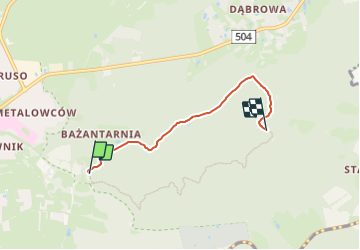
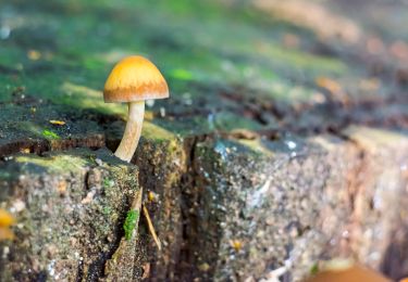
Tocht Te voet van 3,2 km beschikbaar op Woiwodschap Ermland-Mazurië, Elbląg. Deze tocht wordt voorgesteld door SityTrail - itinéraires balisés pédestres.
Website: http://www.szlaki.mazury.pl/Elblag-Bazantarnia-Restauracja-Mysliwska-Gora-J.../szlak-126
 "
data-pinterest-text="Pin it"
data-tweet-text="share on twitter"
data-facebook-share-url="https://www.sitytrail.com/nl/trails/3128370-unknown--niebieski-xokreznyx-lesny/?photo=1#lg=1&slide=1"
data-twitter-share-url="https://www.sitytrail.com/nl/trails/3128370-unknown--niebieski-xokreznyx-lesny/?photo=1#lg=1&slide=1"
data-googleplus-share-url="https://www.sitytrail.com/nl/trails/3128370-unknown--niebieski-xokreznyx-lesny/?photo=1#lg=1&slide=1"
data-pinterest-share-url="https://www.sitytrail.com/nl/trails/3128370-unknown--niebieski-xokreznyx-lesny/?photo=1#lg=1&slide=1">
"
data-pinterest-text="Pin it"
data-tweet-text="share on twitter"
data-facebook-share-url="https://www.sitytrail.com/nl/trails/3128370-unknown--niebieski-xokreznyx-lesny/?photo=1#lg=1&slide=1"
data-twitter-share-url="https://www.sitytrail.com/nl/trails/3128370-unknown--niebieski-xokreznyx-lesny/?photo=1#lg=1&slide=1"
data-googleplus-share-url="https://www.sitytrail.com/nl/trails/3128370-unknown--niebieski-xokreznyx-lesny/?photo=1#lg=1&slide=1"
data-pinterest-share-url="https://www.sitytrail.com/nl/trails/3128370-unknown--niebieski-xokreznyx-lesny/?photo=1#lg=1&slide=1">
 "
data-pinterest-text="Pin it"
data-tweet-text="share on twitter"
data-facebook-share-url="https://www.sitytrail.com/nl/trails/3128370-unknown--niebieski-xokreznyx-lesny/?photo=2#lg=1&slide=2"
data-twitter-share-url="https://www.sitytrail.com/nl/trails/3128370-unknown--niebieski-xokreznyx-lesny/?photo=2#lg=1&slide=2"
data-googleplus-share-url="https://www.sitytrail.com/nl/trails/3128370-unknown--niebieski-xokreznyx-lesny/?photo=2#lg=1&slide=2"
data-pinterest-share-url="https://www.sitytrail.com/nl/trails/3128370-unknown--niebieski-xokreznyx-lesny/?photo=2#lg=1&slide=2">
"
data-pinterest-text="Pin it"
data-tweet-text="share on twitter"
data-facebook-share-url="https://www.sitytrail.com/nl/trails/3128370-unknown--niebieski-xokreznyx-lesny/?photo=2#lg=1&slide=2"
data-twitter-share-url="https://www.sitytrail.com/nl/trails/3128370-unknown--niebieski-xokreznyx-lesny/?photo=2#lg=1&slide=2"
data-googleplus-share-url="https://www.sitytrail.com/nl/trails/3128370-unknown--niebieski-xokreznyx-lesny/?photo=2#lg=1&slide=2"
data-pinterest-share-url="https://www.sitytrail.com/nl/trails/3128370-unknown--niebieski-xokreznyx-lesny/?photo=2#lg=1&slide=2">
 "
data-pinterest-text="Pin it"
data-tweet-text="share on twitter"
data-facebook-share-url="https://www.sitytrail.com/nl/trails/3128370-unknown--niebieski-xokreznyx-lesny/?photo=3#lg=1&slide=3"
data-twitter-share-url="https://www.sitytrail.com/nl/trails/3128370-unknown--niebieski-xokreznyx-lesny/?photo=3#lg=1&slide=3"
data-googleplus-share-url="https://www.sitytrail.com/nl/trails/3128370-unknown--niebieski-xokreznyx-lesny/?photo=3#lg=1&slide=3"
data-pinterest-share-url="https://www.sitytrail.com/nl/trails/3128370-unknown--niebieski-xokreznyx-lesny/?photo=3#lg=1&slide=3">
"
data-pinterest-text="Pin it"
data-tweet-text="share on twitter"
data-facebook-share-url="https://www.sitytrail.com/nl/trails/3128370-unknown--niebieski-xokreznyx-lesny/?photo=3#lg=1&slide=3"
data-twitter-share-url="https://www.sitytrail.com/nl/trails/3128370-unknown--niebieski-xokreznyx-lesny/?photo=3#lg=1&slide=3"
data-googleplus-share-url="https://www.sitytrail.com/nl/trails/3128370-unknown--niebieski-xokreznyx-lesny/?photo=3#lg=1&slide=3"
data-pinterest-share-url="https://www.sitytrail.com/nl/trails/3128370-unknown--niebieski-xokreznyx-lesny/?photo=3#lg=1&slide=3">
 "
data-pinterest-text="Pin it"
data-tweet-text="share on twitter"
data-facebook-share-url="https://www.sitytrail.com/nl/trails/3128370-unknown--niebieski-xokreznyx-lesny/?photo=4#lg=1&slide=4"
data-twitter-share-url="https://www.sitytrail.com/nl/trails/3128370-unknown--niebieski-xokreznyx-lesny/?photo=4#lg=1&slide=4"
data-googleplus-share-url="https://www.sitytrail.com/nl/trails/3128370-unknown--niebieski-xokreznyx-lesny/?photo=4#lg=1&slide=4"
data-pinterest-share-url="https://www.sitytrail.com/nl/trails/3128370-unknown--niebieski-xokreznyx-lesny/?photo=4#lg=1&slide=4">
"
data-pinterest-text="Pin it"
data-tweet-text="share on twitter"
data-facebook-share-url="https://www.sitytrail.com/nl/trails/3128370-unknown--niebieski-xokreznyx-lesny/?photo=4#lg=1&slide=4"
data-twitter-share-url="https://www.sitytrail.com/nl/trails/3128370-unknown--niebieski-xokreznyx-lesny/?photo=4#lg=1&slide=4"
data-googleplus-share-url="https://www.sitytrail.com/nl/trails/3128370-unknown--niebieski-xokreznyx-lesny/?photo=4#lg=1&slide=4"
data-pinterest-share-url="https://www.sitytrail.com/nl/trails/3128370-unknown--niebieski-xokreznyx-lesny/?photo=4#lg=1&slide=4">
 "
data-pinterest-text="Pin it"
data-tweet-text="share on twitter"
data-facebook-share-url="https://www.sitytrail.com/nl/trails/3128370-unknown--niebieski-xokreznyx-lesny/?photo=5#lg=1&slide=5"
data-twitter-share-url="https://www.sitytrail.com/nl/trails/3128370-unknown--niebieski-xokreznyx-lesny/?photo=5#lg=1&slide=5"
data-googleplus-share-url="https://www.sitytrail.com/nl/trails/3128370-unknown--niebieski-xokreznyx-lesny/?photo=5#lg=1&slide=5"
data-pinterest-share-url="https://www.sitytrail.com/nl/trails/3128370-unknown--niebieski-xokreznyx-lesny/?photo=5#lg=1&slide=5">
"
data-pinterest-text="Pin it"
data-tweet-text="share on twitter"
data-facebook-share-url="https://www.sitytrail.com/nl/trails/3128370-unknown--niebieski-xokreznyx-lesny/?photo=5#lg=1&slide=5"
data-twitter-share-url="https://www.sitytrail.com/nl/trails/3128370-unknown--niebieski-xokreznyx-lesny/?photo=5#lg=1&slide=5"
data-googleplus-share-url="https://www.sitytrail.com/nl/trails/3128370-unknown--niebieski-xokreznyx-lesny/?photo=5#lg=1&slide=5"
data-pinterest-share-url="https://www.sitytrail.com/nl/trails/3128370-unknown--niebieski-xokreznyx-lesny/?photo=5#lg=1&slide=5">
 "
data-pinterest-text="Pin it"
data-tweet-text="share on twitter"
data-facebook-share-url="https://www.sitytrail.com/nl/trails/3128370-unknown--niebieski-xokreznyx-lesny/?photo=6#lg=1&slide=6"
data-twitter-share-url="https://www.sitytrail.com/nl/trails/3128370-unknown--niebieski-xokreznyx-lesny/?photo=6#lg=1&slide=6"
data-googleplus-share-url="https://www.sitytrail.com/nl/trails/3128370-unknown--niebieski-xokreznyx-lesny/?photo=6#lg=1&slide=6"
data-pinterest-share-url="https://www.sitytrail.com/nl/trails/3128370-unknown--niebieski-xokreznyx-lesny/?photo=6#lg=1&slide=6">
"
data-pinterest-text="Pin it"
data-tweet-text="share on twitter"
data-facebook-share-url="https://www.sitytrail.com/nl/trails/3128370-unknown--niebieski-xokreznyx-lesny/?photo=6#lg=1&slide=6"
data-twitter-share-url="https://www.sitytrail.com/nl/trails/3128370-unknown--niebieski-xokreznyx-lesny/?photo=6#lg=1&slide=6"
data-googleplus-share-url="https://www.sitytrail.com/nl/trails/3128370-unknown--niebieski-xokreznyx-lesny/?photo=6#lg=1&slide=6"
data-pinterest-share-url="https://www.sitytrail.com/nl/trails/3128370-unknown--niebieski-xokreznyx-lesny/?photo=6#lg=1&slide=6">

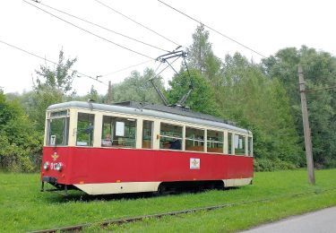
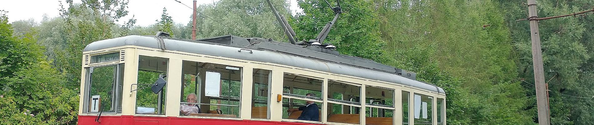
Te voet
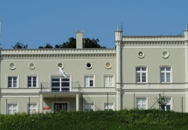
Te voet
Te voet