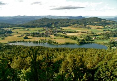

Pleschenberg
SityTrail - itinéraires balisés pédestres
Tous les sentiers balisés d’Europe GUIDE+

Lengte
5,1 km

Max. hoogte
796 m

Positief hoogteverschil
27 m

Km-Effort
6,5 km

Min. hoogte
459 m

Negatief hoogteverschil
338 m
Boucle
Neen
Markering
Datum van aanmaak :
2022-02-16 16:46:33.765
Laatste wijziging :
2022-03-03 11:53:01.707
1h28
Moeilijkheid : Gemakkelijk

Gratisgps-wandelapplicatie
Over ons
Tocht Te voet van 5,1 km beschikbaar op Karinthië, Bezirk Klagenfurt-Land, Köttmannsdorf. Deze tocht wordt voorgesteld door SityTrail - itinéraires balisés pédestres.
Beschrijving
Trail created by Stadtgarten Klagenfurt.
http://wiki.openstreetmap.org/wiki/WikiProject_Austria/Wanderwege
Symbol: rot-weiss-rot 43
Plaatsbepaling
Land:
Austria
Regio :
Karinthië
Departement/Provincie :
Bezirk Klagenfurt-Land
Gemeente :
Köttmannsdorf
Locatie:
Unknown
Vertrek:(Dec)
Vertrek:(UTM)
441502 ; 5157931 (33T) N.
Opmerkingen
Wandeltochten in de omgeving

W17 Pyramidenkogelweg Reifnitz


Te voet
Gemakkelijk
Maria Wörth,
Karinthië,
Bezirk Klagenfurt-Land,
Austria

5,4 km | 9,7 km-effort
2h 12min
Neen

4-Seenweg Keutschach


Te voet
Gemakkelijk
Keutschach am See,
Karinthië,
Bezirk Klagenfurt-Land,
Austria

3,4 km | 4,2 km-effort
56min
Neen

Hörtendorf-Loretto


Te voet
Gemakkelijk
Onbekend,
Karinthië,
Klagenfurt am Wörthersee,
Austria

5 km | 5,4 km-effort
1h 13min
Neen

Keutschach Wanderweg 33


Te voet
Gemakkelijk
Keutschach am See,
Karinthië,
Bezirk Klagenfurt-Land,
Austria

4,7 km | 7,4 km-effort
1h 40min
Neen


 SityTrail


