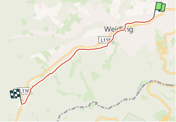
![](/images/other/stat-length.png)
![Tocht Te voet Gemeinde Klosterneuburg - Klosterneuburg - Hinterweidling - Photo](https://media.geolcdn.com/t/1900/400/f829833b-6801-4cba-96fc-04e334598f2f.jpeg&format=pjpeg&maxdim=2)
Klosterneuburg - Hinterweidling
SityTrail - itinéraires balisés pédestres
Tous les sentiers balisés d’Europe GUIDE+
![Lengte](/images/other/stat-length.png)
![Max. hoogte](https://static1.geolcdn.com/siteimages/upload/files/1508320355ic_sort_altitude_max_24dp.png)
![Positief hoogteverschil](https://static1.geolcdn.com/siteimages/upload/files/1508320355ic_sort_den_pos_24dp.png)
![Km-Effort](/images/other/stat-length.png)
![Min. hoogte](https://static1.geolcdn.com/siteimages/upload/files/1508320355ic_sort_altitude_min_24dp.png)
![Negatief hoogteverschil](https://static1.geolcdn.com/siteimages/upload/files/1508320355ic_sort_den_neg_24dp.png)
![Boucle](https://static1.geolcdn.com/siteimages/upload/files/16400158638029165_repeat_loop_refresh_sync_direction_icon.png)
![Te voet](https://static1.geolcdn.com/sitytour/trail-icons/100.png)
1h15
Moeilijkheid : Gemakkelijk
![Scan deze QR-code om de tocht te openen in de SityTrail-applicatie](https://capi.geolives.com/qq0zvz2zws4bq2lad0pu/sitytour/trails/3127496/qr.png?size=200)
Gratisgps-wandelapplicatie
Over ons
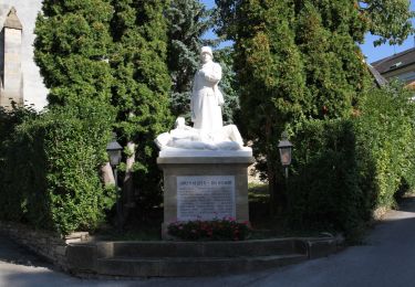
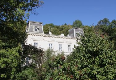
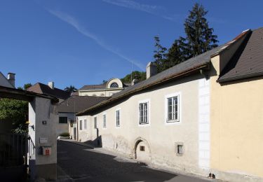
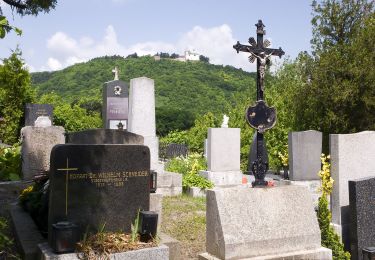
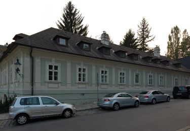
Tocht Te voet van 4,5 km beschikbaar op Neder-Oostenrijk, Bezirk Tulln, Gemeinde Klosterneuburg. Deze tocht wordt voorgesteld door SityTrail - itinéraires balisés pédestres.
Beschrijving
Trail created by ÖTK-Klosterneuburg.
Symbol: weiss-gruen-weiss
Website: https://www.oetk-klosterneuburg.at/index.php/unsere-wege/weginformation/412-klosterneuburg-hinterweidling
Plaatsbepaling
Opmerkingen
Wandeltochten in de omgeving
![Tocht Te voet Gemeinde Klosterneuburg - Rundwanderweg 4 - Photo](https://media.geolcdn.com/t/375/260/5781b571-b3f3-42cf-8768-6a9cd954d762.jpeg&format=jpg&maxdim=2)
![Te voet Te voet](https://static1.geolcdn.com/sitytour/trail-icons/100.png)
Te voet
![](/images/other/stat-length.png)
![](https://static1.geolcdn.com/siteimages/upload/files/16400158638029165_repeat_loop_refresh_sync_direction_icon.png)
![Tocht Te voet Gemeinde St. Andrä-Wördern - Rundwanderweg 2 - Photo](https://media.geolcdn.com/t/375/260/5781b571-b3f3-42cf-8768-6a9cd954d762.jpeg&format=jpg&maxdim=2)
![Te voet Te voet](https://static1.geolcdn.com/sitytour/trail-icons/100.png)
Te voet
![](/images/other/stat-length.png)
![](https://static1.geolcdn.com/siteimages/upload/files/16400158638029165_repeat_loop_refresh_sync_direction_icon.png)
![Tocht Te voet Gemeinde Klosterneuburg - Klosterneuburg - Hohenauer Wiese (Adolf Robl Weg) - Photo](https://media.geolcdn.com/t/375/260/0ad0fdf4-6d13-42e8-a837-bd5f989cca6c.jpeg&format=jpg&maxdim=2)
![Te voet Te voet](https://static1.geolcdn.com/sitytour/trail-icons/100.png)
Te voet
![](/images/other/stat-length.png)
![](https://static1.geolcdn.com/siteimages/upload/files/16400158638029165_repeat_loop_refresh_sync_direction_icon.png)
![Tocht Te voet Gemeinde Klosterneuburg - Kierling - Eichenhain - Photo](https://media.geolcdn.com/t/375/260/dac8ea3a-c503-4e65-8032-64dfd703fdc0.jpeg&format=jpg&maxdim=2)
![Te voet Te voet](https://static1.geolcdn.com/sitytour/trail-icons/100.png)
Te voet
![](/images/other/stat-length.png)
![](https://static1.geolcdn.com/siteimages/upload/files/16400158638029165_repeat_loop_refresh_sync_direction_icon.png)
![Tocht Te voet Gemeinde Klosterneuburg - Weidling - Kierling (Dr. Walter Brandstetter Weg) - Photo](https://media.geolcdn.com/t/375/260/4443d887-bb67-409e-9884-c1e7d6cd8438.jpeg&format=jpg&maxdim=2)
![Te voet Te voet](https://static1.geolcdn.com/sitytour/trail-icons/100.png)
Te voet
![](/images/other/stat-length.png)
![](https://static1.geolcdn.com/siteimages/upload/files/16400158638029165_repeat_loop_refresh_sync_direction_icon.png)
![Tocht Te voet Gemeinde Klosterneuburg - Weidling - Hohenauer Wiese - Photo](https://media.geolcdn.com/t/375/260/a3fef88e-6ffd-425c-81bc-63c3658ae9d6.jpeg&format=jpg&maxdim=2)
![Te voet Te voet](https://static1.geolcdn.com/sitytour/trail-icons/100.png)
Te voet
![](/images/other/stat-length.png)
![](https://static1.geolcdn.com/siteimages/upload/files/16400158638029165_repeat_loop_refresh_sync_direction_icon.png)
![Tocht Te voet Onbekend - Kahlenbergerdorfer Weinrundwanderweg - Photo](https://media.geolcdn.com/t/375/260/e218559e-5d8c-463c-80d9-0b8152eec5ac.jpeg&format=jpg&maxdim=2)
![Te voet Te voet](https://static1.geolcdn.com/sitytour/trail-icons/100.png)
Te voet
![](/images/other/stat-length.png)
![](https://static1.geolcdn.com/siteimages/upload/files/16400158638029165_repeat_loop_refresh_sync_direction_icon.png)
![Tocht Te voet Onbekend - Grüß di a Gott Wirt - Cobenzl - Photo](https://media.geolcdn.com/t/375/260/0343ff54-7543-4905-afff-c2d6aabb810a.jpeg&format=jpg&maxdim=2)
![Te voet Te voet](https://static1.geolcdn.com/sitytour/trail-icons/100.png)
Te voet
![](/images/other/stat-length.png)
![](https://static1.geolcdn.com/siteimages/upload/files/16400158638029165_repeat_loop_refresh_sync_direction_icon.png)
![Tocht Te voet Onbekend - Sievering/Gspöttgraben - Habsburgwarte - Photo](https://media.geolcdn.com/t/375/260/a0373cb7-e5a7-4848-9c81-91f4b5c5255d.jpeg&format=jpg&maxdim=2)
![Te voet Te voet](https://static1.geolcdn.com/sitytour/trail-icons/100.png)
Te voet
![](/images/other/stat-length.png)
![](https://static1.geolcdn.com/siteimages/upload/files/16400158638029165_repeat_loop_refresh_sync_direction_icon.png)