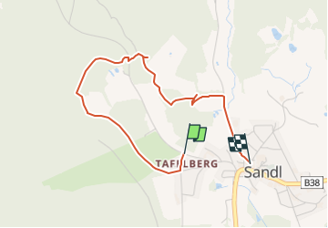
![](/images/other/stat-length.png)
![Tocht Te voet Sandl - Feuerwehr Erlebnisweg - Photo](https://media.geolcdn.com/t/1900/400/73c2063c-163b-4768-a96b-0910ea9d3381.jpeg&format=pjpeg&maxdim=2)
Feuerwehr Erlebnisweg
SityTrail - itinéraires balisés pédestres
Tous les sentiers balisés d’Europe GUIDE+
![Lengte](/images/other/stat-length.png)
![Max. hoogte](https://static1.geolcdn.com/siteimages/upload/files/1508320355ic_sort_altitude_max_24dp.png)
![Positief hoogteverschil](https://static1.geolcdn.com/siteimages/upload/files/1508320355ic_sort_den_pos_24dp.png)
![Km-Effort](/images/other/stat-length.png)
![Min. hoogte](https://static1.geolcdn.com/siteimages/upload/files/1508320355ic_sort_altitude_min_24dp.png)
![Negatief hoogteverschil](https://static1.geolcdn.com/siteimages/upload/files/1508320355ic_sort_den_neg_24dp.png)
![Boucle](https://static1.geolcdn.com/siteimages/upload/files/16400158638029165_repeat_loop_refresh_sync_direction_icon.png)
![Te voet](https://static1.geolcdn.com/sitytour/trail-icons/100.png)
1h01
Moeilijkheid : Gemakkelijk
![Scan deze QR-code om de tocht te openen in de SityTrail-applicatie](https://capi.geolives.com/qq0zvz2zws4bq2lad0pu/sitytour/trails/3127235/qr.png?size=200)
Gratisgps-wandelapplicatie
Over ons
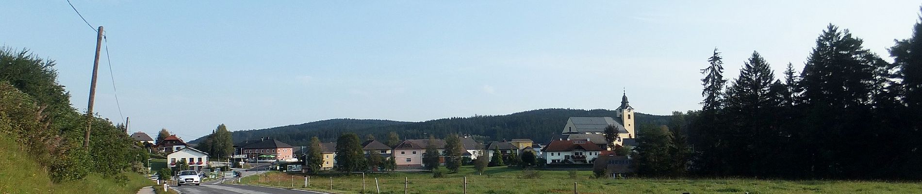
Tocht Te voet van 3,3 km beschikbaar op Opper-Oostenrijk, Bezirk Freistadt, Sandl. Deze tocht wordt voorgesteld door SityTrail - itinéraires balisés pédestres.
Beschrijving
Trail created by Tourismusverband Sandl.
Symbol: http://www.feuerwehrerlebnisweg-sandl.at/images/Flori rechts 20.12.gif
Symbol: Flori : http://www.feuerwehrerlebnisweg-sandl.at/images/Flori rechts 20.12.gif
Website: http://www.feuerwehrerlebnisweg-sandl.at
Plaatsbepaling
Opmerkingen
Wandeltochten in de omgeving
![Tocht Te voet Sankt Oswald bei Freistadt - Panoramaweg - Mitterbach - Photo](https://media.geolcdn.com/t/375/260/d7243e97-9a42-45d3-9620-9027b8a406e1.jpeg&format=jpg&maxdim=2)
![Te voet Te voet](https://static1.geolcdn.com/sitytour/trail-icons/100.png)
Te voet
![](/images/other/stat-length.png)
![](https://static1.geolcdn.com/siteimages/upload/files/16400158638029165_repeat_loop_refresh_sync_direction_icon.png)
![Tocht Te voet Sandl - AT-S7 - Photo](https://media.geolcdn.com/t/375/260/fadfdd0e-5cd4-46bf-bff3-f5e0e0aab457.jpeg&format=jpg&maxdim=2)
![Te voet Te voet](https://static1.geolcdn.com/sitytour/trail-icons/100.png)
Te voet
![](/images/other/stat-length.png)
![](https://static1.geolcdn.com/siteimages/upload/files/16400158638029165_repeat_loop_refresh_sync_direction_icon.png)
![Tocht Te voet Sankt Oswald bei Freistadt - Hochplateauweg - Photo](https://media.geolcdn.com/t/375/260/ext.jpg?maxdim=2&url=https%3A%2F%2Fstatic1.geolcdn.com%2Fsiteimages%2Fupload%2Ffiles%2F1545311037marcheuse_200dpi.jpg)
![Te voet Te voet](https://static1.geolcdn.com/sitytour/trail-icons/100.png)
Te voet
![](/images/other/stat-length.png)
![](https://static1.geolcdn.com/siteimages/upload/files/16400158638029165_repeat_loop_refresh_sync_direction_icon.png)