![](/images/other/stat-length.png)
![Tocht Te voet Alkoven - Innbachrunde - Photo](https://media.geolcdn.com/t/1900/400/47097783-b7b9-4d8e-ad21-10fa3025fddf.jpeg&format=pjpeg&maxdim=2)
Innbachrunde
SityTrail - itinéraires balisés pédestres
Tous les sentiers balisés d’Europe GUIDE+
![Lengte](/images/other/stat-length.png)
Lengte
16,5 km
![Max. hoogte](https://static1.geolcdn.com/siteimages/upload/files/1508320355ic_sort_altitude_max_24dp.png)
Max. hoogte
326 m
![Positief hoogteverschil](https://static1.geolcdn.com/siteimages/upload/files/1508320355ic_sort_den_pos_24dp.png)
Positief hoogteverschil
154 m
![Km-Effort](/images/other/stat-length.png)
Km-Effort
18,6 km
![Min. hoogte](https://static1.geolcdn.com/siteimages/upload/files/1508320355ic_sort_altitude_min_24dp.png)
Min. hoogte
254 m
![Negatief hoogteverschil](https://static1.geolcdn.com/siteimages/upload/files/1508320355ic_sort_den_neg_24dp.png)
Negatief hoogteverschil
153 m
![Boucle](https://static1.geolcdn.com/siteimages/upload/files/16400158638029165_repeat_loop_refresh_sync_direction_icon.png)
Boucle
Ja
Markering
Datum van aanmaak :
2022-02-16 16:22:55.644
Laatste wijziging :
2022-03-03 06:58:35.468
![Te voet](https://static1.geolcdn.com/sitytour/trail-icons/100.png)
4h13
Moeilijkheid : Gemakkelijk
![Scan deze QR-code om de tocht te openen in de SityTrail-applicatie](https://capi.geolives.com/qq0zvz2zws4bq2lad0pu/sitytour/trails/3126841/qr.png?size=200)
Gratisgps-wandelapplicatie
Over ons
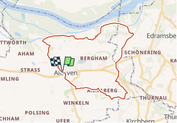
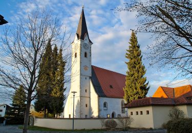
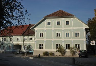
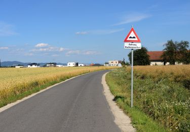
Tocht Te voet van 16,5 km beschikbaar op Opper-Oostenrijk, Bezirk Eferding, Alkoven. Deze tocht wordt voorgesteld door SityTrail - itinéraires balisés pédestres.
Beschrijving
Symbol: gelber Hinweispfeil mit dem Text "A1 Innbachrunde"
Plaatsbepaling
Land:
Austria
Regio :
Opper-Oostenrijk
Departement/Provincie :
Bezirk Eferding
Gemeente :
Alkoven
Locatie:
Unknown
Vertrek:(Dec)
Vertrek:(UTM)
433609 ; 5348678 (33U) N.
Opmerkingen
Wandeltochten in de omgeving
![Tocht Te voet Goldwörth - Amerika-Runde - Photo](https://media.geolcdn.com/t/375/260/2323184a-07b3-4a39-a702-0963b77f5fe8.jpeg&format=jpg&maxdim=2)
![Te voet Te voet](https://static1.geolcdn.com/sitytour/trail-icons/100.png)
Amerika-Runde
Te voet
Gemakkelijk
Goldwörth,
Opper-Oostenrijk,
Bezirk Urfahr-Umgebung,
Austria
![](/images/other/stat-length.png)
8,9 km | 9,9 km-effort
2h 14min
![](https://static1.geolcdn.com/siteimages/upload/files/16400158638029165_repeat_loop_refresh_sync_direction_icon.png)
Ja
![Tocht Te voet Alkoven - Kulturrunde - Photo](https://media.geolcdn.com/t/375/260/5535f343-6d0c-48a4-b678-d833cda801bc.jpeg&format=jpg&maxdim=2)
![Te voet Te voet](https://static1.geolcdn.com/sitytour/trail-icons/100.png)
Kulturrunde
Te voet
Gemakkelijk
Alkoven,
Opper-Oostenrijk,
Bezirk Eferding,
Austria
![](/images/other/stat-length.png)
5,3 km | 6,5 km-effort
1h 28min
![](https://static1.geolcdn.com/siteimages/upload/files/16400158638029165_repeat_loop_refresh_sync_direction_icon.png)
Ja
![Tocht Te voet Goldwörth - Großer Goldwörther Donaurundweg - Photo](https://media.geolcdn.com/t/375/260/8669db61-1119-4fdb-9caf-81ce383e5d37.jpeg&format=jpg&maxdim=2)
![Te voet Te voet](https://static1.geolcdn.com/sitytour/trail-icons/100.png)
Großer Goldwörther Donaurundweg
Te voet
Gemakkelijk
Goldwörth,
Opper-Oostenrijk,
Bezirk Urfahr-Umgebung,
Austria
![](/images/other/stat-length.png)
11 km | 11,9 km-effort
2h 42min
![](https://static1.geolcdn.com/siteimages/upload/files/16400158638029165_repeat_loop_refresh_sync_direction_icon.png)
Ja
![Tocht Te voet Goldwörth - Kleiner Goldwörther Donaurundweg - Photo](https://media.geolcdn.com/t/375/260/8669db61-1119-4fdb-9caf-81ce383e5d37.jpeg&format=jpg&maxdim=2)
![Te voet Te voet](https://static1.geolcdn.com/sitytour/trail-icons/100.png)
Kleiner Goldwörther Donaurundweg
Te voet
Gemakkelijk
Goldwörth,
Opper-Oostenrijk,
Bezirk Urfahr-Umgebung,
Austria
![](/images/other/stat-length.png)
5 km | 5,4 km-effort
1h 13min
![](https://static1.geolcdn.com/siteimages/upload/files/16400158638029165_repeat_loop_refresh_sync_direction_icon.png)
Ja
![Tocht Te voet Alkoven - Naturfreundeweg - Photo](https://media.geolcdn.com/t/375/260/5535f343-6d0c-48a4-b678-d833cda801bc.jpeg&format=jpg&maxdim=2)
![Te voet Te voet](https://static1.geolcdn.com/sitytour/trail-icons/100.png)
Naturfreundeweg
Te voet
Medium
Alkoven,
Opper-Oostenrijk,
Bezirk Eferding,
Austria
![](/images/other/stat-length.png)
16,8 km | 20 km-effort
4h 38min
![](https://static1.geolcdn.com/siteimages/upload/files/16400158638029165_repeat_loop_refresh_sync_direction_icon.png)
Neen
![Tocht Te voet Kirchberg-Thening - Rundwanderweg Thening - Photo](https://media.geolcdn.com/t/375/260/1fda2cdd-c7df-4ea2-ab6c-9198319ca3ff.jpeg&format=jpg&maxdim=2)
![Te voet Te voet](https://static1.geolcdn.com/sitytour/trail-icons/100.png)
Rundwanderweg Thening
Te voet
Gemakkelijk
Kirchberg-Thening,
Opper-Oostenrijk,
Bezirk Linz-Land,
Austria
![](/images/other/stat-length.png)
9,4 km | 11,4 km-effort
2h 35min
![](https://static1.geolcdn.com/siteimages/upload/files/16400158638029165_repeat_loop_refresh_sync_direction_icon.png)
Ja
![Tocht Te voet Kirchberg-Thening - Rundwanderweg Kirchberg Thening 1 - Photo](https://media.geolcdn.com/t/375/260/17054e25-c847-4db7-bc8f-2bb398d13771.jpeg&format=jpg&maxdim=2)
![Te voet Te voet](https://static1.geolcdn.com/sitytour/trail-icons/100.png)
Rundwanderweg Kirchberg Thening 1
Te voet
Gemakkelijk
Kirchberg-Thening,
Opper-Oostenrijk,
Bezirk Linz-Land,
Austria
![](/images/other/stat-length.png)
9,8 km | 12,2 km-effort
2h 46min
![](https://static1.geolcdn.com/siteimages/upload/files/16400158638029165_repeat_loop_refresh_sync_direction_icon.png)
Ja
![Tocht Te voet Wilhering - Schönering-Appersberg - Photo](https://media.geolcdn.com/t/375/260/f1656241-15e5-45a1-a99a-d1d4fc992da7.jpeg&format=jpg&maxdim=2)
![Te voet Te voet](https://static1.geolcdn.com/sitytour/trail-icons/100.png)
Schönering-Appersberg
Te voet
Gemakkelijk
Wilhering,
Opper-Oostenrijk,
Bezirk Linz-Land,
Austria
![](/images/other/stat-length.png)
3,6 km | 4,9 km-effort
1h 6min
![](https://static1.geolcdn.com/siteimages/upload/files/16400158638029165_repeat_loop_refresh_sync_direction_icon.png)
Neen
![Tocht Te voet Wilhering - Schönering-Dörnbach - Photo](https://media.geolcdn.com/t/375/260/f1656241-15e5-45a1-a99a-d1d4fc992da7.jpeg&format=jpg&maxdim=2)
![Te voet Te voet](https://static1.geolcdn.com/sitytour/trail-icons/100.png)
Schönering-Dörnbach
Te voet
Gemakkelijk
Wilhering,
Opper-Oostenrijk,
Bezirk Linz-Land,
Austria
![](/images/other/stat-length.png)
4,4 km | 5,8 km-effort
1h 18min
![](https://static1.geolcdn.com/siteimages/upload/files/16400158638029165_repeat_loop_refresh_sync_direction_icon.png)
Neen