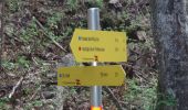
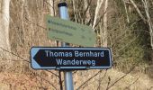
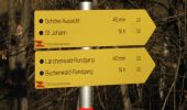
![](/images/other/stat-length.png)
![Tocht Te voet Sankt Veit im Pongau - St. Veit-Kinderalm über Seelacken - Photo](https://media.geolcdn.com/t/1900/400/876af22c-ddea-40c2-a09a-e0eb6c463c3c.jpeg&format=pjpeg&maxdim=2)
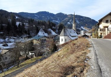
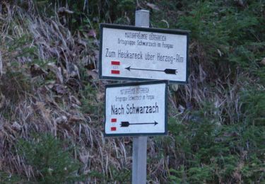
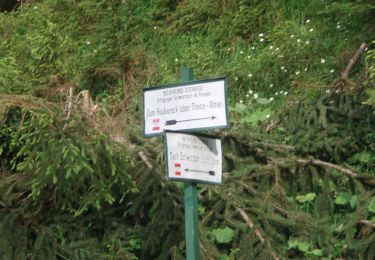
St. Veit-Kinderalm über Seelacken
SityTrail - itinéraires balisés pédestres
Tous les sentiers balisés d’Europe GUIDE+
![Lengte](/images/other/stat-length.png)
Lengte
3,1 km
![Max. hoogte](https://static1.geolcdn.com/siteimages/upload/files/1508320355ic_sort_altitude_max_24dp.png)
Max. hoogte
1271 m
![Positief hoogteverschil](https://static1.geolcdn.com/siteimages/upload/files/1508320355ic_sort_den_pos_24dp.png)
Positief hoogteverschil
487 m
![Km-Effort](/images/other/stat-length.png)
Km-Effort
8 km
![Min. hoogte](https://static1.geolcdn.com/siteimages/upload/files/1508320355ic_sort_altitude_min_24dp.png)
Min. hoogte
788 m
![Negatief hoogteverschil](https://static1.geolcdn.com/siteimages/upload/files/1508320355ic_sort_den_neg_24dp.png)
Negatief hoogteverschil
4 m
![Boucle](https://static1.geolcdn.com/siteimages/upload/files/16400158638029165_repeat_loop_refresh_sync_direction_icon.png)
Boucle
Neen
Markering
Datum van aanmaak :
2022-02-16 16:21:48.628
Laatste wijziging :
2022-03-03 06:20:50.316
![Te voet](https://static1.geolcdn.com/sitytour/trail-icons/100.png)
1h49
Moeilijkheid : Gemakkelijk
![Scan deze QR-code om de tocht te openen in de SityTrail-applicatie](https://capi.geolives.com/qq0zvz2zws4bq2lad0pu/sitytour/trails/3126747/qr.png?size=200)
Gratisgps-wandelapplicatie
Over ons
Tocht Te voet van 3,1 km beschikbaar op Salzburg, Bezirk St. Johann im Pongau, Sankt Veit im Pongau. Deze tocht wordt voorgesteld door SityTrail - itinéraires balisés pédestres.
Beschrijving
Trail created by TVB St. Veit - Schwarzach.
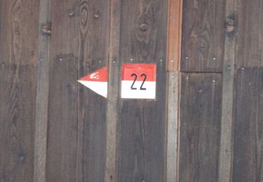
Symbol: rot-weiss-rot 23b
Plaatsbepaling
Land:
Austria
Regio :
Salzburg
Departement/Provincie :
Bezirk St. Johann im Pongau
Gemeente :
Sankt Veit im Pongau
Locatie:
Unknown
Vertrek:(Dec)
Vertrek:(UTM)
361084 ; 5243769 (33T) N.
Opmerkingen
Wandeltochten in de omgeving
![Tocht Te voet Mühlbach am Hochkönig - Mühlbach-Brennerköpfl - Photo](https://media.geolcdn.com/t/375/260/32854a2f-78da-46b2-8da7-784e392eed1d.jpeg&format=jpg&maxdim=2)
![Te voet Te voet](https://static1.geolcdn.com/sitytour/trail-icons/100.png)
Mühlbach-Brennerköpfl
Te voet
Gemakkelijk
Mühlbach am Hochkönig,
Salzburg,
Bezirk St. Johann im Pongau,
Austria
![](/images/other/stat-length.png)
3,7 km | 9 km-effort
2h 2min
![](https://static1.geolcdn.com/siteimages/upload/files/16400158638029165_repeat_loop_refresh_sync_direction_icon.png)
Neen
![Tocht Te voet Mühlbach am Hochkönig - Mühlbach-Althaussattel - Photo](https://media.geolcdn.com/t/375/260/3d7a7ddf-10fa-4d47-a362-cb5930ed8e60.jpeg&format=jpg&maxdim=2)
![Te voet Te voet](https://static1.geolcdn.com/sitytour/trail-icons/100.png)
Mühlbach-Althaussattel
Te voet
Gemakkelijk
Mühlbach am Hochkönig,
Salzburg,
Bezirk St. Johann im Pongau,
Austria
![](/images/other/stat-length.png)
3,9 km | 7,4 km-effort
1h 41min
![](https://static1.geolcdn.com/siteimages/upload/files/16400158638029165_repeat_loop_refresh_sync_direction_icon.png)
Neen
![Tocht Te voet Sankt Veit im Pongau - Schwarzach Höhenweg - Photo](https://media.geolcdn.com/t/375/260/c021223c-b274-4996-9acf-64cf6390d87d.jpeg&format=jpg&maxdim=2)
![Te voet Te voet](https://static1.geolcdn.com/sitytour/trail-icons/100.png)
Schwarzach Höhenweg
Te voet
Gemakkelijk
Sankt Veit im Pongau,
Salzburg,
Bezirk St. Johann im Pongau,
Austria
![](/images/other/stat-length.png)
3,1 km | 5,5 km-effort
1h 15min
![](https://static1.geolcdn.com/siteimages/upload/files/16400158638029165_repeat_loop_refresh_sync_direction_icon.png)
Neen
![Tocht Te voet Sankt Veit im Pongau - Bräualm-Untere Thennalm - Photo](https://media.geolcdn.com/t/375/260/045d8b49-3fa8-4724-9e50-4e90050906cb.jpeg&format=jpg&maxdim=2)
![Te voet Te voet](https://static1.geolcdn.com/sitytour/trail-icons/100.png)
Bräualm-Untere Thennalm
Te voet
Gemakkelijk
Sankt Veit im Pongau,
Salzburg,
Bezirk St. Johann im Pongau,
Austria
![](/images/other/stat-length.png)
6,2 km | 13,4 km-effort
3h 3min
![](https://static1.geolcdn.com/siteimages/upload/files/16400158638029165_repeat_loop_refresh_sync_direction_icon.png)
Neen
![Tocht Te voet Schwarzach im Pongau - Schwarzach-Liechtensteinklamm (Alternative) - Photo](https://media.geolcdn.com/t/375/260/19af35ee-ca20-4485-b742-7dac568bcdb4.jpeg&format=jpg&maxdim=2)
![Te voet Te voet](https://static1.geolcdn.com/sitytour/trail-icons/100.png)
Schwarzach-Liechtensteinklamm (Alternative)
Te voet
Gemakkelijk
Schwarzach im Pongau,
Salzburg,
Bezirk St. Johann im Pongau,
Austria
![](/images/other/stat-length.png)
3,6 km | 5,3 km-effort
1h 12min
![](https://static1.geolcdn.com/siteimages/upload/files/16400158638029165_repeat_loop_refresh_sync_direction_icon.png)
Neen
![Tocht Te voet Schwarzach im Pongau - Verbindung Schwarzach/St. Veit/Goldegg - Photo](https://media.geolcdn.com/t/375/260/8f51bacc-9048-4266-9bae-0a4a37b4fdcc.jpeg&format=jpg&maxdim=2)
![Te voet Te voet](https://static1.geolcdn.com/sitytour/trail-icons/100.png)
Verbindung Schwarzach/St. Veit/Goldegg
Te voet
Gemakkelijk
Schwarzach im Pongau,
Salzburg,
Bezirk St. Johann im Pongau,
Austria
![](/images/other/stat-length.png)
9,5 km | 15,7 km-effort
3h 34min
![](https://static1.geolcdn.com/siteimages/upload/files/16400158638029165_repeat_loop_refresh_sync_direction_icon.png)
Neen
![Tocht Te voet Sankt Veit im Pongau - Thomas Bernhard Wanderweg - Photo](https://media.geolcdn.com/t/375/260/67af7073-618d-4c3b-835e-32a5933fb619.jpeg&format=jpg&maxdim=2)
![Te voet Te voet](https://static1.geolcdn.com/sitytour/trail-icons/100.png)
Thomas Bernhard Wanderweg
Te voet
Gemakkelijk
Sankt Veit im Pongau,
Salzburg,
Bezirk St. Johann im Pongau,
Austria
![](/images/other/stat-length.png)
3,6 km | 4,8 km-effort
1h 4min
![](https://static1.geolcdn.com/siteimages/upload/files/16400158638029165_repeat_loop_refresh_sync_direction_icon.png)
Ja
![Tocht Te voet Goldegg - Goldegg-Schwarzach über Buchenkopf - Photo](https://media.geolcdn.com/t/375/260/f1a0f12f-fa49-4cad-895d-a3142e1aa776.jpeg&format=jpg&maxdim=2)
![Te voet Te voet](https://static1.geolcdn.com/sitytour/trail-icons/100.png)
Goldegg-Schwarzach über Buchenkopf
Te voet
Gemakkelijk
Goldegg,
Salzburg,
Bezirk St. Johann im Pongau,
Austria
![](/images/other/stat-length.png)
4,3 km | 6,2 km-effort
1h 24min
![](https://static1.geolcdn.com/siteimages/upload/files/16400158638029165_repeat_loop_refresh_sync_direction_icon.png)
Neen
![Tocht Te voet Sankt Veit im Pongau - St. Veit-Hochglocker (Alternative) - Photo](https://media.geolcdn.com/t/375/260/899c8403-0f99-4ac0-827f-f9449fad44c5.jpeg&format=jpg&maxdim=2)
![Te voet Te voet](https://static1.geolcdn.com/sitytour/trail-icons/100.png)
St. Veit-Hochglocker (Alternative)
Te voet
Gemakkelijk
Sankt Veit im Pongau,
Salzburg,
Bezirk St. Johann im Pongau,
Austria
![](/images/other/stat-length.png)
5,5 km | 10,9 km-effort
2h 28min
![](https://static1.geolcdn.com/siteimages/upload/files/16400158638029165_repeat_loop_refresh_sync_direction_icon.png)
Neen