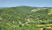
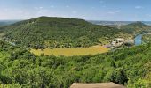
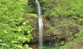
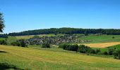
![](/images/other/stat-length.png)
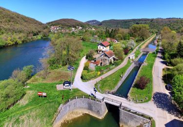
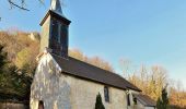
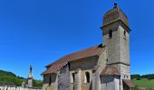
![Tocht Te voet Fontain - Sentier des Grands Prés - Photo](https://media.geolcdn.com/t/1900/400/b5a7d0a4-551b-456d-ac6c-7ab118f9fe97.jpeg&format=pjpeg&maxdim=2)
Sentier des Grands Prés
SityTrail - itinéraires balisés pédestres
Tous les sentiers balisés d’Europe GUIDE+
![Lengte](/images/other/stat-length.png)
Lengte
6,6 km
![Max. hoogte](https://static1.geolcdn.com/siteimages/upload/files/1508320355ic_sort_altitude_max_24dp.png)
Max. hoogte
500 m
![Positief hoogteverschil](https://static1.geolcdn.com/siteimages/upload/files/1508320355ic_sort_den_pos_24dp.png)
Positief hoogteverschil
221 m
![Km-Effort](/images/other/stat-length.png)
Km-Effort
9,6 km
![Min. hoogte](https://static1.geolcdn.com/siteimages/upload/files/1508320355ic_sort_altitude_min_24dp.png)
Min. hoogte
368 m
![Negatief hoogteverschil](https://static1.geolcdn.com/siteimages/upload/files/1508320355ic_sort_den_neg_24dp.png)
Negatief hoogteverschil
218 m
![Boucle](https://static1.geolcdn.com/siteimages/upload/files/16400158638029165_repeat_loop_refresh_sync_direction_icon.png)
Boucle
Ja
Markering
Datum van aanmaak :
2022-02-15 19:29:31.461
Laatste wijziging :
2022-03-03 00:09:49.682
![Te voet](https://static1.geolcdn.com/sitytour/trail-icons/100.png)
2h10
Moeilijkheid : Gemakkelijk
![Scan deze QR-code om de tocht te openen in de SityTrail-applicatie](https://capi.geolives.com/qq0zvz2zws4bq2lad0pu/sitytour/trails/3124761/qr.png?size=200)
Gratisgps-wandelapplicatie
Over ons
Tocht Te voet van 6,6 km beschikbaar op Bourgondië-Franche-Comté, Doubs, Fontain. Deze tocht wordt voorgesteld door SityTrail - itinéraires balisés pédestres.
Beschrijving
Trail created by Grand Besançon.
Plaatsbepaling
Land:
France
Regio :
Bourgondië-Franche-Comté
Departement/Provincie :
Doubs
Gemeente :
Fontain
Locatie:
Arguel
Vertrek:(Dec)
Vertrek:(UTM)
272860 ; 5231470 (32T) N.
Opmerkingen
Wandeltochten in de omgeving
![Tocht Stappen Beure - Beure de la pisseur au mercureau - Photo](https://media.geolcdn.com/t/375/260/af87c349-0861-4e70-9a13-b157a632bd51.jpg&format=jpg&maxdim=2)
![Stappen Stappen](https://static1.geolcdn.com/sitytour/trail-icons/101.png)
Beure de la pisseur au mercureau
Stappen
Moeilijk
(1)
Beure,
Bourgondië-Franche-Comté,
Doubs,
France
![](/images/other/stat-length.png)
16,8 km | 24 km-effort
3h 48min
![](https://static1.geolcdn.com/siteimages/upload/files/16400158638029165_repeat_loop_refresh_sync_direction_icon.png)
Ja
![Tocht Stappen Serre-les-Sapins - serre les sapins la ménère - Photo](https://media.geolcdn.com/t/375/260/3176f1cf-3aa6-46f8-8561-9e33aee32d1a.jpg&format=jpg&maxdim=2)
![Stappen Stappen](https://static1.geolcdn.com/sitytour/trail-icons/101.png)
serre les sapins la ménère
Stappen
Heel gemakkelijk
(1)
Serre-les-Sapins,
Bourgondië-Franche-Comté,
Doubs,
France
![](/images/other/stat-length.png)
10,4 km | 12,6 km-effort
1h 48min
![](https://static1.geolcdn.com/siteimages/upload/files/16400158638029165_repeat_loop_refresh_sync_direction_icon.png)
Ja
![Tocht Stappen Beure -](https://media.geolcdn.com/t/375/260/1d465e36-f50c-4143-b089-4392e69daccf.jpg&format=jpg&maxdim=2)
![Stappen Stappen](https://static1.geolcdn.com/sitytour/trail-icons/101.png)
"De grottes en grottes par voies celtiques" Chabui Fontain
Stappen
Medium
(1)
Beure,
Bourgondië-Franche-Comté,
Doubs,
France
![](/images/other/stat-length.png)
15,7 km | 22 km-effort
6h 35min
![](https://static1.geolcdn.com/siteimages/upload/files/16400158638029165_repeat_loop_refresh_sync_direction_icon.png)
Ja
![Tocht Stappen Beure - Beure, fort Planoise, Valmy, Roche trouée, vieille église. - Photo](https://media.geolcdn.com/t/375/260/f17b22e5-5227-4f08-8b37-03856be840af.jpg&format=jpg&maxdim=2)
![Stappen Stappen](https://static1.geolcdn.com/sitytour/trail-icons/101.png)
Beure, fort Planoise, Valmy, Roche trouée, vieille église.
Stappen
Zeer moeilijk
(1)
Beure,
Bourgondië-Franche-Comté,
Doubs,
France
![](/images/other/stat-length.png)
12,9 km | 20 km-effort
4h 38min
![](https://static1.geolcdn.com/siteimages/upload/files/16400158638029165_repeat_loop_refresh_sync_direction_icon.png)
Ja
![Tocht Stappen Fontain - fontain - fort de Fontain - forêt de Fontain - Photo](https://media.geolcdn.com/t/375/260/dda8671d-de1b-4872-afba-e5376a2d57f0.jpg&format=jpg&maxdim=2)
![Stappen Stappen](https://static1.geolcdn.com/sitytour/trail-icons/101.png)
fontain - fort de Fontain - forêt de Fontain
Stappen
Heel gemakkelijk
(2)
Fontain,
Bourgondië-Franche-Comté,
Doubs,
France
![](/images/other/stat-length.png)
11,9 km | 15,2 km-effort
3h 11min
![](https://static1.geolcdn.com/siteimages/upload/files/16400158638029165_repeat_loop_refresh_sync_direction_icon.png)
Ja
![Tocht Te voet Busy - Sentier de la Pierre de Vorges - Photo](https://media.geolcdn.com/t/375/260/6f249824-322a-4d94-8931-19d5b1d90e88.jpeg&format=jpg&maxdim=2)
![Te voet Te voet](https://static1.geolcdn.com/sitytour/trail-icons/100.png)
Sentier de la Pierre de Vorges
Te voet
Gemakkelijk
Busy,
Bourgondië-Franche-Comté,
Doubs,
France
![](/images/other/stat-length.png)
7,2 km | 9,4 km-effort
2h 8min
![](https://static1.geolcdn.com/siteimages/upload/files/16400158638029165_repeat_loop_refresh_sync_direction_icon.png)
Ja
![Tocht Te voet Fontain - Grande Boucle de Fontain - Photo](https://media.geolcdn.com/t/375/260/f1d37a4d-b9db-4571-aaef-737a004f40e0.jpeg&format=jpg&maxdim=2)
![Te voet Te voet](https://static1.geolcdn.com/sitytour/trail-icons/100.png)
Grande Boucle de Fontain
Te voet
Gemakkelijk
(1)
Fontain,
Bourgondië-Franche-Comté,
Doubs,
France
![](/images/other/stat-length.png)
10 km | 13,2 km-effort
2h 59min
![](https://static1.geolcdn.com/siteimages/upload/files/16400158638029165_repeat_loop_refresh_sync_direction_icon.png)
Ja
![Tocht Te voet Morre - Sentier des Buis - Photo](https://media.geolcdn.com/t/375/260/00c23f5f-41e9-4001-afe9-fc138b72cbaf.jpeg&format=jpg&maxdim=2)
![Te voet Te voet](https://static1.geolcdn.com/sitytour/trail-icons/100.png)
Sentier des Buis
Te voet
Gemakkelijk
Morre,
Bourgondië-Franche-Comté,
Doubs,
France
![](/images/other/stat-length.png)
6,4 km | 9 km-effort
2h 2min
![](https://static1.geolcdn.com/siteimages/upload/files/16400158638029165_repeat_loop_refresh_sync_direction_icon.png)
Ja
![Tocht Te voet Besançon - Circuit de Planoise - Photo](https://media.geolcdn.com/t/375/260/8ca51ab7-77ad-4be9-b376-83a7b1e031a5.jpeg&format=jpg&maxdim=2)
![Te voet Te voet](https://static1.geolcdn.com/sitytour/trail-icons/100.png)
Circuit de Planoise
Te voet
Gemakkelijk
Besançon,
Bourgondië-Franche-Comté,
Doubs,
France
![](/images/other/stat-length.png)
4,6 km | 7,6 km-effort
1h 43min
![](https://static1.geolcdn.com/siteimages/upload/files/16400158638029165_repeat_loop_refresh_sync_direction_icon.png)
Ja