![](/images/other/stat-length.png)
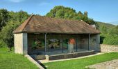
![Tocht Te voet Thise - Sentier du Coutelot - Photo](https://media.geolcdn.com/t/1900/400/afb256b5-7789-4ded-ae1d-d84139dab379.jpeg&format=pjpeg&maxdim=2)
Sentier du Coutelot
SityTrail - itinéraires balisés pédestres
Tous les sentiers balisés d’Europe GUIDE+
![Lengte](/images/other/stat-length.png)
Lengte
9,1 km
![Max. hoogte](https://static1.geolcdn.com/siteimages/upload/files/1508320355ic_sort_altitude_max_24dp.png)
Max. hoogte
464 m
![Positief hoogteverschil](https://static1.geolcdn.com/siteimages/upload/files/1508320355ic_sort_den_pos_24dp.png)
Positief hoogteverschil
247 m
![Km-Effort](/images/other/stat-length.png)
Km-Effort
12,4 km
![Min. hoogte](https://static1.geolcdn.com/siteimages/upload/files/1508320355ic_sort_altitude_min_24dp.png)
Min. hoogte
271 m
![Negatief hoogteverschil](https://static1.geolcdn.com/siteimages/upload/files/1508320355ic_sort_den_neg_24dp.png)
Negatief hoogteverschil
250 m
![Boucle](https://static1.geolcdn.com/siteimages/upload/files/16400158638029165_repeat_loop_refresh_sync_direction_icon.png)
Boucle
Ja
Markering
Datum van aanmaak :
2022-02-15 19:29:11.16
Laatste wijziging :
2022-03-03 00:08:26.242
![Te voet](https://static1.geolcdn.com/sitytour/trail-icons/100.png)
2h49
Moeilijkheid : Gemakkelijk
![Scan deze QR-code om de tocht te openen in de SityTrail-applicatie](https://capi.geolives.com/qq0zvz2zws4bq2lad0pu/sitytour/trails/3124758/qr.png?size=200)
Gratisgps-wandelapplicatie
Over ons
Tocht Te voet van 9,1 km beschikbaar op Bourgondië-Franche-Comté, Doubs, Thise. Deze tocht wordt voorgesteld door SityTrail - itinéraires balisés pédestres.
Beschrijving
Trail created by Grand Besançon.
Plaatsbepaling
Land:
France
Regio :
Bourgondië-Franche-Comté
Departement/Provincie :
Doubs
Gemeente :
Thise
Locatie:
Unknown
Vertrek:(Dec)
Vertrek:(UTM)
279276 ; 5240924 (32T) N.
Opmerkingen
Wandeltochten in de omgeving
![Tocht Stappen Besançon - Colline de Besançon 29-08-2020 - Photo](https://media.geolcdn.com/t/375/260/1e155548-d400-46d3-8b28-207c9933a379.jpg&format=jpg&maxdim=2)
![Stappen Stappen](https://static1.geolcdn.com/sitytour/trail-icons/101.png)
Colline de Besançon 29-08-2020
Stappen
Medium
(1)
Besançon,
Bourgondië-Franche-Comté,
Doubs,
France
![](/images/other/stat-length.png)
13,4 km | 17,7 km-effort
2h 46min
![](https://static1.geolcdn.com/siteimages/upload/files/16400158638029165_repeat_loop_refresh_sync_direction_icon.png)
Ja
![Tocht Te voet Gennes - Sentier du Fort des Epesses - Photo](https://media.geolcdn.com/t/375/260/2fa8fbf5-c0df-4124-9465-bd35fd5b8500.jpeg&format=jpg&maxdim=2)
![Te voet Te voet](https://static1.geolcdn.com/sitytour/trail-icons/100.png)
Sentier du Fort des Epesses
Te voet
Gemakkelijk
Gennes,
Bourgondië-Franche-Comté,
Doubs,
France
![](/images/other/stat-length.png)
10,4 km | 14,4 km-effort
3h 16min
![](https://static1.geolcdn.com/siteimages/upload/files/16400158638029165_repeat_loop_refresh_sync_direction_icon.png)
Ja
![Tocht Te voet Besançon - Dame Blanche et Vieux Tilleul - Photo](https://media.geolcdn.com/t/375/260/a831d8ab-a72b-4417-bd94-e54f01ff5dc4.jpeg&format=jpg&maxdim=2)
![Te voet Te voet](https://static1.geolcdn.com/sitytour/trail-icons/100.png)
Dame Blanche et Vieux Tilleul
Te voet
Medium
Besançon,
Bourgondië-Franche-Comté,
Doubs,
France
![](/images/other/stat-length.png)
14,6 km | 20 km-effort
4h 36min
![](https://static1.geolcdn.com/siteimages/upload/files/16400158638029165_repeat_loop_refresh_sync_direction_icon.png)
Ja
![Tocht Te voet Vaire - Sentier des Sources 1 - Photo](https://media.geolcdn.com/t/375/260/3b895425-3268-42d6-8ef6-757959f26627.jpeg&format=jpg&maxdim=2)
![Te voet Te voet](https://static1.geolcdn.com/sitytour/trail-icons/100.png)
Sentier des Sources 1
Te voet
Gemakkelijk
Vaire,
Bourgondië-Franche-Comté,
Doubs,
France
![](/images/other/stat-length.png)
7,6 km | 10,9 km-effort
2h 29min
![](https://static1.geolcdn.com/siteimages/upload/files/16400158638029165_repeat_loop_refresh_sync_direction_icon.png)
Ja
![Tocht Te voet Besançon - Circuit du Fort de Brégille - Photo](https://media.geolcdn.com/t/375/260/3fe36d03-26e1-4116-af74-e51c6db9c0fc.jpeg&format=jpg&maxdim=2)
![Te voet Te voet](https://static1.geolcdn.com/sitytour/trail-icons/100.png)
Circuit du Fort de Brégille
Te voet
Gemakkelijk
Besançon,
Bourgondië-Franche-Comté,
Doubs,
France
![](/images/other/stat-length.png)
6,9 km | 10,6 km-effort
2h 24min
![](https://static1.geolcdn.com/siteimages/upload/files/16400158638029165_repeat_loop_refresh_sync_direction_icon.png)
Ja
![Tocht Stappen Braillans - Braillans - Photo](https://media.geolcdn.com/t/375/260/ext.jpg?maxdim=2&url=https%3A%2F%2Fstatic1.geolcdn.com%2Fsiteimages%2Fupload%2Ffiles%2F1553511878bg_sport_marche.png)
![Stappen Stappen](https://static1.geolcdn.com/sitytour/trail-icons/101.png)
Braillans
Stappen
Gemakkelijk
(1)
Braillans,
Bourgondië-Franche-Comté,
Doubs,
France
![](/images/other/stat-length.png)
9,1 km | 11,7 km-effort
1h 24min
![](https://static1.geolcdn.com/siteimages/upload/files/16400158638029165_repeat_loop_refresh_sync_direction_icon.png)
Ja
![Tocht Stappen Devecey - devecey - Photo](https://media.geolcdn.com/t/375/260/e2eb8cdb-b528-42ec-8ea9-1c3aaa4eef69.jpg&format=jpg&maxdim=2)
![Stappen Stappen](https://static1.geolcdn.com/sitytour/trail-icons/101.png)
devecey
Stappen
Gemakkelijk
Devecey,
Bourgondië-Franche-Comté,
Doubs,
France
![](/images/other/stat-length.png)
12,3 km | 17,8 km-effort
5h 0min
![](https://static1.geolcdn.com/siteimages/upload/files/16400158638029165_repeat_loop_refresh_sync_direction_icon.png)
Ja
![Tocht Stappen Thise - Thise et sa Dame blanche - Photo](https://media.geolcdn.com/t/375/260/e57870fc-695b-4fa2-949a-ebb6a1ab9ba8.jpg&format=jpg&maxdim=2)
![Stappen Stappen](https://static1.geolcdn.com/sitytour/trail-icons/101.png)
Thise et sa Dame blanche
Stappen
Zeer moeilijk
Thise,
Bourgondië-Franche-Comté,
Doubs,
France
![](/images/other/stat-length.png)
16,2 km | 23 km-effort
5h 7min
![](https://static1.geolcdn.com/siteimages/upload/files/16400158638029165_repeat_loop_refresh_sync_direction_icon.png)
Ja
![Tocht Stappen Gennes - Source d'Arcier - Photo](https://media.geolcdn.com/t/375/260/ccadba48-d083-43f7-8a9d-9b2ad3b4bf3c.jpg&format=jpg&maxdim=2)
![Stappen Stappen](https://static1.geolcdn.com/sitytour/trail-icons/101.png)
Source d'Arcier
Stappen
Gemakkelijk
Gennes,
Bourgondië-Franche-Comté,
Doubs,
France
![](/images/other/stat-length.png)
6,3 km | 10,7 km-effort
1h 54min
![](https://static1.geolcdn.com/siteimages/upload/files/16400158638029165_repeat_loop_refresh_sync_direction_icon.png)
Ja