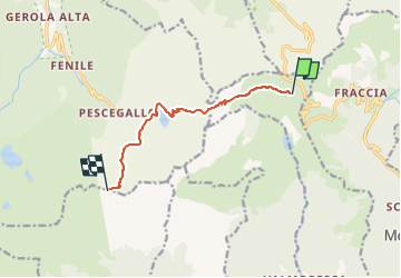
![](/images/other/stat-length.png)
![Tocht Te voet Averara - IT-161 - Photo](https://media.geolcdn.com/t/1900/400/766ea1b4-e990-4dd2-be13-c0404ff52356.jpeg&format=pjpeg&maxdim=2)
IT-161
SityTrail - itinéraires balisés pédestres
Tous les sentiers balisés d’Europe GUIDE+
![Lengte](/images/other/stat-length.png)
![Max. hoogte](https://static1.geolcdn.com/siteimages/upload/files/1508320355ic_sort_altitude_max_24dp.png)
![Positief hoogteverschil](https://static1.geolcdn.com/siteimages/upload/files/1508320355ic_sort_den_pos_24dp.png)
![Km-Effort](/images/other/stat-length.png)
![Min. hoogte](https://static1.geolcdn.com/siteimages/upload/files/1508320355ic_sort_altitude_min_24dp.png)
![Negatief hoogteverschil](https://static1.geolcdn.com/siteimages/upload/files/1508320355ic_sort_den_neg_24dp.png)
![Boucle](https://static1.geolcdn.com/siteimages/upload/files/16400158638029165_repeat_loop_refresh_sync_direction_icon.png)
![Te voet](https://static1.geolcdn.com/sitytour/trail-icons/100.png)
3h21
Moeilijkheid : Gemakkelijk
![Scan deze QR-code om de tocht te openen in de SityTrail-applicatie](https://capi.geolives.com/qq0zvz2zws4bq2lad0pu/sitytour/trails/3124506/qr.png?size=200)
Gratisgps-wandelapplicatie
Over ons
Tocht Te voet van 7,5 km beschikbaar op Lombardije, Bergamo, Averara. Deze tocht wordt voorgesteld door SityTrail - itinéraires balisés pédestres.
Beschrijving
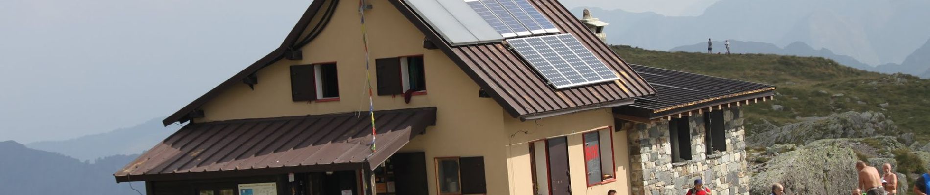
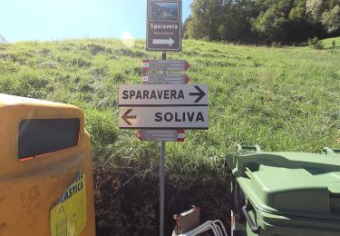
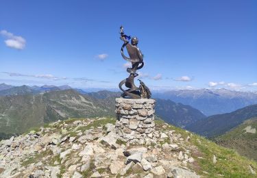
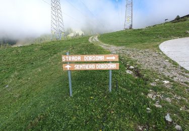
Dal piazzale del rifugio Ca' S. Marco (1830 m) si prende il sentiero che parte in prossimità dei tralicci dell'alta tensione, per il primo tratto (20' circa) si segue il medesimo tracciato del sentiero 101 che scende poi a sinistra in direzione del piano dell'Acqua Nera. Si prosegue a mezzacosta tenendo la destra e si sale fino al passo del Verrobbio (2026 m).
Website: http://geoportale.caibergamo.it/sentiero/161
Plaatsbepaling
Opmerkingen
Wandeltochten in de omgeving
![Tocht Te voet Mezzoldo - Sentiero 111: Mezzoldo (Madonna delle Nevi) - Forcella Rossa - Photo](https://media.geolcdn.com/t/375/260/b68c7924-ce52-4be5-831c-fdef220ba4d3.jpeg&format=jpg&maxdim=2)
![Te voet Te voet](https://static1.geolcdn.com/sitytour/trail-icons/100.png)
Te voet
![](/images/other/stat-length.png)
![](https://static1.geolcdn.com/siteimages/upload/files/16400158638029165_repeat_loop_refresh_sync_direction_icon.png)
![Tocht Te voet Mezzoldo - Sentiero 115: Mezzoldo (Ponte dell'Acqua) - Passo di S. Simone - Photo](https://media.geolcdn.com/t/375/260/b89a21bd-8ca4-4a30-b37a-953d42c6f447.jpeg&format=jpg&maxdim=2)
![Te voet Te voet](https://static1.geolcdn.com/sitytour/trail-icons/100.png)
Te voet
![](/images/other/stat-length.png)
![](https://static1.geolcdn.com/siteimages/upload/files/16400158638029165_repeat_loop_refresh_sync_direction_icon.png)
![Tocht Te voet Averara - Sentiero 113: Mezzoldo (Soliva) - Ca' San Marco - Photo](https://media.geolcdn.com/t/375/260/b115d387-71a6-4154-8ca8-a048f966bffa.jpeg&format=jpg&maxdim=2)
![Te voet Te voet](https://static1.geolcdn.com/sitytour/trail-icons/100.png)
Te voet
![](/images/other/stat-length.png)
![](https://static1.geolcdn.com/siteimages/upload/files/16400158638029165_repeat_loop_refresh_sync_direction_icon.png)
![Tocht Te voet Ornica - Sentiero delle Orobie Occidentali - Tappa 3 - Photo](https://media.geolcdn.com/t/375/260/bf042f57-cdb2-457c-931c-64f348431201.jpeg&format=jpg&maxdim=2)
![Te voet Te voet](https://static1.geolcdn.com/sitytour/trail-icons/100.png)
Te voet
![](/images/other/stat-length.png)
![](https://static1.geolcdn.com/siteimages/upload/files/16400158638029165_repeat_loop_refresh_sync_direction_icon.png)
![Tocht Te voet Cusio - IT-108 - Photo](https://media.geolcdn.com/t/375/260/cd5b6074-39ef-42f7-b967-0a97a0b3a154.jpeg&format=jpg&maxdim=2)
![Te voet Te voet](https://static1.geolcdn.com/sitytour/trail-icons/100.png)
![Tocht Te voet Mezzoldo - Sentiero 124: Rifugio Madonna delle Nevi - Bivacco Zamboni - Photo](https://media.geolcdn.com/t/375/260/697c64b8-be05-43a3-96cc-dad10aa82c2a.jpeg&format=jpg&maxdim=2)
![Te voet Te voet](https://static1.geolcdn.com/sitytour/trail-icons/100.png)
Te voet
![](/images/other/stat-length.png)
![](https://static1.geolcdn.com/siteimages/upload/files/16400158638029165_repeat_loop_refresh_sync_direction_icon.png)
![Tocht Te voet Mezzoldo - (SI D17S) Rifugio Balicco - Rifugio Dordona - Photo](https://media.geolcdn.com/t/375/260/5895fabb-8256-4cb3-906a-f85bf70bcd24.jpeg&format=jpg&maxdim=2)
![Te voet Te voet](https://static1.geolcdn.com/sitytour/trail-icons/100.png)
Te voet
![](/images/other/stat-length.png)
![](https://static1.geolcdn.com/siteimages/upload/files/16400158638029165_repeat_loop_refresh_sync_direction_icon.png)
![Tocht Te voet Averara - Sentiero delle Orobie Occidentali - Tappa 4 - Photo](https://media.geolcdn.com/t/375/260/3181807b-d7d9-4afb-9c20-cd7a3c0ad38d.jpeg&format=jpg&maxdim=2)
![Te voet Te voet](https://static1.geolcdn.com/sitytour/trail-icons/100.png)
Te voet
![](/images/other/stat-length.png)
![](https://static1.geolcdn.com/siteimages/upload/files/16400158638029165_repeat_loop_refresh_sync_direction_icon.png)
![Tocht Te voet Mezzoldo - Sentiero 124A: Fraccia - Bivacco Zamboni - Rifugio Balicco - Photo](https://media.geolcdn.com/t/375/260/ext.jpg?maxdim=2&url=https%3A%2F%2Fstatic1.geolcdn.com%2Fsiteimages%2Fupload%2Ffiles%2F1545311037marcheuse_200dpi.jpg)
![Te voet Te voet](https://static1.geolcdn.com/sitytour/trail-icons/100.png)
Te voet
![](/images/other/stat-length.png)
![](https://static1.geolcdn.com/siteimages/upload/files/16400158638029165_repeat_loop_refresh_sync_direction_icon.png)