![](/images/other/stat-length.png)
![Tocht Te voet Roncola - Sentiero 861: Barzana - Palazzago - Monte Albenza (Sentiero del crinale) - Photo](https://media.geolcdn.com/t/1900/400/a600ffe3-522e-43dd-b38a-286ba735c067.jpeg&format=pjpeg&maxdim=2)
Sentiero 861: Barzana - Palazzago - Monte Albenza (Sentiero del crinale)
SityTrail - itinéraires balisés pédestres
Tous les sentiers balisés d’Europe GUIDE+
![Lengte](/images/other/stat-length.png)
![Max. hoogte](https://static1.geolcdn.com/siteimages/upload/files/1508320355ic_sort_altitude_max_24dp.png)
![Positief hoogteverschil](https://static1.geolcdn.com/siteimages/upload/files/1508320355ic_sort_den_pos_24dp.png)
![Km-Effort](/images/other/stat-length.png)
![Min. hoogte](https://static1.geolcdn.com/siteimages/upload/files/1508320355ic_sort_altitude_min_24dp.png)
![Negatief hoogteverschil](https://static1.geolcdn.com/siteimages/upload/files/1508320355ic_sort_den_neg_24dp.png)
![Boucle](https://static1.geolcdn.com/siteimages/upload/files/16400158638029165_repeat_loop_refresh_sync_direction_icon.png)
![Te voet](https://static1.geolcdn.com/sitytour/trail-icons/100.png)
2h13
Moeilijkheid : Gemakkelijk
![Scan deze QR-code om de tocht te openen in de SityTrail-applicatie](https://capi.geolives.com/qq0zvz2zws4bq2lad0pu/sitytour/trails/3124270/qr.png?size=200)
Gratisgps-wandelapplicatie
Over ons
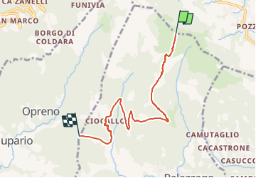
Tocht Te voet van 5,7 km beschikbaar op Lombardije, Bergamo, Roncola. Deze tocht wordt voorgesteld door SityTrail - itinéraires balisés pédestres.
Beschrijving
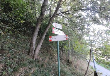
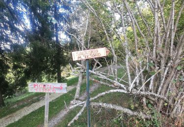
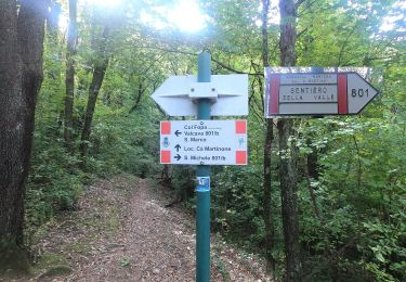
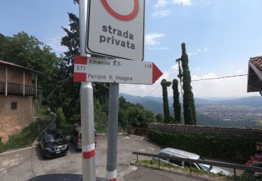
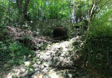
L'itinerario collega il Parco Oasi sito nel comune di Barzana con la vetta del Monte Linzone passando per alcune frazioni del comune di Palazzago. Le principali località toccate dal sentiero sono: Barzana, Montebello, La Vena, Picco Alto, Valmora, Burligo, Colle Pedrino, Colle Albenza e Linzone. La tipologia di sentiero è nella prima parte collinare e dolce nei dislivelli (da
Website: http://geoportale.caibergamo.it/it/sentiero/861
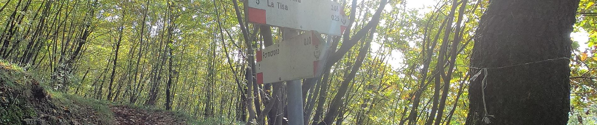
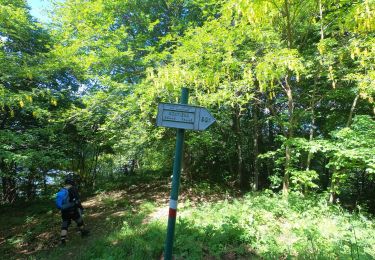
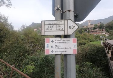
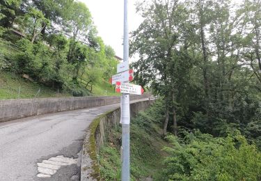
Plaatsbepaling
Opmerkingen
Wandeltochten in de omgeving
![Tocht Te voet Costa Valle Imagna - Sentiero 801C: Ripetitori (Valcava) - Convento del Pertus - Photo](https://media.geolcdn.com/t/375/260/bc854a3c-84b8-45d7-a03f-9dd7f589afe9.jpeg&format=jpg&maxdim=2)
![Te voet Te voet](https://static1.geolcdn.com/sitytour/trail-icons/100.png)
Te voet
![](/images/other/stat-length.png)
![](https://static1.geolcdn.com/siteimages/upload/files/16400158638029165_repeat_loop_refresh_sync_direction_icon.png)
![Tocht Te voet Torre de' Busi - Sentiero 822: Torre de Busi - Sopracornola - Photo](https://media.geolcdn.com/t/375/260/274a2259-6ac6-41e7-a486-a574d63745e0.jpeg&format=jpg&maxdim=2)
![Te voet Te voet](https://static1.geolcdn.com/sitytour/trail-icons/100.png)
Te voet
![](/images/other/stat-length.png)
![](https://static1.geolcdn.com/siteimages/upload/files/16400158638029165_repeat_loop_refresh_sync_direction_icon.png)
![Tocht Te voet Caprino Bergamasco - Sentiero 808: Località Foppa - Coldara - Photo](https://media.geolcdn.com/t/375/260/ef7baea5-52a8-4da3-8e0b-a014b1e649e3.jpeg&format=jpg&maxdim=2)
![Te voet Te voet](https://static1.geolcdn.com/sitytour/trail-icons/100.png)
Te voet
![](/images/other/stat-length.png)
![](https://static1.geolcdn.com/siteimages/upload/files/16400158638029165_repeat_loop_refresh_sync_direction_icon.png)
![Tocht Te voet Torre de' Busi - Sentiero 823: Torre de' Busi - Colle di Sogno - Valcava - Photo](https://media.geolcdn.com/t/375/260/a2555aac-c087-460d-ae0b-2e8ee56abcbe.jpeg&format=jpg&maxdim=2)
![Te voet Te voet](https://static1.geolcdn.com/sitytour/trail-icons/100.png)
Te voet
![](/images/other/stat-length.png)
![](https://static1.geolcdn.com/siteimages/upload/files/16400158638029165_repeat_loop_refresh_sync_direction_icon.png)
![Tocht Te voet Torre de' Busi - Sentiero 821: Torre de' Busi - Valcava - Photo](https://media.geolcdn.com/t/375/260/75f4d701-adad-4597-b2c8-0e35f23cd501.jpeg&format=jpg&maxdim=2)
![Te voet Te voet](https://static1.geolcdn.com/sitytour/trail-icons/100.png)
Te voet
![](/images/other/stat-length.png)
![](https://static1.geolcdn.com/siteimages/upload/files/16400158638029165_repeat_loop_refresh_sync_direction_icon.png)
![Tocht Te voet Costa Valle Imagna - Sentiero 801B: Torre de' Busi - Ripetitori (Valcava) - Photo](https://media.geolcdn.com/t/375/260/b6e4df54-c73f-41dc-867b-e80432539ddd.jpeg&format=jpg&maxdim=2)
![Te voet Te voet](https://static1.geolcdn.com/sitytour/trail-icons/100.png)
Te voet
![](/images/other/stat-length.png)
![](https://static1.geolcdn.com/siteimages/upload/files/16400158638029165_repeat_loop_refresh_sync_direction_icon.png)
![Tocht Te voet Berbenno - Antiche Tracce - Photo](https://media.geolcdn.com/t/375/260/9f948c45-acef-43a4-9085-51ba39b69770.jpeg&format=jpg&maxdim=2)
![Te voet Te voet](https://static1.geolcdn.com/sitytour/trail-icons/100.png)
Te voet
![](/images/other/stat-length.png)
![](https://static1.geolcdn.com/siteimages/upload/files/16400158638029165_repeat_loop_refresh_sync_direction_icon.png)
![Tocht Te voet Roncola - Sentiero dell'Acqua - Photo](https://media.geolcdn.com/t/375/260/e17b9110-3add-479c-8950-f93c4b339c2d.jpeg&format=jpg&maxdim=2)
![Te voet Te voet](https://static1.geolcdn.com/sitytour/trail-icons/100.png)
Te voet
![](/images/other/stat-length.png)
![](https://static1.geolcdn.com/siteimages/upload/files/16400158638029165_repeat_loop_refresh_sync_direction_icon.png)
![Tocht Te voet Roncola - Sentiero dei Borghi - Photo](https://media.geolcdn.com/t/375/260/bb9c965c-e3db-454f-828a-121ccb7e9adc.jpeg&format=jpg&maxdim=2)
![Te voet Te voet](https://static1.geolcdn.com/sitytour/trail-icons/100.png)
Te voet
![](/images/other/stat-length.png)
![](https://static1.geolcdn.com/siteimages/upload/files/16400158638029165_repeat_loop_refresh_sync_direction_icon.png)