![](/images/other/stat-length.png)
![Tocht Te voet Laveno-Mombello - Anulare Valcuviano - Photo](https://media.geolcdn.com/t/1900/400/4c23e9a5-5369-4b45-81e0-b5a7e2447a49.jpeg&format=pjpeg&maxdim=2)
Anulare Valcuviano
SityTrail - itinéraires balisés pédestres
Tous les sentiers balisés d’Europe GUIDE+
![Lengte](/images/other/stat-length.png)
Lengte
71 km
![Max. hoogte](https://static1.geolcdn.com/siteimages/upload/files/1508320355ic_sort_altitude_max_24dp.png)
Max. hoogte
1139 m
![Positief hoogteverschil](https://static1.geolcdn.com/siteimages/upload/files/1508320355ic_sort_den_pos_24dp.png)
Positief hoogteverschil
3535 m
![Km-Effort](/images/other/stat-length.png)
Km-Effort
118 km
![Min. hoogte](https://static1.geolcdn.com/siteimages/upload/files/1508320355ic_sort_altitude_min_24dp.png)
Min. hoogte
213 m
![Negatief hoogteverschil](https://static1.geolcdn.com/siteimages/upload/files/1508320355ic_sort_den_neg_24dp.png)
Negatief hoogteverschil
3456 m
![Boucle](https://static1.geolcdn.com/siteimages/upload/files/16400158638029165_repeat_loop_refresh_sync_direction_icon.png)
Boucle
Neen
Markering
Datum van aanmaak :
2022-02-15 18:41:23.79
Laatste wijziging :
2022-03-01 23:16:55.96
![Te voet](https://static1.geolcdn.com/sitytour/trail-icons/100.png)
26h48
Moeilijkheid : Zeer moeilijk
![Scan deze QR-code om de tocht te openen in de SityTrail-applicatie](https://capi.geolives.com/qq0zvz2zws4bq2lad0pu/sitytour/trails/3123820/qr.png?size=200)
Gratisgps-wandelapplicatie
Over ons
Tocht Te voet van 71 km beschikbaar op Lombardije, Varese, Laveno-Mombello. Deze tocht wordt voorgesteld door SityTrail - itinéraires balisés pédestres.
Beschrijving
Trail created by Provincia di Varese.
Plaatsbepaling
Land:
Italy
Regio :
Lombardije
Departement/Provincie :
Varese
Gemeente :
Laveno-Mombello
Locatie:
Unknown
Vertrek:(Dec)
Vertrek:(UTM)
470386 ; 5084555 (32T) N.
Opmerkingen
Wandeltochten in de omgeving
![Tocht Te voet Leggiuno - Anello di Santa Caterina - Photo](https://media.geolcdn.com/t/375/260/a07fc679-03be-453a-bd27-6d3a9ca5aaa1.jpeg&format=jpg&maxdim=2)
![Te voet Te voet](https://static1.geolcdn.com/sitytour/trail-icons/100.png)
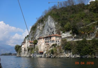
Anello di Santa Caterina
Te voet
Gemakkelijk
Leggiuno,
Lombardije,
Varese,
Italy
![](/images/other/stat-length.png)
10,9 km | 14 km-effort
3h 11min
![](https://static1.geolcdn.com/siteimages/upload/files/16400158638029165_repeat_loop_refresh_sync_direction_icon.png)
Neen
![Tocht Te voet Verbania - R00 Verbania Intra P.le Flaim - Trobaso - Cambiasca - Caprezzo - Intragna - Aurano - Photo](https://media.geolcdn.com/t/375/260/506517bd-786d-45d7-85ec-7295c338ccc9.jpeg&format=jpg&maxdim=2)
![Te voet Te voet](https://static1.geolcdn.com/sitytour/trail-icons/100.png)
R00 Verbania Intra P.le Flaim - Trobaso - Cambiasca - Caprezzo - Intragna - A...
Te voet
Medium
Verbania,
Piëmont,
Verbano-Cusio-Ossola,
Italy
![](/images/other/stat-length.png)
16,5 km | 28 km-effort
6h 21min
![](https://static1.geolcdn.com/siteimages/upload/files/16400158638029165_repeat_loop_refresh_sync_direction_icon.png)
Neen
![Tocht Te voet Verbania - R04 Verbania Intra - Zoverallo - San Martino - Bèe - Monte Cimolo - Pian Nava - Photo](https://media.geolcdn.com/t/375/260/787b139b-4234-4442-b82c-3bd88ffe11bb.jpeg&format=jpg&maxdim=2)
![Te voet Te voet](https://static1.geolcdn.com/sitytour/trail-icons/100.png)
R04 Verbania Intra - Zoverallo - San Martino - Bèe - Monte Cimolo - Pian Nava
Te voet
Gemakkelijk
Verbania,
Piëmont,
Verbano-Cusio-Ossola,
Italy
![](/images/other/stat-length.png)
10,4 km | 18,8 km-effort
4h 16min
![](https://static1.geolcdn.com/siteimages/upload/files/16400158638029165_repeat_loop_refresh_sync_direction_icon.png)
Neen
![Tocht Te voet Castelveccana - IT-225B - Photo](https://media.geolcdn.com/t/375/260/d0e6782b-e07e-45ea-b574-5d00362a6671.jpeg&format=jpg&maxdim=2)
![Te voet Te voet](https://static1.geolcdn.com/sitytour/trail-icons/100.png)
IT-225B
Te voet
Gemakkelijk
Castelveccana,
Lombardije,
Varese,
Italy
![](/images/other/stat-length.png)
4,3 km | 6,8 km-effort
1h 32min
![](https://static1.geolcdn.com/siteimages/upload/files/16400158638029165_repeat_loop_refresh_sync_direction_icon.png)
Neen
![Tocht Te voet Castelveccana - IT-225A - Photo](https://media.geolcdn.com/t/375/260/3555bd43-382c-4e76-814a-710a581e6d79.jpeg&format=jpg&maxdim=2)
![Te voet Te voet](https://static1.geolcdn.com/sitytour/trail-icons/100.png)
IT-225A
Te voet
Gemakkelijk
Castelveccana,
Lombardije,
Varese,
Italy
![](/images/other/stat-length.png)
4,1 km | 6,1 km-effort
1h 22min
![](https://static1.geolcdn.com/siteimages/upload/files/16400158638029165_repeat_loop_refresh_sync_direction_icon.png)
Neen
![Tocht Te voet Cittiglio - IT-225 - Photo](https://media.geolcdn.com/t/375/260/d0e6782b-e07e-45ea-b574-5d00362a6671.jpeg&format=jpg&maxdim=2)
![Te voet Te voet](https://static1.geolcdn.com/sitytour/trail-icons/100.png)
![Tocht Te voet Cittiglio - Via Verde Varesina tappa 5 - Photo](https://media.geolcdn.com/t/375/260/c554328c-5e2f-43ff-921e-f0b8d199abe6.jpeg&format=jpg&maxdim=2)
![Te voet Te voet](https://static1.geolcdn.com/sitytour/trail-icons/100.png)
Via Verde Varesina tappa 5
Te voet
Gemakkelijk
Cittiglio,
Lombardije,
Varese,
Italy
![](/images/other/stat-length.png)
10,2 km | 18,4 km-effort
4h 10min
![](https://static1.geolcdn.com/siteimages/upload/files/16400158638029165_repeat_loop_refresh_sync_direction_icon.png)
Neen
![Tocht Te voet Cittiglio - IT-204 - Photo](https://media.geolcdn.com/t/375/260/98c02d10-dabb-49b5-aa5c-24361f7494ae.jpeg&format=jpg&maxdim=2)
![Te voet Te voet](https://static1.geolcdn.com/sitytour/trail-icons/100.png)
IT-204
Te voet
Gemakkelijk
Cittiglio,
Lombardije,
Varese,
Italy
![](/images/other/stat-length.png)
4,6 km | 10,5 km-effort
2h 23min
![](https://static1.geolcdn.com/siteimages/upload/files/16400158638029165_repeat_loop_refresh_sync_direction_icon.png)
Neen
![Tocht Te voet Laveno-Mombello - IT-222 - Photo](https://media.geolcdn.com/t/375/260/98c02d10-dabb-49b5-aa5c-24361f7494ae.jpeg&format=jpg&maxdim=2)
![Te voet Te voet](https://static1.geolcdn.com/sitytour/trail-icons/100.png)
IT-222
Te voet
Gemakkelijk
Laveno-Mombello,
Lombardije,
Varese,
Italy
![](/images/other/stat-length.png)
3,3 km | 6,4 km-effort
1h 27min
![](https://static1.geolcdn.com/siteimages/upload/files/16400158638029165_repeat_loop_refresh_sync_direction_icon.png)
Ja