![](/images/other/stat-length.png)
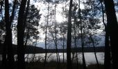
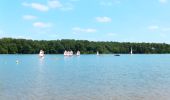
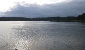
![Tocht Te voet Iffendic - La Pierre Longue - Photo](https://media.geolcdn.com/t/1900/400/8b094444-c6e7-42e6-b27a-c82fe025f95f.jpeg&format=pjpeg&maxdim=2)
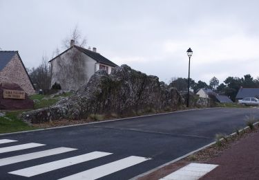
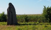
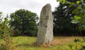
La Pierre Longue
SityTrail - itinéraires balisés pédestres
Tous les sentiers balisés d’Europe GUIDE+
![Lengte](/images/other/stat-length.png)
Lengte
8,3 km
![Max. hoogte](https://static1.geolcdn.com/siteimages/upload/files/1508320355ic_sort_altitude_max_24dp.png)
Max. hoogte
109 m
![Positief hoogteverschil](https://static1.geolcdn.com/siteimages/upload/files/1508320355ic_sort_den_pos_24dp.png)
Positief hoogteverschil
125 m
![Km-Effort](/images/other/stat-length.png)
Km-Effort
9,9 km
![Min. hoogte](https://static1.geolcdn.com/siteimages/upload/files/1508320355ic_sort_altitude_min_24dp.png)
Min. hoogte
41 m
![Negatief hoogteverschil](https://static1.geolcdn.com/siteimages/upload/files/1508320355ic_sort_den_neg_24dp.png)
Negatief hoogteverschil
124 m
![Boucle](https://static1.geolcdn.com/siteimages/upload/files/16400158638029165_repeat_loop_refresh_sync_direction_icon.png)
Boucle
Ja
Markering
Datum van aanmaak :
2022-02-15 18:33:20.319
Laatste wijziging :
2022-03-02 21:08:56.399
![Te voet](https://static1.geolcdn.com/sitytour/trail-icons/100.png)
2h15
Moeilijkheid : Gemakkelijk
![Scan deze QR-code om de tocht te openen in de SityTrail-applicatie](https://capi.geolives.com/qq0zvz2zws4bq2lad0pu/sitytour/trails/3123702/qr.png?size=200)
Gratisgps-wandelapplicatie
Over ons
Tocht Te voet van 8,3 km beschikbaar op Bretagne, Ille-et-Vilaine, Iffendic. Deze tocht wordt voorgesteld door SityTrail - itinéraires balisés pédestres.
Beschrijving
Trail created by Montfort Communauté.
Parcours provisoire par le Vaugrassin
Plaatsbepaling
Land:
France
Regio :
Bretagne
Departement/Provincie :
Ille-et-Vilaine
Gemeente :
Iffendic
Locatie:
Unknown
Vertrek:(Dec)
Vertrek:(UTM)
572383 ; 5328009 (30U) N.
Opmerkingen
Wandeltochten in de omgeving
![Tocht Te voet Iffendic - Lac et landiers de Trémelin - Photo](https://media.geolcdn.com/t/375/260/7ac840cd-e5f1-4d8d-95cf-07084d9e8f75.jpeg&format=jpg&maxdim=2)
![Te voet Te voet](https://static1.geolcdn.com/sitytour/trail-icons/100.png)
Lac et landiers de Trémelin
Te voet
Gemakkelijk
Iffendic,
Bretagne,
Ille-et-Vilaine,
France
![](/images/other/stat-length.png)
9,9 km | 11,4 km-effort
2h 34min
![](https://static1.geolcdn.com/siteimages/upload/files/16400158638029165_repeat_loop_refresh_sync_direction_icon.png)
Ja
![Tocht Te voet Monterfil - Les Balcons de Monterfil - Photo](https://media.geolcdn.com/t/375/260/274d2856-8512-43c4-a2e1-3af681726e15.jpeg&format=jpg&maxdim=2)
![Te voet Te voet](https://static1.geolcdn.com/sitytour/trail-icons/100.png)
Les Balcons de Monterfil
Te voet
Gemakkelijk
Monterfil,
Bretagne,
Ille-et-Vilaine,
France
![](/images/other/stat-length.png)
15,3 km | 19 km-effort
4h 19min
![](https://static1.geolcdn.com/siteimages/upload/files/16400158638029165_repeat_loop_refresh_sync_direction_icon.png)
Ja
![Tocht Te voet Iffendic - Le Tour du Lac de Trémelin - Photo](https://media.geolcdn.com/t/375/260/b24516e3-87a2-4631-bc74-5cefab2c06d9.jpeg&format=jpg&maxdim=2)
![Te voet Te voet](https://static1.geolcdn.com/sitytour/trail-icons/100.png)
Le Tour du Lac de Trémelin
Te voet
Gemakkelijk
Iffendic,
Bretagne,
Ille-et-Vilaine,
France
![](/images/other/stat-length.png)
5 km | 5,5 km-effort
1h 15min
![](https://static1.geolcdn.com/siteimages/upload/files/16400158638029165_repeat_loop_refresh_sync_direction_icon.png)
Ja
![Tocht Stappen Iffendic - GR_37_CC_37_Iffendic_Plelan-le-Grand_20220821 - Photo](https://media.geolcdn.com/t/375/260/a461a4e2-f121-4384-a36b-7fa282322953.jpg&format=jpg&maxdim=2)
![Stappen Stappen](https://static1.geolcdn.com/sitytour/trail-icons/101.png)
GR_37_CC_37_Iffendic_Plelan-le-Grand_20220821
Stappen
Gemakkelijk
Iffendic,
Bretagne,
Ille-et-Vilaine,
France
![](/images/other/stat-length.png)
22 km | 25 km-effort
5h 25min
![](https://static1.geolcdn.com/siteimages/upload/files/16400158638029165_repeat_loop_refresh_sync_direction_icon.png)
Neen
![Tocht Te voet Saint-Gonlay - Circuit de Lorinou - Photo](https://media.geolcdn.com/t/375/260/6659771c-e661-47f3-8cb5-3a3f13080ca5.jpeg&format=jpg&maxdim=2)
![Te voet Te voet](https://static1.geolcdn.com/sitytour/trail-icons/100.png)
Circuit de Lorinou
Te voet
Gemakkelijk
Saint-Gonlay,
Bretagne,
Ille-et-Vilaine,
France
![](/images/other/stat-length.png)
9,2 km | 11 km-effort
2h 29min
![](https://static1.geolcdn.com/siteimages/upload/files/16400158638029165_repeat_loop_refresh_sync_direction_icon.png)
Ja
![Tocht Te voet Saint-Gonlay - Chemin des Moulins - Photo](https://media.geolcdn.com/t/375/260/bc01016c-afeb-4a6c-a5c1-892106093006.jpeg&format=jpg&maxdim=2)
![Te voet Te voet](https://static1.geolcdn.com/sitytour/trail-icons/100.png)
Chemin des Moulins
Te voet
Gemakkelijk
Saint-Gonlay,
Bretagne,
Ille-et-Vilaine,
France
![](/images/other/stat-length.png)
7,9 km | 9,1 km-effort
2h 3min
![](https://static1.geolcdn.com/siteimages/upload/files/16400158638029165_repeat_loop_refresh_sync_direction_icon.png)
Ja
![Tocht Te voet Iffendic - La Chambre-au-Loup - Photo](https://media.geolcdn.com/t/375/260/035739df-732e-4c49-94a4-b2bf0e9233ac.jpeg&format=jpg&maxdim=2)
![Te voet Te voet](https://static1.geolcdn.com/sitytour/trail-icons/100.png)
La Chambre-au-Loup
Te voet
Gemakkelijk
Iffendic,
Bretagne,
Ille-et-Vilaine,
France
![](/images/other/stat-length.png)
9,5 km | 11,1 km-effort
2h 30min
![](https://static1.geolcdn.com/siteimages/upload/files/16400158638029165_repeat_loop_refresh_sync_direction_icon.png)
Ja
![Tocht Stappen Iffendic - La balade des deux étangs entre Trémelin et Careil - Iffendic - Photo](https://media.geolcdn.com/t/375/260/ext.jpg?maxdim=2&url=https%3A%2F%2Fservices.sitytrail.com%2FGeolivesWS%2FDownloadMedia.ashx%3FTrailID%3D317843%26Media%3D17217_5.jpg)
![Stappen Stappen](https://static1.geolcdn.com/sitytour/trail-icons/101.png)
La balade des deux étangs entre Trémelin et Careil - Iffendic
Stappen
Medium
(1)
Iffendic,
Bretagne,
Ille-et-Vilaine,
France
![](/images/other/stat-length.png)
12,7 km | 14,3 km-effort
3h 30min
![](https://static1.geolcdn.com/siteimages/upload/files/16400158638029165_repeat_loop_refresh_sync_direction_icon.png)
Ja
![Tocht Stappen Iffendic - L'étang des landiers - Iffendic - Photo](https://media.geolcdn.com/t/375/260/ext.jpg?maxdim=2&url=https%3A%2F%2Fservices.sitytrail.com%2FGeolivesWS%2FDownloadMedia.ashx%3FTrailID%3D317719%26Media%3D17030_5.jpg)
![Stappen Stappen](https://static1.geolcdn.com/sitytour/trail-icons/101.png)
L'étang des landiers - Iffendic
Stappen
Medium
(1)
Iffendic,
Bretagne,
Ille-et-Vilaine,
France
![](/images/other/stat-length.png)
9,7 km | 11,1 km-effort
3h 0min
![](https://static1.geolcdn.com/siteimages/upload/files/16400158638029165_repeat_loop_refresh_sync_direction_icon.png)
Ja