![](/images/other/stat-length.png)
![Tocht Te voet Aurano - R11 Scareno - Alpe Piaggia - Passo Folungo - Photo](https://media.geolcdn.com/t/1900/400/e1eed737-bcd5-4dc6-a8b7-7c6c2277c0f8.jpeg&format=pjpeg&maxdim=2)
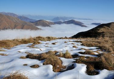
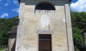
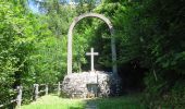
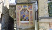
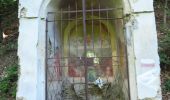
R11 Scareno - Alpe Piaggia - Passo Folungo
SityTrail - itinéraires balisés pédestres
Tous les sentiers balisés d’Europe GUIDE+
![Lengte](/images/other/stat-length.png)
![Max. hoogte](https://static1.geolcdn.com/siteimages/upload/files/1508320355ic_sort_altitude_max_24dp.png)
![Positief hoogteverschil](https://static1.geolcdn.com/siteimages/upload/files/1508320355ic_sort_den_pos_24dp.png)
![Km-Effort](/images/other/stat-length.png)
![Min. hoogte](https://static1.geolcdn.com/siteimages/upload/files/1508320355ic_sort_altitude_min_24dp.png)
![Negatief hoogteverschil](https://static1.geolcdn.com/siteimages/upload/files/1508320355ic_sort_den_neg_24dp.png)
![Boucle](https://static1.geolcdn.com/siteimages/upload/files/16400158638029165_repeat_loop_refresh_sync_direction_icon.png)
![Te voet](https://static1.geolcdn.com/sitytour/trail-icons/100.png)
3h10
Moeilijkheid : Gemakkelijk
![Scan deze QR-code om de tocht te openen in de SityTrail-applicatie](https://capi.geolives.com/qq0zvz2zws4bq2lad0pu/sitytour/trails/3123615/qr.png?size=200)
Gratisgps-wandelapplicatie
Over ons
Tocht Te voet van 5,9 km beschikbaar op Piëmont, Verbano-Cusio-Ossola, Aurano. Deze tocht wordt voorgesteld door SityTrail - itinéraires balisés pédestres.
Beschrijving
Club Alpino Italiano Sezioni Est Monte Rosa - Associazione delle Sezioni del Club Alpino Italiano delle Province del Verbano Cusio Ossola e di Novara. Chi siamo, organigramma, storia, eventi e notizie; calendario escursioni sezionali con attività di alpinismo, alpinismo giovanile, escursionismo, sci alpinismo, ferrate, ciclo escursionismo, speleologia, cultura e tradizione; gallerie fotografiche; scuole di alpinismo, sci alpinismo, escursionismo, speleologia, alpinismo giovanile; itinerari escursionistici; sentieri, rifugi e bivacchi.
Plaatsbepaling
Opmerkingen
Wandeltochten in de omgeving
![Tocht Te voet Aurano - R15a Bivio R15 Alpe Segletta - Piancavallo - Photo](https://media.geolcdn.com/t/375/260/3652371a-7a28-492b-afe4-29c5dd2f1c56.jpeg&format=jpg&maxdim=2)
![Te voet Te voet](https://static1.geolcdn.com/sitytour/trail-icons/100.png)
Te voet
![](/images/other/stat-length.png)
![](https://static1.geolcdn.com/siteimages/upload/files/16400158638029165_repeat_loop_refresh_sync_direction_icon.png)
![Tocht Te voet Aurano - R15 Aurano - Calpera - il Colle - Photo](https://media.geolcdn.com/t/375/260/b5041733-af99-46d1-b8c6-be72241b576c.jpeg&format=jpg&maxdim=2)
![Te voet Te voet](https://static1.geolcdn.com/sitytour/trail-icons/100.png)
Te voet
![](/images/other/stat-length.png)
![](https://static1.geolcdn.com/siteimages/upload/files/16400158638029165_repeat_loop_refresh_sync_direction_icon.png)
![Tocht Te voet Aurano - R13 Scareno - Pian d'Arla - Photo](https://media.geolcdn.com/t/375/260/19165ffd-ed09-466b-b6a1-8a69b42fad33.jpeg&format=jpg&maxdim=2)
![Te voet Te voet](https://static1.geolcdn.com/sitytour/trail-icons/100.png)
Te voet
![](/images/other/stat-length.png)
![](https://static1.geolcdn.com/siteimages/upload/files/16400158638029165_repeat_loop_refresh_sync_direction_icon.png)
![Tocht Te voet Aurano - R08 Aurano - Esio - Premeno - Photo](https://media.geolcdn.com/t/375/260/b5041733-af99-46d1-b8c6-be72241b576c.jpeg&format=jpg&maxdim=2)
![Te voet Te voet](https://static1.geolcdn.com/sitytour/trail-icons/100.png)
Te voet
![](/images/other/stat-length.png)
![](https://static1.geolcdn.com/siteimages/upload/files/16400158638029165_repeat_loop_refresh_sync_direction_icon.png)
![Tocht Te voet Miazzina - R03a Cappella Fina bivio R03 - Bivio R05 tra Cappella Porta e Cornala - Photo](https://media.geolcdn.com/t/375/260/00c4334e-506f-41c9-b8e0-5be565926aad.jpeg&format=jpg&maxdim=2)
![Te voet Te voet](https://static1.geolcdn.com/sitytour/trail-icons/100.png)
Te voet
![](/images/other/stat-length.png)
![](https://static1.geolcdn.com/siteimages/upload/files/16400158638029165_repeat_loop_refresh_sync_direction_icon.png)
![Tocht Te voet Caprezzo - R05 Caprezzo - Pian Cavallone bivio R07 - Photo](https://media.geolcdn.com/t/375/260/00c4334e-506f-41c9-b8e0-5be565926aad.jpeg&format=jpg&maxdim=2)
![Te voet Te voet](https://static1.geolcdn.com/sitytour/trail-icons/100.png)
Te voet
![](/images/other/stat-length.png)
![](https://static1.geolcdn.com/siteimages/upload/files/16400158638029165_repeat_loop_refresh_sync_direction_icon.png)
![Tocht Te voet Intragna - R07 Intragna - Cappella del Pian Cavallone - Photo](https://media.geolcdn.com/t/375/260/00c4334e-506f-41c9-b8e0-5be565926aad.jpeg&format=jpg&maxdim=2)
![Te voet Te voet](https://static1.geolcdn.com/sitytour/trail-icons/100.png)
Te voet
![](/images/other/stat-length.png)
![](https://static1.geolcdn.com/siteimages/upload/files/16400158638029165_repeat_loop_refresh_sync_direction_icon.png)
![Tocht Te voet Aurano - R14 Aurano - Luera - Photo](https://media.geolcdn.com/t/375/260/2f93f67d-e4ca-487a-a9d1-ce49628fe8d2.jpeg&format=jpg&maxdim=2)
![Te voet Te voet](https://static1.geolcdn.com/sitytour/trail-icons/100.png)
Te voet
![](/images/other/stat-length.png)
![](https://static1.geolcdn.com/siteimages/upload/files/16400158638029165_repeat_loop_refresh_sync_direction_icon.png)
![Tocht Te voet Miazzina - R03 - Sentiero BOVE tratto Pian Cavallone Monte Zeda - Photo](https://media.geolcdn.com/t/375/260/26223a5e-e908-42b5-b164-a1ce3755c00a.jpeg&format=jpg&maxdim=2)
![Te voet Te voet](https://static1.geolcdn.com/sitytour/trail-icons/100.png)
Te voet
![](/images/other/stat-length.png)
![](https://static1.geolcdn.com/siteimages/upload/files/16400158638029165_repeat_loop_refresh_sync_direction_icon.png)