![](/images/other/stat-length.png)
![Tocht Te voet Ratzwiller - Chevalet vert - Photo](https://media.geolcdn.com/t/1900/400/e1ca6c5c-ec16-4e6c-a9bf-b3aef84f04a4.jpeg&format=pjpeg&maxdim=2)
Chevalet vert
SityTrail - itinéraires balisés pédestres
Tous les sentiers balisés d’Europe GUIDE+
![Lengte](/images/other/stat-length.png)
Lengte
6,1 km
![Max. hoogte](https://static1.geolcdn.com/siteimages/upload/files/1508320355ic_sort_altitude_max_24dp.png)
Max. hoogte
391 m
![Positief hoogteverschil](https://static1.geolcdn.com/siteimages/upload/files/1508320355ic_sort_den_pos_24dp.png)
Positief hoogteverschil
170 m
![Km-Effort](/images/other/stat-length.png)
Km-Effort
8,2 km
![Min. hoogte](https://static1.geolcdn.com/siteimages/upload/files/1508320355ic_sort_altitude_min_24dp.png)
Min. hoogte
246 m
![Negatief hoogteverschil](https://static1.geolcdn.com/siteimages/upload/files/1508320355ic_sort_den_neg_24dp.png)
Negatief hoogteverschil
101 m
![Boucle](https://static1.geolcdn.com/siteimages/upload/files/16400158638029165_repeat_loop_refresh_sync_direction_icon.png)
Boucle
Neen
Markering
Datum van aanmaak :
2022-02-15 18:09:19.819
Laatste wijziging :
2022-03-02 20:33:43.801
![Te voet](https://static1.geolcdn.com/sitytour/trail-icons/100.png)
1h51
Moeilijkheid : Gemakkelijk
![Scan deze QR-code om de tocht te openen in de SityTrail-applicatie](https://capi.geolives.com/qq0zvz2zws4bq2lad0pu/sitytour/trails/3123358/qr.png?size=200)
Gratisgps-wandelapplicatie
Over ons
Tocht Te voet van 6,1 km beschikbaar op Grand Est, Bas-Rhin, Ratzwiller. Deze tocht wordt voorgesteld door SityTrail - itinéraires balisés pédestres.
Beschrijving
Trail created by Club Vosgien.
route complete
Plaatsbepaling
Land:
France
Regio :
Grand Est
Departement/Provincie :
Bas-Rhin
Gemeente :
Ratzwiller
Locatie:
Unknown
Vertrek:(Dec)
Vertrek:(UTM)
372162 ; 5423298 (32U) N.
Opmerkingen
Wandeltochten in de omgeving
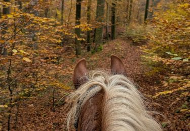
![Tocht Paardrijden Soucht - suuntoapp-HorsebackRiding-2024-11-10T08-15-44Z - Photo](https://media.geolcdn.com/t/375/260/d294c360-1d28-4f9f-ab80-3f1d986cc1d0.jpg&format=jpg&maxdim=2)
![Paardrijden Paardrijden](https://static1.geolcdn.com/sitytour/trail-icons/301.png)
suuntoapp-HorsebackRiding-2024-11-10T08-15-44Z
Paardrijden
Heel gemakkelijk
Soucht,
Grand Est,
Moselle,
France
![](/images/other/stat-length.png)
26 km | 34 km-effort
4h 27min
![](https://static1.geolcdn.com/siteimages/upload/files/16400158638029165_repeat_loop_refresh_sync_direction_icon.png)
Ja
![Tocht Paardrijden Soucht - suuntoapp-HorsebackRiding-2024-11-09T08-23-34Z - Photo](https://media.geolcdn.com/t/375/260/0bfc4fa4-827c-4487-84af-819b72092ea6.jpg&format=jpg&maxdim=2)
![Paardrijden Paardrijden](https://static1.geolcdn.com/sitytour/trail-icons/301.png)
suuntoapp-HorsebackRiding-2024-11-09T08-23-34Z
Paardrijden
Heel gemakkelijk
Soucht,
Grand Est,
Moselle,
France
![](/images/other/stat-length.png)
28 km | 37 km-effort
4h 53min
![](https://static1.geolcdn.com/siteimages/upload/files/16400158638029165_repeat_loop_refresh_sync_direction_icon.png)
Ja
![Tocht Te voet Montbronn - Circuit des calvaires n°4 - Photo](https://media.geolcdn.com/t/375/260/a7b9a56e-05f0-4134-ac47-01c83168e22f.jpeg&format=jpg&maxdim=2)
![Te voet Te voet](https://static1.geolcdn.com/sitytour/trail-icons/100.png)
Circuit des calvaires n°4
Te voet
Gemakkelijk
Montbronn,
Grand Est,
Moselle,
France
![](/images/other/stat-length.png)
4,9 km | 6,2 km-effort
1h 24min
![](https://static1.geolcdn.com/siteimages/upload/files/16400158638029165_repeat_loop_refresh_sync_direction_icon.png)
Neen
![Tocht Te voet Butten - Anneau bleu - Photo](https://media.geolcdn.com/t/375/260/81231655-9cac-4d3c-8b6a-5b23a7072ecc.jpeg&format=jpg&maxdim=2)
![Te voet Te voet](https://static1.geolcdn.com/sitytour/trail-icons/100.png)
Anneau bleu
Te voet
Gemakkelijk
Butten,
Grand Est,
Bas-Rhin,
France
![](/images/other/stat-length.png)
5,8 km | 7,9 km-effort
1h 48min
![](https://static1.geolcdn.com/siteimages/upload/files/16400158638029165_repeat_loop_refresh_sync_direction_icon.png)
Ja
![Tocht Te voet Butten - Anneau rouge - Photo](https://media.geolcdn.com/t/375/260/81231655-9cac-4d3c-8b6a-5b23a7072ecc.jpeg&format=jpg&maxdim=2)
![Te voet Te voet](https://static1.geolcdn.com/sitytour/trail-icons/100.png)
Anneau rouge
Te voet
Gemakkelijk
Butten,
Grand Est,
Bas-Rhin,
France
![](/images/other/stat-length.png)
6,2 km | 8 km-effort
1h 48min
![](https://static1.geolcdn.com/siteimages/upload/files/16400158638029165_repeat_loop_refresh_sync_direction_icon.png)
Ja
![Tocht Te voet Volksberg - Losange vert - Photo](https://media.geolcdn.com/t/375/260/40af32f9-2f69-4f07-9a93-cacfd66f615c.jpeg&format=jpg&maxdim=2)
![Te voet Te voet](https://static1.geolcdn.com/sitytour/trail-icons/100.png)
Losange vert
Te voet
Gemakkelijk
Volksberg,
Grand Est,
Bas-Rhin,
France
![](/images/other/stat-length.png)
9,1 km | 12,3 km-effort
2h 48min
![](https://static1.geolcdn.com/siteimages/upload/files/16400158638029165_repeat_loop_refresh_sync_direction_icon.png)
Ja
![Tocht Te voet Diemeringen - Mackwiller la romaine - Photo](https://media.geolcdn.com/t/375/260/6e42945c-7f24-4443-aff5-37264c5394f0.jpeg&format=jpg&maxdim=2)
![Te voet Te voet](https://static1.geolcdn.com/sitytour/trail-icons/100.png)
Mackwiller la romaine
Te voet
Gemakkelijk
Diemeringen,
Grand Est,
Bas-Rhin,
France
![](/images/other/stat-length.png)
4,6 km | 5,4 km-effort
1h 14min
![](https://static1.geolcdn.com/siteimages/upload/files/16400158638029165_repeat_loop_refresh_sync_direction_icon.png)
Ja
![Tocht Te voet Volksberg - Anneau vert - Photo](https://media.geolcdn.com/t/375/260/e2590e39-af6c-4003-9899-64cc7064b496.jpeg&format=jpg&maxdim=2)
![Te voet Te voet](https://static1.geolcdn.com/sitytour/trail-icons/100.png)
Anneau vert
Te voet
Gemakkelijk
Volksberg,
Grand Est,
Bas-Rhin,
France
![](/images/other/stat-length.png)
5,6 km | 7,6 km-effort
1h 43min
![](https://static1.geolcdn.com/siteimages/upload/files/16400158638029165_repeat_loop_refresh_sync_direction_icon.png)
Ja
![Tocht Te voet Puberg - Disque vert - Photo](https://media.geolcdn.com/t/375/260/038b5fbd-ad7d-4d8f-a6b9-4f60e8eebeb8.jpeg&format=jpg&maxdim=2)
![Te voet Te voet](https://static1.geolcdn.com/sitytour/trail-icons/100.png)