Tocht Te voet Lumezzane - Via del Sacro - Photo

Tous les sentiers balisés d’Europe GUIDE+

© OpenStreetMap contributors
Lengte
Lengte
26 km
Max. hoogte
Max. hoogte
1334 m
Positief hoogteverschil
1395 m
Km-Effort
Km-Effort  
47 km
Min. hoogte
Min. hoogte
501 m
Negatief hoogteverschil
1907 m
Boucle
Boucle
Neen
Markering
Markering
Datum van aanmaak :
2022-02-15 18:07:31.179
Laatste wijziging :
2022-03-01 22:31:05.42

(0 Bericht)

Te voet
Te voet
10h34
Moeilijkheid : Zeer moeilijk

Scan deze QR-code om de tocht te openen in de SityTrail-applicatie

Gratisgps-wandelapplicatie

Logo SityTrail SityTrail

IGN / Geografische instituten

SityTrail uit de App Store downloaden SityTrail uit Google Play downloaden

Logo SityTrail SityTrail World

De wereld gaat voor u open

SityTrail uit de App Store downloaden SityTrail uit Google Play downloaden SityTrail op Huawei AppGallery downloaden

Over ons

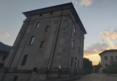
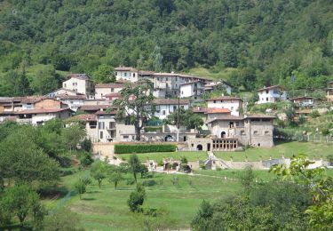
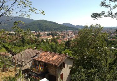
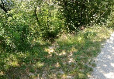
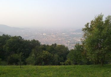
Tocht Te voet van 26 km beschikbaar op Lombardije, Brescia, Lumezzane. Deze tocht wordt voorgesteld door SityTrail - itinéraires balisés pédestres.

Beschrijving

Trail created by Club Alpino Italiano - Sezione di Lumezzane.

Symbol: unmarked


Website: http://www.cailumezzane.it/sentieri/Via del Sacro/Via del Sacro a lumezzane.html

Hoogteprofiel

Foto's

Plaatsbepaling

Land:
Italy
Regio :
Lombardije
Departement/Provincie :
Brescia
Gemeente :
Lumezzane
Locatie:
Unknown
Vertrek:(UTM)
598045 ; 5053808 (32T) N.

Wandeltochten in de omgeving

Tocht Te voet Lumezzane - Via del Sacro da Lumezzane (Fontana) - San Bernardo - Photo
Te voet
GUIDE+

Te voet

Gemakkelijk
Lumezzane, Lombardije, Brescia, Italy
3,4 km | 5,9 km-effort
1h 20min
Neen
Tocht Te voet Caino - Caino (Villa Sera) - Santuario di Conche - Colle di Sant'Eusebio - Photo
Te voet
GUIDE+

Te voet

Moeilijk
Caino, Lombardije, Brescia, Italy
20 km | 38 km-effort
8h 33min
Neen
Tocht Te voet Lumezzane - Via del Sacro - Percorso principale - Photo
Te voet
GUIDE+

Te voet

Zeer moeilijk
Lumezzane, Lombardije, Brescia, Italy
26 km | 50 km-effort
11h 21min
Neen
Tocht Te voet Bovezzo - Sentiero dei marroni - Photo
Te voet
GUIDE+

Te voet

Medium
Bovezzo, Lombardije, Brescia, Italy
14,4 km | 27 km-effort
6h 6min
Neen
Tocht Te voet Bovezzo - Concesio (Sant'Andrea) - Sant'Onofrio - Photo
Te voet
GUIDE+

Te voet

Gemakkelijk
Bovezzo, Lombardije, Brescia, Italy
4,7 km | 7,2 km-effort
1h 37min
Neen
Tocht Te voet Bovezzo - Bovezzo - Sant'Onofrio - Photo
Te voet
GUIDE+

Te voet

Gemakkelijk
Bovezzo, Lombardije, Brescia, Italy
3,4 km | 10,5 km-effort
2h 23min
Neen
Tocht Te voet Lumezzane - Lumezzane (Pieve) - Grassi - Corna di Sonclino - Photo
Te voet
GUIDE+

Te voet

Gemakkelijk
Lumezzane, Lombardije, Brescia, Italy
8,1 km | 16,9 km-effort
3h 50min
Neen
Tocht Te voet Lumezzane - Lumezzane (Ver) - San Bernardo - Photo
Te voet
GUIDE+

Te voet

Gemakkelijk
Lumezzane, Lombardije, Brescia, Italy
4 km | 6,8 km-effort
1h 32min
Neen
Tocht Te voet Concesio - Concesio - Valsorda - Photo
Te voet
GUIDE+

Te voet

Gemakkelijk
Concesio, Lombardije, Brescia, Italy
6,1 km | 8,9 km-effort
2h 1min
Ja


Sluiten
Mijn abonnementen