![](/images/other/stat-length.png)
![Tocht Te voet Saint-Pierre-de-Chignac - Boucle de la Chapelle - Photo](https://media.geolcdn.com/t/1900/400/d3c39e97-2e4b-4bda-bfae-5ac5d4c513f2.jpeg&format=pjpeg&maxdim=2)
Boucle de la Chapelle
SityTrail - itinéraires balisés pédestres
Tous les sentiers balisés d’Europe GUIDE+
![Lengte](/images/other/stat-length.png)
Lengte
14,7 km
![Max. hoogte](https://static1.geolcdn.com/siteimages/upload/files/1508320355ic_sort_altitude_max_24dp.png)
Max. hoogte
233 m
![Positief hoogteverschil](https://static1.geolcdn.com/siteimages/upload/files/1508320355ic_sort_den_pos_24dp.png)
Positief hoogteverschil
301 m
![Km-Effort](/images/other/stat-length.png)
Km-Effort
18,7 km
![Min. hoogte](https://static1.geolcdn.com/siteimages/upload/files/1508320355ic_sort_altitude_min_24dp.png)
Min. hoogte
132 m
![Negatief hoogteverschil](https://static1.geolcdn.com/siteimages/upload/files/1508320355ic_sort_den_neg_24dp.png)
Negatief hoogteverschil
302 m
![Boucle](https://static1.geolcdn.com/siteimages/upload/files/16400158638029165_repeat_loop_refresh_sync_direction_icon.png)
Boucle
Neen
Markering
Datum van aanmaak :
2022-02-15 17:37:08.719
Laatste wijziging :
2022-03-02 19:50:42.182
![Te voet](https://static1.geolcdn.com/sitytour/trail-icons/100.png)
4h14
Moeilijkheid : Gemakkelijk
![Scan deze QR-code om de tocht te openen in de SityTrail-applicatie](https://capi.geolives.com/qq0zvz2zws4bq2lad0pu/sitytour/trails/3122784/qr.png?size=200)
Gratisgps-wandelapplicatie
Over ons
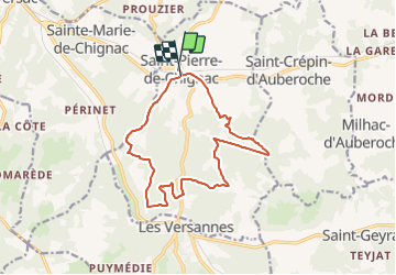
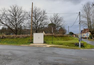
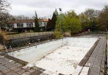
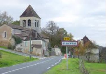
Tocht Te voet van 14,7 km beschikbaar op Nieuw-Aquitanië, Dordogne, Saint-Pierre-de-Chignac. Deze tocht wordt voorgesteld door SityTrail - itinéraires balisés pédestres.
Beschrijving
Symbol: yellow:white:yellow_bar
Plaatsbepaling
Land:
France
Regio :
Nieuw-Aquitanië
Departement/Provincie :
Dordogne
Gemeente :
Saint-Pierre-de-Chignac
Locatie:
Unknown
Vertrek:(Dec)
Vertrek:(UTM)
331382 ; 4999017 (31T) N.
Opmerkingen
Wandeltochten in de omgeving
![Tocht Te voet Saint-Pierre-de-Chignac - Boucle du Lavoir - Photo](https://media.geolcdn.com/t/375/260/e386a542-1ce6-4d44-946f-087c4c01d831.jpeg&format=jpg&maxdim=2)
![Te voet Te voet](https://static1.geolcdn.com/sitytour/trail-icons/100.png)
Boucle du Lavoir
Te voet
Gemakkelijk
Saint-Pierre-de-Chignac,
Nieuw-Aquitanië,
Dordogne,
France
![](/images/other/stat-length.png)
5,3 km | 7,1 km-effort
1h 37min
![](https://static1.geolcdn.com/siteimages/upload/files/16400158638029165_repeat_loop_refresh_sync_direction_icon.png)
Ja
![Tocht Stappen Saint-Pierre-de-Chignac - boucle chai lamardie - Photo](https://media.geolcdn.com/t/375/260/21e6bc13-c5ca-4323-a746-a80ff6aa9b77.jpg&format=jpg&maxdim=2)
![Stappen Stappen](https://static1.geolcdn.com/sitytour/trail-icons/101.png)
boucle chai lamardie
Stappen
Gemakkelijk
Saint-Pierre-de-Chignac,
Nieuw-Aquitanië,
Dordogne,
France
![](/images/other/stat-length.png)
8,6 km | 11 km-effort
2h 45min
![](https://static1.geolcdn.com/siteimages/upload/files/16400158638029165_repeat_loop_refresh_sync_direction_icon.png)
Ja
![Tocht Te voet Saint-Crépin-d'Auberoche - Boucle de la Tuillère - Photo](https://media.geolcdn.com/t/375/260/43b94199-7445-405d-8654-dfea16f06fd9.jpeg&format=jpg&maxdim=2)
![Te voet Te voet](https://static1.geolcdn.com/sitytour/trail-icons/100.png)
Boucle de la Tuillère
Te voet
Gemakkelijk
(1)
Saint-Crépin-d'Auberoche,
Nieuw-Aquitanië,
Dordogne,
France
![](/images/other/stat-length.png)
7,6 km | 9,5 km-effort
2h 9min
![](https://static1.geolcdn.com/siteimages/upload/files/16400158638029165_repeat_loop_refresh_sync_direction_icon.png)
Ja
![Tocht Te voet Saint-Crépin-d'Auberoche - Boucle de la Tuillère (Variante courte) - Photo](https://media.geolcdn.com/t/375/260/fae48319-4f5c-4d98-9f56-fe274312e9a7.jpeg&format=jpg&maxdim=2)
![Te voet Te voet](https://static1.geolcdn.com/sitytour/trail-icons/100.png)
Boucle de la Tuillère (Variante courte)
Te voet
Gemakkelijk
Saint-Crépin-d'Auberoche,
Nieuw-Aquitanië,
Dordogne,
France
![](/images/other/stat-length.png)
5,2 km | 6,8 km-effort
1h 33min
![](https://static1.geolcdn.com/siteimages/upload/files/16400158638029165_repeat_loop_refresh_sync_direction_icon.png)
Ja
![Tocht Stappen Boulazac Isle Manoire - Saint Laurent sur Manoire - Photo](https://media.geolcdn.com/t/375/260/ebe685e6-5319-4e99-8153-a55006b30e22.jpg&format=jpg&maxdim=2)
![Stappen Stappen](https://static1.geolcdn.com/sitytour/trail-icons/101.png)
Saint Laurent sur Manoire
Stappen
Moeilijk
(1)
Boulazac Isle Manoire,
Nieuw-Aquitanië,
Dordogne,
France
![](/images/other/stat-length.png)
11,2 km | 14,1 km-effort
3h 12min
![](https://static1.geolcdn.com/siteimages/upload/files/16400158638029165_repeat_loop_refresh_sync_direction_icon.png)
Ja
![Tocht Stappen Saint-Geyrac - Boucle de la Forêt - Photo](https://media.geolcdn.com/t/375/260/4db006ff-30dc-4e31-b362-4edd70e8f0d5.jpg&format=jpg&maxdim=2)
![Stappen Stappen](https://static1.geolcdn.com/sitytour/trail-icons/101.png)
Boucle de la Forêt
Stappen
Moeilijk
Saint-Geyrac,
Nieuw-Aquitanië,
Dordogne,
France
![](/images/other/stat-length.png)
13,1 km | 16,6 km-effort
3h 46min
![](https://static1.geolcdn.com/siteimages/upload/files/16400158638029165_repeat_loop_refresh_sync_direction_icon.png)
Ja
![Tocht Stappen Bassillac et Auberoche - Eyliac Milpas - Photo](https://media.geolcdn.com/t/375/260/ext.jpg?maxdim=2&url=https%3A%2F%2Fstatic1.geolcdn.com%2Fsiteimages%2Fupload%2Ffiles%2F1553511878bg_sport_marche.png)
![Stappen Stappen](https://static1.geolcdn.com/sitytour/trail-icons/101.png)
Eyliac Milpas
Stappen
Moeilijk
Bassillac et Auberoche,
Nieuw-Aquitanië,
Dordogne,
France
![](/images/other/stat-length.png)
12,4 km | 15,8 km-effort
3h 2min
![](https://static1.geolcdn.com/siteimages/upload/files/16400158638029165_repeat_loop_refresh_sync_direction_icon.png)
Ja
![Tocht Stappen Saint-Pierre-de-Chignac - Lardimalie, chai, chateau, le puy - Photo](https://media.geolcdn.com/t/375/260/ext.jpg?maxdim=2&url=https%3A%2F%2Fstatic1.geolcdn.com%2Fsiteimages%2Fupload%2Ffiles%2F1553511878bg_sport_marche.png)
![Stappen Stappen](https://static1.geolcdn.com/sitytour/trail-icons/101.png)
Lardimalie, chai, chateau, le puy
Stappen
Gemakkelijk
(2)
Saint-Pierre-de-Chignac,
Nieuw-Aquitanië,
Dordogne,
France
![](/images/other/stat-length.png)
8,9 km | 11,3 km-effort
2h 20min
![](https://static1.geolcdn.com/siteimages/upload/files/16400158638029165_repeat_loop_refresh_sync_direction_icon.png)
Ja
![Tocht Stappen Bassillac et Auberoche - blis et born - Photo](https://media.geolcdn.com/t/375/260/ext.jpg?maxdim=2&url=https%3A%2F%2Fstatic1.geolcdn.com%2Fsiteimages%2Fupload%2Ffiles%2F1553511878bg_sport_marche.png)
![Stappen Stappen](https://static1.geolcdn.com/sitytour/trail-icons/101.png)
blis et born
Stappen
Heel gemakkelijk
Bassillac et Auberoche,
Nieuw-Aquitanië,
Dordogne,
France
![](/images/other/stat-length.png)
6,2 km | 7,9 km-effort
55min
![](https://static1.geolcdn.com/siteimages/upload/files/16400158638029165_repeat_loop_refresh_sync_direction_icon.png)
Ja