![](/images/other/stat-length.png)
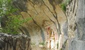
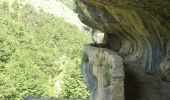
![Tocht Te voet Caramanico Terme - Tratto Eremo di San Giovanni - Roccamorice - Photo](https://media.geolcdn.com/t/1900/400/5536a4a1-b968-48ef-8d93-f50b8b11adcb.jpeg&format=pjpeg&maxdim=2)
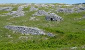
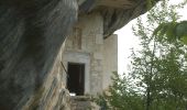
Tratto Eremo di San Giovanni - Roccamorice
SityTrail - itinéraires balisés pédestres
Tous les sentiers balisés d’Europe GUIDE+
![Lengte](/images/other/stat-length.png)
Lengte
15,6 km
![Max. hoogte](https://static1.geolcdn.com/siteimages/upload/files/1508320355ic_sort_altitude_max_24dp.png)
Max. hoogte
1504 m
![Positief hoogteverschil](https://static1.geolcdn.com/siteimages/upload/files/1508320355ic_sort_den_pos_24dp.png)
Positief hoogteverschil
537 m
![Km-Effort](/images/other/stat-length.png)
Km-Effort
25 km
![Min. hoogte](https://static1.geolcdn.com/siteimages/upload/files/1508320355ic_sort_altitude_min_24dp.png)
Min. hoogte
676 m
![Negatief hoogteverschil](https://static1.geolcdn.com/siteimages/upload/files/1508320355ic_sort_den_neg_24dp.png)
Negatief hoogteverschil
1185 m
![Boucle](https://static1.geolcdn.com/siteimages/upload/files/16400158638029165_repeat_loop_refresh_sync_direction_icon.png)
Boucle
Neen
Markering
Datum van aanmaak :
2022-02-15 17:18:47.337
Laatste wijziging :
2022-03-01 20:30:26.35
![Te voet](https://static1.geolcdn.com/sitytour/trail-icons/100.png)
5h39
Moeilijkheid : Medium
![Scan deze QR-code om de tocht te openen in de SityTrail-applicatie](https://capi.geolives.com/qq0zvz2zws4bq2lad0pu/sitytour/trails/3122403/qr.png?size=200)
Gratisgps-wandelapplicatie
Over ons
Tocht Te voet van 15,6 km beschikbaar op Abruzzen, Pescara, Caramanico Terme. Deze tocht wordt voorgesteld door SityTrail - itinéraires balisés pédestres.
Beschrijving
Symbol: S on white red flags
Plaatsbepaling
Land:
Italy
Regio :
Abruzzen
Departement/Provincie :
Pescara
Gemeente :
Caramanico Terme
Locatie:
Unknown
Vertrek:(Dec)
Vertrek:(UTM)
424073 ; 4667270 (33T) N.
Opmerkingen
Wandeltochten in de omgeving
![Tocht Te voet Pretoro - Tratto Rifugio Pomilio - Monte Amaro - Photo](https://media.geolcdn.com/t/375/260/84249c0a-f19f-4071-bbfb-4460fc45e6ea.jpeg&format=jpg&maxdim=2)
![Te voet Te voet](https://static1.geolcdn.com/sitytour/trail-icons/100.png)
Tratto Rifugio Pomilio - Monte Amaro
Te voet
Medium
Pretoro,
Abruzzen,
Chieti,
Italy
![](/images/other/stat-length.png)
12,7 km | 26 km-effort
5h 58min
![](https://static1.geolcdn.com/siteimages/upload/files/16400158638029165_repeat_loop_refresh_sync_direction_icon.png)
Neen
![Tocht Te voet Lettomanoppello - Anello della Cerratina - Photo](https://media.geolcdn.com/t/375/260/29396302-2853-4fa5-9e1e-67890157ddc1.jpeg&format=jpg&maxdim=2)
![Te voet Te voet](https://static1.geolcdn.com/sitytour/trail-icons/100.png)
Anello della Cerratina
Te voet
Gemakkelijk
Lettomanoppello,
Abruzzen,
Pescara,
Italy
![](/images/other/stat-length.png)
5,1 km | 7 km-effort
1h 35min
![](https://static1.geolcdn.com/siteimages/upload/files/16400158638029165_repeat_loop_refresh_sync_direction_icon.png)
Neen
![Tocht Te voet Lettomanoppello - Anello di Colle dell'Astoro - Photo](https://media.geolcdn.com/t/375/260/29396302-2853-4fa5-9e1e-67890157ddc1.jpeg&format=jpg&maxdim=2)
![Te voet Te voet](https://static1.geolcdn.com/sitytour/trail-icons/100.png)
Anello di Colle dell'Astoro
Te voet
Gemakkelijk
Lettomanoppello,
Abruzzen,
Pescara,
Italy
![](/images/other/stat-length.png)
5,2 km | 8,5 km-effort
1h 56min
![](https://static1.geolcdn.com/siteimages/upload/files/16400158638029165_repeat_loop_refresh_sync_direction_icon.png)
Neen
![Tocht Te voet Roccamorice - Anello di Colle della Civita - Photo](https://media.geolcdn.com/t/375/260/40146891-37b1-4c0a-84f0-93f9b91e7e7f.jpeg&format=jpg&maxdim=2)
![Te voet Te voet](https://static1.geolcdn.com/sitytour/trail-icons/100.png)
Anello di Colle della Civita
Te voet
Gemakkelijk
Roccamorice,
Abruzzen,
Pescara,
Italy
![](/images/other/stat-length.png)
4,4 km | 6,9 km-effort
1h 34min
![](https://static1.geolcdn.com/siteimages/upload/files/16400158638029165_repeat_loop_refresh_sync_direction_icon.png)
Ja
![Tocht Te voet Abbateggio - Anello di Valle Giumentina - Photo](https://media.geolcdn.com/t/375/260/f94e3f18-1f88-427d-844c-e5c9d3dddcd7.jpeg&format=jpg&maxdim=2)
![Te voet Te voet](https://static1.geolcdn.com/sitytour/trail-icons/100.png)
Anello di Valle Giumentina
Te voet
Gemakkelijk
Abbateggio,
Abruzzen,
Pescara,
Italy
![](/images/other/stat-length.png)
5,1 km | 7,1 km-effort
1h 36min
![](https://static1.geolcdn.com/siteimages/upload/files/16400158638029165_repeat_loop_refresh_sync_direction_icon.png)
Neen
![Tocht Te voet Sant'Eufemia a Maiella - San Giacomo - Roccacaramanico - Barbusciana di Salle - Photo](https://media.geolcdn.com/t/375/260/f2d79928-09d9-4225-a550-1bc430af9a12.jpeg&format=jpg&maxdim=2)
![Te voet Te voet](https://static1.geolcdn.com/sitytour/trail-icons/100.png)
San Giacomo - Roccacaramanico - Barbusciana di Salle
Te voet
Gemakkelijk
Sant'Eufemia a Maiella,
Abruzzen,
Pescara,
Italy
![](/images/other/stat-length.png)
11 km | 15,7 km-effort
3h 34min
![](https://static1.geolcdn.com/siteimages/upload/files/16400158638029165_repeat_loop_refresh_sync_direction_icon.png)
Neen
![Tocht Te voet Caramanico Terme - Sentiero Parco - Cima Murelle - Photo](https://media.geolcdn.com/t/375/260/b1a97235-7a17-4c76-9a89-82bdf2a04ebe.jpeg&format=jpg&maxdim=2)
![Te voet Te voet](https://static1.geolcdn.com/sitytour/trail-icons/100.png)
Sentiero Parco - Cima Murelle
Te voet
Gemakkelijk
Caramanico Terme,
Abruzzen,
Pescara,
Italy
![](/images/other/stat-length.png)
4,5 km | 12,3 km-effort
2h 47min
![](https://static1.geolcdn.com/siteimages/upload/files/16400158638029165_repeat_loop_refresh_sync_direction_icon.png)
Neen
![Tocht Te voet Pretoro - Colle dell'Angelo - Sentiero E1 - Photo](https://media.geolcdn.com/t/375/260/580080df-4e4d-474c-8087-9ca9827fe423.jpeg&format=jpg&maxdim=2)
![Te voet Te voet](https://static1.geolcdn.com/sitytour/trail-icons/100.png)
Colle dell'Angelo - Sentiero E1
Te voet
Gemakkelijk
Pretoro,
Abruzzen,
Chieti,
Italy
![](/images/other/stat-length.png)
4,6 km | 7,7 km-effort
1h 45min
![](https://static1.geolcdn.com/siteimages/upload/files/16400158638029165_repeat_loop_refresh_sync_direction_icon.png)
Neen
![Tocht Stappen Sant'Eufemia a Maiella - Dan Giacomo - Roccomarino - Photo](https://media.geolcdn.com/t/375/260/a806cdb4-3cac-4781-8cdc-6c9abb6e4897.jpg&format=jpg&maxdim=2)
![Stappen Stappen](https://static1.geolcdn.com/sitytour/trail-icons/101.png)
Dan Giacomo - Roccomarino
Stappen
Gemakkelijk
Sant'Eufemia a Maiella,
Abruzzen,
Pescara,
Italy
![](/images/other/stat-length.png)
5,9 km | 8,8 km-effort
45min
![](https://static1.geolcdn.com/siteimages/upload/files/16400158638029165_repeat_loop_refresh_sync_direction_icon.png)
Ja