![](/images/other/stat-length.png)
![Tocht Te voet Colere - IT-404 - Photo](https://media.geolcdn.com/t/1900/400/17228836-e5a8-4aa1-96f8-901fa723ac79.jpeg&format=pjpeg&maxdim=2)
IT-404
SityTrail - itinéraires balisés pédestres
Tous les sentiers balisés d’Europe GUIDE+
![Lengte](/images/other/stat-length.png)
![Max. hoogte](https://static1.geolcdn.com/siteimages/upload/files/1508320355ic_sort_altitude_max_24dp.png)
![Positief hoogteverschil](https://static1.geolcdn.com/siteimages/upload/files/1508320355ic_sort_den_pos_24dp.png)
![Km-Effort](/images/other/stat-length.png)
![Min. hoogte](https://static1.geolcdn.com/siteimages/upload/files/1508320355ic_sort_altitude_min_24dp.png)
![Negatief hoogteverschil](https://static1.geolcdn.com/siteimages/upload/files/1508320355ic_sort_den_neg_24dp.png)
![Boucle](https://static1.geolcdn.com/siteimages/upload/files/16400158638029165_repeat_loop_refresh_sync_direction_icon.png)
![Te voet](https://static1.geolcdn.com/sitytour/trail-icons/100.png)
4h00
Moeilijkheid : Gemakkelijk
![Scan deze QR-code om de tocht te openen in de SityTrail-applicatie](https://capi.geolives.com/qq0zvz2zws4bq2lad0pu/sitytour/trails/3120559/qr.png?size=200)
Gratisgps-wandelapplicatie
Over ons
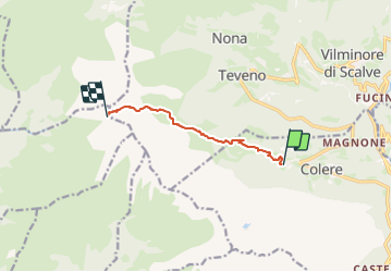
Tocht Te voet van 6,2 km beschikbaar op Lombardije, Bergamo, Colere. Deze tocht wordt voorgesteld door SityTrail - itinéraires balisés pédestres.
Beschrijving
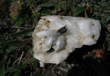
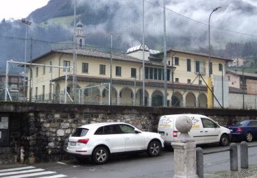
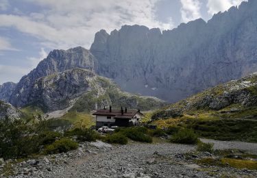
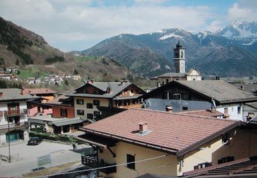
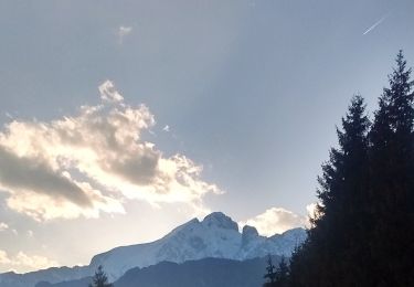
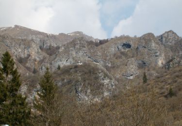
Partendo dalla frazione Carbonera di Colere (1043 m - parcheggio impianti di sci) si sale lungo la strada cementata fino alla malga Polzone, stazione intermedia degli impianti da sci (1571 m). Proseguendo in direzione ovest, dapprima sulla pista da sci e poi su sentiero, si giunge alla malga di Conchetta (1796 m) e da qui si sale tutta la val Conchetta fino a raggiungere il
Website: http://geoportale.caibergamo.it/it/sentiero/404
Plaatsbepaling
Opmerkingen
Wandeltochten in de omgeving
![Tocht Te voet Vilminore di Scalve - IT-407 - Photo](https://media.geolcdn.com/t/375/260/3a344b4e-a35f-4190-ad72-4463857492f4.jpeg&format=jpg&maxdim=2)
![Te voet Te voet](https://static1.geolcdn.com/sitytour/trail-icons/100.png)
Te voet
![](/images/other/stat-length.png)
![](https://static1.geolcdn.com/siteimages/upload/files/16400158638029165_repeat_loop_refresh_sync_direction_icon.png)
![Tocht Te voet Colere - IT-401 - Photo](https://media.geolcdn.com/t/375/260/6123d9d7-cca3-4b52-b64f-f80d90363769.jpeg&format=jpg&maxdim=2)
![Te voet Te voet](https://static1.geolcdn.com/sitytour/trail-icons/100.png)
![Tocht Te voet Oltressenda Alta - CAI320: Baite del Möschel - Grotta dei Pagani - Photo](https://media.geolcdn.com/t/375/260/07ed0ca4-c94e-41ba-9d8b-58c3c04ec842.jpeg&format=jpg&maxdim=2)
![Te voet Te voet](https://static1.geolcdn.com/sitytour/trail-icons/100.png)
Te voet
![](/images/other/stat-length.png)
![](https://static1.geolcdn.com/siteimages/upload/files/16400158638029165_repeat_loop_refresh_sync_direction_icon.png)
![Tocht Te voet Colere - Sentiero delle Orobie Orientali - Tappa finale Anello - Photo](https://media.geolcdn.com/t/375/260/08606b6c-30fc-4584-b124-177dd3367da7.jpeg&format=jpg&maxdim=2)
![Te voet Te voet](https://static1.geolcdn.com/sitytour/trail-icons/100.png)
Te voet
![](/images/other/stat-length.png)
![](https://static1.geolcdn.com/siteimages/upload/files/16400158638029165_repeat_loop_refresh_sync_direction_icon.png)
![Tocht Te voet Colere - Sentiero delle Orobie Orientali - Tappa finale Classico - Photo](https://media.geolcdn.com/t/375/260/76765d9a-4898-4654-8692-0eca7d7ca2c7.jpeg&format=jpg&maxdim=2)
![Te voet Te voet](https://static1.geolcdn.com/sitytour/trail-icons/100.png)
Te voet
![](/images/other/stat-length.png)
![](https://static1.geolcdn.com/siteimages/upload/files/16400158638029165_repeat_loop_refresh_sync_direction_icon.png)
![Tocht Te voet Colere - IT-403 - Photo](https://media.geolcdn.com/t/375/260/17228836-e5a8-4aa1-96f8-901fa723ac79.jpeg&format=jpg&maxdim=2)
![Te voet Te voet](https://static1.geolcdn.com/sitytour/trail-icons/100.png)
![Tocht Te voet Azzone - Trekking tra malghe e menhir anello 3: Salven - Costone - San Fermo - Photo](https://media.geolcdn.com/t/375/260/bd6171fc-f596-402b-93aa-c7a5279637c8.jpeg&format=jpg&maxdim=2)
![Te voet Te voet](https://static1.geolcdn.com/sitytour/trail-icons/100.png)
Te voet
![](/images/other/stat-length.png)
![](https://static1.geolcdn.com/siteimages/upload/files/16400158638029165_repeat_loop_refresh_sync_direction_icon.png)
![Tocht Te voet Colere - CAI326: Rifugio Albani - Monte Visolo (ferrata della Porta) - Photo](https://media.geolcdn.com/t/375/260/76765d9a-4898-4654-8692-0eca7d7ca2c7.jpeg&format=jpg&maxdim=2)
![Te voet Te voet](https://static1.geolcdn.com/sitytour/trail-icons/100.png)
Te voet
![](/images/other/stat-length.png)
![](https://static1.geolcdn.com/siteimages/upload/files/16400158638029165_repeat_loop_refresh_sync_direction_icon.png)
![Tocht Te voet Castione della Presolana - Castione - Via del Latte - Photo](https://media.geolcdn.com/t/375/260/05fc9400-47e5-4353-874a-589cb2e1281f.jpeg&format=jpg&maxdim=2)
![Te voet Te voet](https://static1.geolcdn.com/sitytour/trail-icons/100.png)
Te voet
![](/images/other/stat-length.png)
![](https://static1.geolcdn.com/siteimages/upload/files/16400158638029165_repeat_loop_refresh_sync_direction_icon.png)