


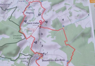
15 km | 18,8 km-effort

Tous les sentiers balisés d’Europe GUIDE+


Gratisgps-wandelapplicatie
 SityTrail
IGN / Geografische instituten
SityTrail World
De wereld gaat voor u open
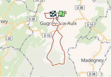
Tocht Te voet van 7,3 km beschikbaar op Grand Est, Vogezen, Gugney-aux-Aulx. Deze tocht wordt voorgesteld door SityTrail - itinéraires balisés pédestres.
Trail created by Club Vosgien Dompaire-La Gitte.
Symbol: red_circle


Te voet
Te voet
Stappen
Stappen

Stappen
Stappen
Stappen
Stappen