![](/images/other/stat-length.png)
![Tocht Te voet Perugia - Via di Francesco - Tappa 10B variante Perugia - Perugia-Assisi - Photo](https://media.geolcdn.com/t/1900/400/6278d926-561f-422d-b716-9329bb605d01.jpeg&format=pjpeg&maxdim=2)
Via di Francesco - Tappa 10B variante Perugia - Perugia-Assisi
SityTrail - itinéraires balisés pédestres
Tous les sentiers balisés d’Europe GUIDE+
![Lengte](/images/other/stat-length.png)
![Max. hoogte](https://static1.geolcdn.com/siteimages/upload/files/1508320355ic_sort_altitude_max_24dp.png)
![Positief hoogteverschil](https://static1.geolcdn.com/siteimages/upload/files/1508320355ic_sort_den_pos_24dp.png)
![Km-Effort](/images/other/stat-length.png)
![Min. hoogte](https://static1.geolcdn.com/siteimages/upload/files/1508320355ic_sort_altitude_min_24dp.png)
![Negatief hoogteverschil](https://static1.geolcdn.com/siteimages/upload/files/1508320355ic_sort_den_neg_24dp.png)
![Boucle](https://static1.geolcdn.com/siteimages/upload/files/16400158638029165_repeat_loop_refresh_sync_direction_icon.png)
![Te voet](https://static1.geolcdn.com/sitytour/trail-icons/100.png)
6h48
Moeilijkheid : Medium
![Scan deze QR-code om de tocht te openen in de SityTrail-applicatie](https://capi.geolives.com/qq0zvz2zws4bq2lad0pu/sitytour/trails/3119450/qr.png?size=200)
Gratisgps-wandelapplicatie
Over ons
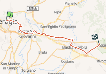
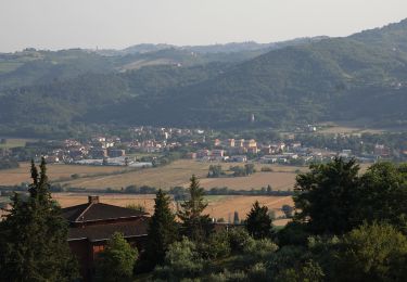
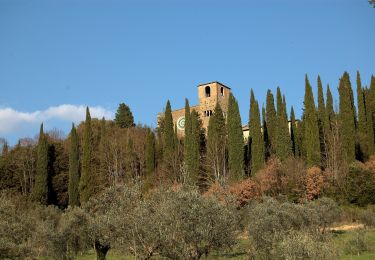
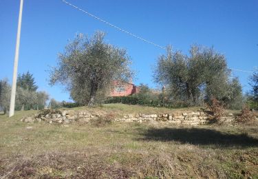
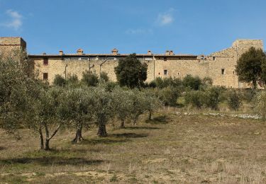
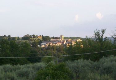
Tocht Te voet van 25 km beschikbaar op Umbrië, Perugia, Perugia. Deze tocht wordt voorgesteld door SityTrail - itinéraires balisés pédestres.
Beschrijving
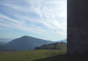
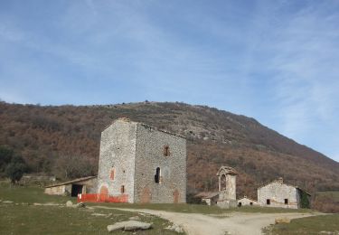
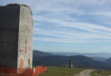
È un unico cammino per raggiungere Assisi sui passi di San Francesco, partendo da Nord (La Verna) o da Sud (Roma)
. È un itinerario che collega tra loro alcuni luoghi che testimoniano della vita e della predicazione del Santo di Assisi; un cammino di pellegrinaggio, che intende riproporre l'esperienza francescana nelle terre che il Poverello ha calcato nelle sue itineranze.
Website: https://www.viadifrancesco.it/
Plaatsbepaling
Opmerkingen
Wandeltochten in de omgeving
![Tocht Te voet Umbertide - Galera - Monte Acuto - Photo](https://media.geolcdn.com/t/375/260/2207cd07-cee1-4c8d-ad34-c7b19758ea24.jpeg&format=jpg&maxdim=2)
![Te voet Te voet](https://static1.geolcdn.com/sitytour/trail-icons/100.png)
Te voet
![](/images/other/stat-length.png)
![](https://static1.geolcdn.com/siteimages/upload/files/16400158638029165_repeat_loop_refresh_sync_direction_icon.png)
![Tocht Te voet Umbertide - Traversata di Monte Acuto - Photo](https://media.geolcdn.com/t/375/260/3b9eb271-5a99-45ce-bdf8-371425508782.jpeg&format=jpg&maxdim=2)
![Te voet Te voet](https://static1.geolcdn.com/sitytour/trail-icons/100.png)
Te voet
![](/images/other/stat-length.png)
![](https://static1.geolcdn.com/siteimages/upload/files/16400158638029165_repeat_loop_refresh_sync_direction_icon.png)
![Tocht Te voet Umbertide - Anello di Monte Acuto - Photo](https://media.geolcdn.com/t/375/260/238e2a0f-cf19-40e0-b2ca-474f05d76b5a.jpeg&format=jpg&maxdim=2)
![Te voet Te voet](https://static1.geolcdn.com/sitytour/trail-icons/100.png)
Te voet
![](/images/other/stat-length.png)
![](https://static1.geolcdn.com/siteimages/upload/files/16400158638029165_repeat_loop_refresh_sync_direction_icon.png)
![Tocht Te voet Perugia - Ponte Pattoli - Photo](https://media.geolcdn.com/t/375/260/958c4bde-65f8-4d7e-b2a0-6673dfc3f987.jpeg&format=jpg&maxdim=2)
![Te voet Te voet](https://static1.geolcdn.com/sitytour/trail-icons/100.png)
Te voet
![](/images/other/stat-length.png)
![](https://static1.geolcdn.com/siteimages/upload/files/16400158638029165_repeat_loop_refresh_sync_direction_icon.png)
![Tocht Te voet Perugia - La Bruna-Montelabate-Casacce - Photo](https://media.geolcdn.com/t/375/260/9b24e17c-da3a-42a3-a7e8-54262460d1df.jpeg&format=jpg&maxdim=2)
![Te voet Te voet](https://static1.geolcdn.com/sitytour/trail-icons/100.png)
Te voet
![](/images/other/stat-length.png)
![](https://static1.geolcdn.com/siteimages/upload/files/16400158638029165_repeat_loop_refresh_sync_direction_icon.png)
![Tocht Te voet Passignano sul Trasimeno - Castel Rigone - Torre Fiume - Photo](https://media.geolcdn.com/t/375/260/9409bc5f-69fc-47cd-9ab7-8dfa80803df1.jpeg&format=jpg&maxdim=2)
![Te voet Te voet](https://static1.geolcdn.com/sitytour/trail-icons/100.png)
Te voet
![](/images/other/stat-length.png)
![](https://static1.geolcdn.com/siteimages/upload/files/16400158638029165_repeat_loop_refresh_sync_direction_icon.png)
![Tocht Te voet Marsciano - Compignano - Monte Lagello - Mercatello - Photo](https://media.geolcdn.com/t/375/260/eb9fa763-b59d-4cd9-99c8-ca12c3eb3449.jpeg&format=jpg&maxdim=2)
![Te voet Te voet](https://static1.geolcdn.com/sitytour/trail-icons/100.png)
Te voet
![](/images/other/stat-length.png)
![](https://static1.geolcdn.com/siteimages/upload/files/16400158638029165_repeat_loop_refresh_sync_direction_icon.png)
![Tocht Te voet Perugia - Montelabate - Ventia - Photo](https://media.geolcdn.com/t/375/260/9b24e17c-da3a-42a3-a7e8-54262460d1df.jpeg&format=jpg&maxdim=2)
![Te voet Te voet](https://static1.geolcdn.com/sitytour/trail-icons/100.png)
Te voet
![](/images/other/stat-length.png)
![](https://static1.geolcdn.com/siteimages/upload/files/16400158638029165_repeat_loop_refresh_sync_direction_icon.png)
![Tocht Te voet Bettona - Bettona - Collemancio - Photo](https://media.geolcdn.com/t/375/260/5205612b-acbc-4603-958a-ef5855e0bbfb.jpeg&format=jpg&maxdim=2)
![Te voet Te voet](https://static1.geolcdn.com/sitytour/trail-icons/100.png)
Te voet
![](/images/other/stat-length.png)
![](https://static1.geolcdn.com/siteimages/upload/files/16400158638029165_repeat_loop_refresh_sync_direction_icon.png)