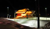
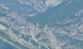
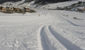
![](/images/other/stat-length.png)
![Tocht Te voet Valdidentro - (SI D33N) Rifugio Val Viola - Livigno - Photo](https://media.geolcdn.com/t/1900/400/2c58f667-13da-47b3-a0c2-8d31a18a74c3.jpeg&format=pjpeg&maxdim=2)
(SI D33N) Rifugio Val Viola - Livigno
SityTrail - itinéraires balisés pédestres
Tous les sentiers balisés d’Europe GUIDE+
![Lengte](/images/other/stat-length.png)
Lengte
23 km
![Max. hoogte](https://static1.geolcdn.com/siteimages/upload/files/1508320355ic_sort_altitude_max_24dp.png)
Max. hoogte
2794 m
![Positief hoogteverschil](https://static1.geolcdn.com/siteimages/upload/files/1508320355ic_sort_den_pos_24dp.png)
Positief hoogteverschil
871 m
![Km-Effort](/images/other/stat-length.png)
Km-Effort
36 km
![Min. hoogte](https://static1.geolcdn.com/siteimages/upload/files/1508320355ic_sort_altitude_min_24dp.png)
Min. hoogte
1865 m
![Negatief hoogteverschil](https://static1.geolcdn.com/siteimages/upload/files/1508320355ic_sort_den_neg_24dp.png)
Negatief hoogteverschil
1312 m
![Boucle](https://static1.geolcdn.com/siteimages/upload/files/16400158638029165_repeat_loop_refresh_sync_direction_icon.png)
Boucle
Neen
Markering
Datum van aanmaak :
2022-02-15 13:26:01.284
Laatste wijziging :
2022-03-01 12:05:26.075
![Te voet](https://static1.geolcdn.com/sitytour/trail-icons/100.png)
8h13
Moeilijkheid : Moeilijk
![Scan deze QR-code om de tocht te openen in de SityTrail-applicatie](https://capi.geolives.com/qq0zvz2zws4bq2lad0pu/sitytour/trails/3119213/qr.png?size=200)
Gratisgps-wandelapplicatie
Over ons
Tocht Te voet van 23 km beschikbaar op Lombardije, Sondrio, Valdidentro. Deze tocht wordt voorgesteld door SityTrail - itinéraires balisés pédestres.
Beschrijving
Sentiero Italia CAI 2019
Plaatsbepaling
Land:
Italy
Regio :
Lombardije
Departement/Provincie :
Sondrio
Gemeente :
Valdidentro
Locatie:
Unknown
Vertrek:(Dec)
Vertrek:(UTM)
589275 ; 5141298 (32T) N.
Opmerkingen
Wandeltochten in de omgeving
![Tocht Te voet Vezza d'Oglio - Slaàse - Photo](https://media.geolcdn.com/t/375/260/522d254e-628c-47ee-a777-01e74ed314de.jpeg&format=jpg&maxdim=2)
![Te voet Te voet](https://static1.geolcdn.com/sitytour/trail-icons/100.png)
Slaàse
Te voet
Gemakkelijk
Vezza d'Oglio,
Lombardije,
Brescia,
Italy
![](/images/other/stat-length.png)
5,2 km | 8,1 km-effort
1h 50min
![](https://static1.geolcdn.com/siteimages/upload/files/16400158638029165_repeat_loop_refresh_sync_direction_icon.png)
Neen
![Tocht Te voet Monno - Sentiero Brigata Fiamme Verdi Antonio Schivardi - Luigi Tosetti - Photo](https://media.geolcdn.com/t/375/260/89589908-54de-4ed7-9c59-b2b43d399f07.jpeg&format=jpg&maxdim=2)
![Te voet Te voet](https://static1.geolcdn.com/sitytour/trail-icons/100.png)
Sentiero Brigata Fiamme Verdi Antonio Schivardi - Luigi Tosetti
Te voet
Gemakkelijk
Monno,
Lombardije,
Brescia,
Italy
![](/images/other/stat-length.png)
6,1 km | 9,9 km-effort
2h 14min
![](https://static1.geolcdn.com/siteimages/upload/files/16400158638029165_repeat_loop_refresh_sync_direction_icon.png)
Ja
![Tocht Te voet Monno - Moiàc - Photo](https://media.geolcdn.com/t/375/260/c4620166-1825-43f8-b0d5-c34992d0bcee.jpeg&format=jpg&maxdim=2)
![Te voet Te voet](https://static1.geolcdn.com/sitytour/trail-icons/100.png)
![Tocht Te voet Valdidentro - (SI D35N) Rifugio Monte alle Scale (Cancano) - Rifugio Campo - Photo](https://media.geolcdn.com/t/375/260/56e4aa90-e065-4f18-833b-8b99173ff4f4.jpeg&format=jpg&maxdim=2)
![Te voet Te voet](https://static1.geolcdn.com/sitytour/trail-icons/100.png)
(SI D35N) Rifugio Monte alle Scale (Cancano) - Rifugio Campo
Te voet
Moeilijk
Valdidentro,
Lombardije,
Sondrio,
Italy
![](/images/other/stat-length.png)
25 km | 39 km-effort
8h 56min
![](https://static1.geolcdn.com/siteimages/upload/files/16400158638029165_repeat_loop_refresh_sync_direction_icon.png)
Neen
![Tocht Te voet Grosotto - (SI D31N) Alpe Salina - Malghera - Photo](https://media.geolcdn.com/t/375/260/dbf1d713-bfa0-43ef-bba8-d99618e6e373.jpeg&format=jpg&maxdim=2)
![Te voet Te voet](https://static1.geolcdn.com/sitytour/trail-icons/100.png)
(SI D31N) Alpe Salina - Malghera
Te voet
Gemakkelijk
Grosotto,
Lombardije,
Sondrio,
Italy
![](/images/other/stat-length.png)
10,3 km | 14,7 km-effort
3h 20min
![](https://static1.geolcdn.com/siteimages/upload/files/16400158638029165_repeat_loop_refresh_sync_direction_icon.png)
Neen
![Tocht Te voet Grosio - (SI D32N) Malghera - Rifugio Val Viola - Photo](https://media.geolcdn.com/t/375/260/3982027b-3f84-42b4-bb6e-35439dba1552.jpeg&format=jpg&maxdim=2)
![Te voet Te voet](https://static1.geolcdn.com/sitytour/trail-icons/100.png)
(SI D32N) Malghera - Rifugio Val Viola
Te voet
Zeer moeilijk
Grosio,
Lombardije,
Sondrio,
Italy
![](/images/other/stat-length.png)
22 km | 42 km-effort
9h 33min
![](https://static1.geolcdn.com/siteimages/upload/files/16400158638029165_repeat_loop_refresh_sync_direction_icon.png)
Neen
![Tocht Te voet Chiuro - (SI D28N) Rifugio Cederna Maffina - Prato Valentino - Photo](https://media.geolcdn.com/t/375/260/ca558386-872d-4ac3-ad8a-5d64fd6a2615.jpeg&format=jpg&maxdim=2)
![Te voet Te voet](https://static1.geolcdn.com/sitytour/trail-icons/100.png)
(SI D28N) Rifugio Cederna Maffina - Prato Valentino
Te voet
Moeilijk
Chiuro,
Lombardije,
Sondrio,
Italy
![](/images/other/stat-length.png)
19,4 km | 31 km-effort
7h 4min
![](https://static1.geolcdn.com/siteimages/upload/files/16400158638029165_repeat_loop_refresh_sync_direction_icon.png)
Neen
![Tocht Te voet Lanzada - (SI D27N) Rifugio Cristina all'Alpe Prabello - Rifugio Cederna Maffina - Photo](https://media.geolcdn.com/t/375/260/183b458f-a077-409f-be44-59e6e5c9c885.jpeg&format=jpg&maxdim=2)
![Te voet Te voet](https://static1.geolcdn.com/sitytour/trail-icons/100.png)
(SI D27N) Rifugio Cristina all'Alpe Prabello - Rifugio Cederna Maffina
Te voet
Gemakkelijk
Lanzada,
Lombardije,
Sondrio,
Italy
![](/images/other/stat-length.png)
5,6 km | 13,7 km-effort
3h 6min
![](https://static1.geolcdn.com/siteimages/upload/files/16400158638029165_repeat_loop_refresh_sync_direction_icon.png)
Neen
![Tocht Te voet Grosio - Sentiero del Sole - Photo](https://media.geolcdn.com/t/375/260/4e0546aa-c7d3-44e5-9530-8a73a76fa2fb.jpeg&format=jpg&maxdim=2)
![Te voet Te voet](https://static1.geolcdn.com/sitytour/trail-icons/100.png)
Sentiero del Sole
Te voet
Zeer moeilijk
Grosio,
Lombardije,
Sondrio,
Italy
![](/images/other/stat-length.png)
66 km | 116 km-effort
26h 23min
![](https://static1.geolcdn.com/siteimages/upload/files/16400158638029165_repeat_loop_refresh_sync_direction_icon.png)
Neen