![](/images/other/stat-length.png)
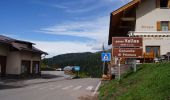
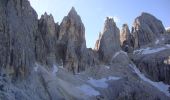
![Tocht Te voet Primiero San Martino di Castrozza - IT-751 - Photo](https://media.geolcdn.com/t/1900/400/84125359-dad4-4994-a82a-7c7aa611646c.jpeg&format=pjpeg&maxdim=2)
IT-751
SityTrail - itinéraires balisés pédestres
Tous les sentiers balisés d’Europe GUIDE+
![Lengte](/images/other/stat-length.png)
Lengte
6,4 km
![Max. hoogte](https://static1.geolcdn.com/siteimages/upload/files/1508320355ic_sort_altitude_max_24dp.png)
Max. hoogte
2586 m
![Positief hoogteverschil](https://static1.geolcdn.com/siteimages/upload/files/1508320355ic_sort_den_pos_24dp.png)
Positief hoogteverschil
740 m
![Km-Effort](/images/other/stat-length.png)
Km-Effort
14,5 km
![Min. hoogte](https://static1.geolcdn.com/siteimages/upload/files/1508320355ic_sort_altitude_min_24dp.png)
Min. hoogte
2036 m
![Negatief hoogteverschil](https://static1.geolcdn.com/siteimages/upload/files/1508320355ic_sort_den_neg_24dp.png)
Negatief hoogteverschil
215 m
![Boucle](https://static1.geolcdn.com/siteimages/upload/files/16400158638029165_repeat_loop_refresh_sync_direction_icon.png)
Boucle
Neen
Markering
Datum van aanmaak :
2022-02-15 13:20:55.531
Laatste wijziging :
2022-03-01 11:40:16.192
![Te voet](https://static1.geolcdn.com/sitytour/trail-icons/100.png)
3h17
Moeilijkheid : Gemakkelijk
![Scan deze QR-code om de tocht te openen in de SityTrail-applicatie](https://capi.geolives.com/qq0zvz2zws4bq2lad0pu/sitytour/trails/3119066/qr.png?size=200)
Gratisgps-wandelapplicatie
Over ons
Tocht Te voet van 6,4 km beschikbaar op Trento-Zuid-Tirol, Provincia di Trento, Primiero San Martino di Castrozza. Deze tocht wordt voorgesteld door SityTrail - itinéraires balisés pédestres.
Beschrijving
Trail created by CAI Agordo.
Plaatsbepaling
Land:
Italy
Regio :
Trento-Zuid-Tirol
Departement/Provincie :
Provincia di Trento
Gemeente :
Primiero San Martino di Castrozza
Locatie:
Unknown
Vertrek:(Dec)
Vertrek:(UTM)
715516 ; 5135468 (32T) N.
Opmerkingen
Wandeltochten in de omgeving
![Tocht Te voet Falcade - IT-722 - Photo](https://media.geolcdn.com/t/375/260/954068cb-5cef-4723-9389-c4a90a29d86f.jpeg&format=jpg&maxdim=2)
![Te voet Te voet](https://static1.geolcdn.com/sitytour/trail-icons/100.png)
![Tocht Te voet Falcade - IT-774 - Photo](https://media.geolcdn.com/t/375/260/e907c0d6-b878-4d2b-99a7-e06af5d3fe29.jpeg&format=jpg&maxdim=2)
![Te voet Te voet](https://static1.geolcdn.com/sitytour/trail-icons/100.png)
![Tocht Te voet Moena - IT-E604 - Photo](https://media.geolcdn.com/t/375/260/2b10f822-f2d2-4825-98d8-8c0108ba658a.jpeg&format=jpg&maxdim=2)
![Te voet Te voet](https://static1.geolcdn.com/sitytour/trail-icons/100.png)
IT-E604
Te voet
Gemakkelijk
Moena,
Trento-Zuid-Tirol,
Provincia di Trento,
Italy
![](/images/other/stat-length.png)
6,5 km | 14,2 km-effort
3h 13min
![](https://static1.geolcdn.com/siteimages/upload/files/16400158638029165_repeat_loop_refresh_sync_direction_icon.png)
Neen
![Tocht Te voet Moena - Sentiero de le Cirele - Photo](https://media.geolcdn.com/t/375/260/25c2bb64-8119-4244-8f16-f986ab0dbfb2.jpeg&format=jpg&maxdim=2)
![Te voet Te voet](https://static1.geolcdn.com/sitytour/trail-icons/100.png)
Sentiero de le Cirele
Te voet
Medium
Moena,
Trento-Zuid-Tirol,
Provincia di Trento,
Italy
![](/images/other/stat-length.png)
11,3 km | 22 km-effort
4h 55min
![](https://static1.geolcdn.com/siteimages/upload/files/16400158638029165_repeat_loop_refresh_sync_direction_icon.png)
Neen
![Tocht Te voet Primiero San Martino di Castrozza - (SI C15S) Passo Rolle - Costazza - Campigolo di Vezzana - Forcella Venegia - Passo Valles - Forcella Pradazzo - Corda degli Zingari - Passo San Pellegrino - Rifugio Fuciade - Photo](https://media.geolcdn.com/t/375/260/b85f7f30-48e1-4a74-8883-4749ac500480.jpeg&format=jpg&maxdim=2)
![Te voet Te voet](https://static1.geolcdn.com/sitytour/trail-icons/100.png)
(SI C15S) Passo Rolle - Costazza - Campigolo di Vezzana - Forcella Venegia - ...
Te voet
Moeilijk
Primiero San Martino di Castrozza,
Trento-Zuid-Tirol,
Provincia di Trento,
Italy
![](/images/other/stat-length.png)
20 km | 32 km-effort
7h 12min
![](https://static1.geolcdn.com/siteimages/upload/files/16400158638029165_repeat_loop_refresh_sync_direction_icon.png)
Neen
![Tocht Te voet Canale d'Agordo - IT-755 - Photo](https://media.geolcdn.com/t/375/260/9c074aee-1c76-426b-9343-1ea858976987.jpeg&format=jpg&maxdim=2)
![Te voet Te voet](https://static1.geolcdn.com/sitytour/trail-icons/100.png)
IT-755
Te voet
Gemakkelijk
Canale d'Agordo,
Veneto,
Belluno,
Italy
![](/images/other/stat-length.png)
5 km | 10 km-effort
2h 16min
![](https://static1.geolcdn.com/siteimages/upload/files/16400158638029165_repeat_loop_refresh_sync_direction_icon.png)
Neen
![Tocht Te voet Primiero San Martino di Castrozza - Sentiero del Mulaz](https://media.geolcdn.com/t/375/260/eca4567e-539b-455f-8f7b-147eae70f6e1.jpeg&format=jpg&maxdim=2)
![Te voet Te voet](https://static1.geolcdn.com/sitytour/trail-icons/100.png)
Sentiero del Mulaz "Quinto Scalet" 710
Te voet
Gemakkelijk
Primiero San Martino di Castrozza,
Trento-Zuid-Tirol,
Provincia di Trento,
Italy
![](/images/other/stat-length.png)
3,5 km | 10,9 km-effort
2h 28min
![](https://static1.geolcdn.com/siteimages/upload/files/16400158638029165_repeat_loop_refresh_sync_direction_icon.png)
Neen
![Tocht Te voet Primiero San Martino di Castrozza - IT-E710A - Photo](https://media.geolcdn.com/t/375/260/95291aeb-500b-44d4-915d-1164145e8cd5.jpeg&format=jpg&maxdim=2)
![Te voet Te voet](https://static1.geolcdn.com/sitytour/trail-icons/100.png)
IT-E710A
Te voet
Gemakkelijk
Primiero San Martino di Castrozza,
Trento-Zuid-Tirol,
Provincia di Trento,
Italy
![](/images/other/stat-length.png)
3,4 km | 5,1 km-effort
1h 9min
![](https://static1.geolcdn.com/siteimages/upload/files/16400158638029165_repeat_loop_refresh_sync_direction_icon.png)
Neen
![Tocht Te voet Primiero San Martino di Castrozza - IT-E629 - Photo](https://media.geolcdn.com/t/375/260/ed22bf8c-fc30-4e8b-852f-bf05a4ba9be6.jpeg&format=jpg&maxdim=2)
![Te voet Te voet](https://static1.geolcdn.com/sitytour/trail-icons/100.png)
IT-E629
Te voet
Gemakkelijk
Primiero San Martino di Castrozza,
Trento-Zuid-Tirol,
Provincia di Trento,
Italy
![](/images/other/stat-length.png)
4,3 km | 10,7 km-effort
2h 25min
![](https://static1.geolcdn.com/siteimages/upload/files/16400158638029165_repeat_loop_refresh_sync_direction_icon.png)
Neen