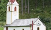

IT-14
SityTrail - itinéraires balisés pédestres
Tous les sentiers balisés d’Europe GUIDE+

Lengte
6 km

Max. hoogte
2267 m

Positief hoogteverschil
891 m

Km-Effort
15 km

Min. hoogte
1365 m

Negatief hoogteverschil
2 m
Boucle
Neen
Markering
Datum van aanmaak :
2022-02-15 09:46:23.371
Laatste wijziging :
2022-03-01 07:14:25.479
3h23
Moeilijkheid : Gemakkelijk

Gratisgps-wandelapplicatie
Over ons
Tocht Te voet van 6 km beschikbaar op Trento-Zuid-Tirol, Bolzano - Bozen, St. Leonhard in Passeier - San Leonardo in Passiria. Deze tocht wordt voorgesteld door SityTrail - itinéraires balisés pédestres.
Beschrijving
Trail created by Alpenverein Südtirol.
Plaatsbepaling
Land:
Italy
Regio :
Trento-Zuid-Tirol
Departement/Provincie :
Bolzano - Bozen
Gemeente :
St. Leonhard in Passeier - San Leonardo in Passiria
Locatie:
Unknown
Vertrek:(Dec)
Vertrek:(UTM)
676732 ; 5187902 (32T) N.
Opmerkingen
Wandeltochten in de omgeving
15


Te voet
Gemakkelijk
St. Leonhard in Passeier - San Leonardo in Passiria,
Trento-Zuid-Tirol,
Bolzano - Bozen,
Italy

3,4 km | 9,8 km-effort
2h 13min
Neen
AVS 6 - Oberberg - Sieben Schupfen - Pens


Te voet
Gemakkelijk
Sarntal - Sarentino,
Trento-Zuid-Tirol,
Bolzano - Bozen,
Italy

7,6 km | 10,4 km-effort
2h 21min
Neen
IT-12


Te voet
Gemakkelijk
Ratschings - Racines,
Trento-Zuid-Tirol,
Bolzano - Bozen,
Italy

5,2 km | 10,4 km-effort
2h 22min
Neen
IT-17A


Te voet
Gemakkelijk
Ratschings - Racines,
Trento-Zuid-Tirol,
Bolzano - Bozen,
Italy

4,2 km | 8 km-effort
1h 48min
Neen
IT-12A


Te voet
Gemakkelijk
Ratschings - Racines,
Trento-Zuid-Tirol,
Bolzano - Bozen,
Italy

3,4 km | 4,8 km-effort
1h 5min
Neen

AVS 9 - Sarner Weißhorn - Oberberg Alm


Te voet
Gemakkelijk
Sarntal - Sarentino,
Trento-Zuid-Tirol,
Bolzano - Bozen,
Italy

3,9 km | 12,6 km-effort
2h 51min
Neen

IT-12


Te voet
Gemakkelijk
St. Leonhard in Passeier - San Leonardo in Passiria,
Trento-Zuid-Tirol,
Bolzano - Bozen,
Italy

3,5 km | 10,6 km-effort
2h 24min
Neen


 SityTrail


