![](/images/other/stat-length.png)
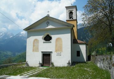
![Tocht Te voet Schilpario - (SI D24S) Passo del Vivione - Rifugio Baita Iseo - Photo](https://media.geolcdn.com/t/1900/400/ec7b4503-b6b8-448d-9c3f-20b241f1b146.jpeg&format=pjpeg&maxdim=2)
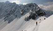
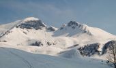
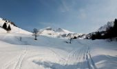
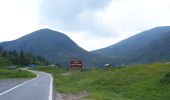
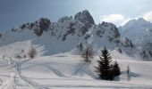
(SI D24S) Passo del Vivione - Rifugio Baita Iseo
SityTrail - itinéraires balisés pédestres
Tous les sentiers balisés d’Europe GUIDE+
![Lengte](/images/other/stat-length.png)
Lengte
10,1 km
![Max. hoogte](https://static1.geolcdn.com/siteimages/upload/files/1508320355ic_sort_altitude_max_24dp.png)
Max. hoogte
2002 m
![Positief hoogteverschil](https://static1.geolcdn.com/siteimages/upload/files/1508320355ic_sort_den_pos_24dp.png)
Positief hoogteverschil
325 m
![Km-Effort](/images/other/stat-length.png)
Km-Effort
16 km
![Min. hoogte](https://static1.geolcdn.com/siteimages/upload/files/1508320355ic_sort_altitude_min_24dp.png)
Min. hoogte
1366 m
![Negatief hoogteverschil](https://static1.geolcdn.com/siteimages/upload/files/1508320355ic_sort_den_neg_24dp.png)
Negatief hoogteverschil
784 m
![Boucle](https://static1.geolcdn.com/siteimages/upload/files/16400158638029165_repeat_loop_refresh_sync_direction_icon.png)
Boucle
Neen
Markering
Datum van aanmaak :
2022-02-15 06:39:34.535
Laatste wijziging :
2022-03-01 05:43:03.468
![Te voet](https://static1.geolcdn.com/sitytour/trail-icons/100.png)
3h37
Moeilijkheid : Gemakkelijk
![Scan deze QR-code om de tocht te openen in de SityTrail-applicatie](https://capi.geolives.com/qq0zvz2zws4bq2lad0pu/sitytour/trails/3116774/qr.png?size=200)
Gratisgps-wandelapplicatie
Over ons
Tocht Te voet van 10,1 km beschikbaar op Lombardije, Bergamo, Schilpario. Deze tocht wordt voorgesteld door SityTrail - itinéraires balisés pédestres.
Beschrijving
Sentiero Italia CAI 2019
Plaatsbepaling
Land:
Italy
Regio :
Lombardije
Departement/Provincie :
Bergamo
Gemeente :
Schilpario
Locatie:
Unknown
Vertrek:(Dec)
Vertrek:(UTM)
592782 ; 5098766 (32T) N.
Opmerkingen
Wandeltochten in de omgeving
![Tocht Te voet Schilpario - IT-421 - Photo](https://media.geolcdn.com/t/375/260/690daa3c-c162-4275-9695-ed7c7bef333f.jpeg&format=jpg&maxdim=2)
![Te voet Te voet](https://static1.geolcdn.com/sitytour/trail-icons/100.png)
IT-421
Te voet
Gemakkelijk
Schilpario,
Lombardije,
Bergamo,
Italy
![](/images/other/stat-length.png)
3,5 km | 11,8 km-effort
2h 41min
![](https://static1.geolcdn.com/siteimages/upload/files/16400158638029165_repeat_loop_refresh_sync_direction_icon.png)
Neen
![Tocht Te voet Lozio - Lozio (Sommaprada) - Rifugio Gualtiero Laeng - Photo](https://media.geolcdn.com/t/375/260/999b953c-144e-4131-9cff-cf1912d6b4df.jpeg&format=jpg&maxdim=2)
![Te voet Te voet](https://static1.geolcdn.com/sitytour/trail-icons/100.png)
Lozio (Sommaprada) - Rifugio Gualtiero Laeng
Te voet
Gemakkelijk
Lozio,
Lombardije,
Brescia,
Italy
![](/images/other/stat-length.png)
9 km | 18,1 km-effort
4h 7min
![](https://static1.geolcdn.com/siteimages/upload/files/16400158638029165_repeat_loop_refresh_sync_direction_icon.png)
Neen
![Tocht Te voet Paisco Loveno - Paisco Loveno (Loveno) - Bivacco Davide Salvadori - Photo](https://media.geolcdn.com/t/375/260/e1d2879a-6480-45aa-b0ea-b3b8716b130b.jpeg&format=jpg&maxdim=2)
![Te voet Te voet](https://static1.geolcdn.com/sitytour/trail-icons/100.png)
Paisco Loveno (Loveno) - Bivacco Davide Salvadori
Te voet
Medium
Paisco Loveno,
Lombardije,
Brescia,
Italy
![](/images/other/stat-length.png)
9,9 km | 23 km-effort
5h 17min
![](https://static1.geolcdn.com/siteimages/upload/files/16400158638029165_repeat_loop_refresh_sync_direction_icon.png)
Neen
![Tocht Te voet Lozio - Lozio - Passo di Baione - Photo](https://media.geolcdn.com/t/375/260/1b3e3337-8d40-4cb3-8492-c9957f0e2cf6.jpeg&format=jpg&maxdim=2)
![Te voet Te voet](https://static1.geolcdn.com/sitytour/trail-icons/100.png)
Lozio - Passo di Baione
Te voet
Gemakkelijk
Lozio,
Lombardije,
Brescia,
Italy
![](/images/other/stat-length.png)
4,8 km | 16,1 km-effort
3h 39min
![](https://static1.geolcdn.com/siteimages/upload/files/16400158638029165_repeat_loop_refresh_sync_direction_icon.png)
Neen
![Tocht Te voet Schilpario - Sentiero Lungo - Photo](https://media.geolcdn.com/t/375/260/68254080-e1ad-4716-b061-67321c85101b.jpeg&format=jpg&maxdim=2)
![Te voet Te voet](https://static1.geolcdn.com/sitytour/trail-icons/100.png)
Sentiero Lungo
Te voet
Moeilijk
Schilpario,
Lombardije,
Bergamo,
Italy
![](/images/other/stat-length.png)
20 km | 34 km-effort
7h 44min
![](https://static1.geolcdn.com/siteimages/upload/files/16400158638029165_repeat_loop_refresh_sync_direction_icon.png)
Neen
![Tocht Te voet Schilpario - IT-428 - Photo](https://media.geolcdn.com/t/375/260/d1f4a2c8-550a-4a58-9b31-2666569571b5.jpeg&format=jpg&maxdim=2)
![Te voet Te voet](https://static1.geolcdn.com/sitytour/trail-icons/100.png)
IT-428
Te voet
Gemakkelijk
Schilpario,
Lombardije,
Bergamo,
Italy
![](/images/other/stat-length.png)
9,3 km | 14,2 km-effort
3h 13min
![](https://static1.geolcdn.com/siteimages/upload/files/16400158638029165_repeat_loop_refresh_sync_direction_icon.png)
Neen
![Tocht Te voet Schilpario - IT-415 - Photo](https://media.geolcdn.com/t/375/260/02e15b36-5728-4d80-bc15-62bc0912f619.jpeg&format=jpg&maxdim=2)
![Te voet Te voet](https://static1.geolcdn.com/sitytour/trail-icons/100.png)
IT-415
Te voet
Gemakkelijk
Schilpario,
Lombardije,
Bergamo,
Italy
![](/images/other/stat-length.png)
6 km | 15,4 km-effort
3h 30min
![](https://static1.geolcdn.com/siteimages/upload/files/16400158638029165_repeat_loop_refresh_sync_direction_icon.png)
Neen
![Tocht Te voet Schilpario - IT-414 - Photo](https://media.geolcdn.com/t/375/260/2455c482-7a8a-45dc-b856-cdaa21054dbf.jpeg&format=jpg&maxdim=2)
![Te voet Te voet](https://static1.geolcdn.com/sitytour/trail-icons/100.png)
IT-414
Te voet
Gemakkelijk
Schilpario,
Lombardije,
Bergamo,
Italy
![](/images/other/stat-length.png)
8,7 km | 12,9 km-effort
2h 55min
![](https://static1.geolcdn.com/siteimages/upload/files/16400158638029165_repeat_loop_refresh_sync_direction_icon.png)
Neen
![Tocht Te voet Schilpario - Sentiero delle Torbiere - Photo](https://media.geolcdn.com/t/375/260/68254080-e1ad-4716-b061-67321c85101b.jpeg&format=jpg&maxdim=2)
![Te voet Te voet](https://static1.geolcdn.com/sitytour/trail-icons/100.png)
Sentiero delle Torbiere
Te voet
Gemakkelijk
Schilpario,
Lombardije,
Bergamo,
Italy
![](/images/other/stat-length.png)
3,1 km | 8,7 km-effort
1h 58min
![](https://static1.geolcdn.com/siteimages/upload/files/16400158638029165_repeat_loop_refresh_sync_direction_icon.png)
Neen