![](/images/other/stat-length.png)
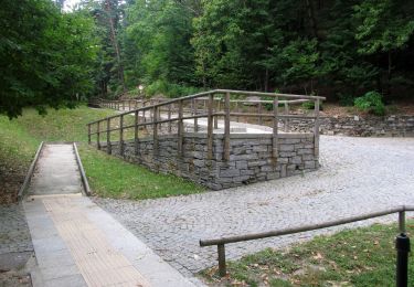
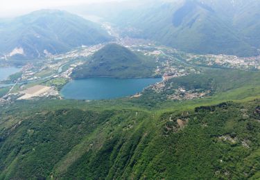
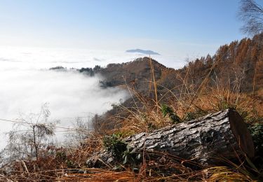
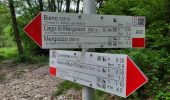
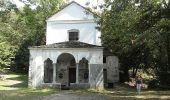
![Tocht Te voet Verbania - P01 -Madonna di campagna - Monterosso - Cavandone - Photo](https://media.geolcdn.com/t/1900/400/e30754f2-2068-461d-84c6-18f2c53e655f.jpeg&format=pjpeg&maxdim=2)
P01 -Madonna di campagna - Monterosso - Cavandone
SityTrail - itinéraires balisés pédestres
Tous les sentiers balisés d’Europe GUIDE+
![Lengte](/images/other/stat-length.png)
![Max. hoogte](https://static1.geolcdn.com/siteimages/upload/files/1508320355ic_sort_altitude_max_24dp.png)
![Positief hoogteverschil](https://static1.geolcdn.com/siteimages/upload/files/1508320355ic_sort_den_pos_24dp.png)
![Km-Effort](/images/other/stat-length.png)
![Min. hoogte](https://static1.geolcdn.com/siteimages/upload/files/1508320355ic_sort_altitude_min_24dp.png)
![Negatief hoogteverschil](https://static1.geolcdn.com/siteimages/upload/files/1508320355ic_sort_den_neg_24dp.png)
![Boucle](https://static1.geolcdn.com/siteimages/upload/files/16400158638029165_repeat_loop_refresh_sync_direction_icon.png)
![Te voet](https://static1.geolcdn.com/sitytour/trail-icons/100.png)
2h28
Moeilijkheid : Gemakkelijk
![Scan deze QR-code om de tocht te openen in de SityTrail-applicatie](https://capi.geolives.com/qq0zvz2zws4bq2lad0pu/sitytour/trails/3116492/qr.png?size=200)
Gratisgps-wandelapplicatie
Over ons
Tocht Te voet van 5,8 km beschikbaar op Piëmont, Verbano-Cusio-Ossola, Verbania. Deze tocht wordt voorgesteld door SityTrail - itinéraires balisés pédestres.
Beschrijving
Trail created by CAI Pallanza.
Relation with photos (click on → Web site) mantained by Danilo (CAI Pallanza)
Symbol: P01 on white ref flag
Website: http://www.cai-pallanza.it/sentieristica
Plaatsbepaling
Opmerkingen
Wandeltochten in de omgeving
![Tocht Te voet Cambiasca - R03 Cambiasca - Pian Cavallone - Pizzo Marona - Monte Zeda - Photo](https://media.geolcdn.com/t/375/260/de5ab5de-a475-4e03-a5e9-bac3f3a94f68.jpeg&format=jpg&maxdim=2)
![Te voet Te voet](https://static1.geolcdn.com/sitytour/trail-icons/100.png)
Te voet
![](/images/other/stat-length.png)
![](https://static1.geolcdn.com/siteimages/upload/files/16400158638029165_repeat_loop_refresh_sync_direction_icon.png)
![Tocht Te voet Ghiffa - R10 Sacro Monte S.S.Trinità di Ghiffa - Pollino - Piancavallo - Colle - Passo Folungo - Photo](https://media.geolcdn.com/t/375/260/789ce0f4-8f4d-4f1f-a718-3f84dfc08510.jpeg&format=jpg&maxdim=2)
![Te voet Te voet](https://static1.geolcdn.com/sitytour/trail-icons/100.png)
Te voet
![](/images/other/stat-length.png)
![](https://static1.geolcdn.com/siteimages/upload/files/16400158638029165_repeat_loop_refresh_sync_direction_icon.png)
![Tocht Te voet Verbania - R01 Verbania Trobaso - Unchio - Motto di Unchio - Pian di Les - Cossogno - Photo](https://media.geolcdn.com/t/375/260/79b54645-a21e-4055-9ebb-fa3bfb6b786d.jpeg&format=jpg&maxdim=2)
![Te voet Te voet](https://static1.geolcdn.com/sitytour/trail-icons/100.png)
Te voet
![](/images/other/stat-length.png)
![](https://static1.geolcdn.com/siteimages/upload/files/16400158638029165_repeat_loop_refresh_sync_direction_icon.png)
![Tocht Te voet Verbania - R00 Verbania Intra P.le Flaim - Trobaso - Cambiasca - Caprezzo - Intragna - Aurano - Photo](https://media.geolcdn.com/t/375/260/506517bd-786d-45d7-85ec-7295c338ccc9.jpeg&format=jpg&maxdim=2)
![Te voet Te voet](https://static1.geolcdn.com/sitytour/trail-icons/100.png)
Te voet
![](/images/other/stat-length.png)
![](https://static1.geolcdn.com/siteimages/upload/files/16400158638029165_repeat_loop_refresh_sync_direction_icon.png)
![Tocht Te voet Verbania - R04 Verbania Intra - Zoverallo - San Martino - Bèe - Monte Cimolo - Pian Nava - Photo](https://media.geolcdn.com/t/375/260/787b139b-4234-4442-b82c-3bd88ffe11bb.jpeg&format=jpg&maxdim=2)
![Te voet Te voet](https://static1.geolcdn.com/sitytour/trail-icons/100.png)
Te voet
![](/images/other/stat-length.png)
![](https://static1.geolcdn.com/siteimages/upload/files/16400158638029165_repeat_loop_refresh_sync_direction_icon.png)
![Tocht Te voet San Bernardino Verbano - P07 - Rovegro - Alpe Buè - Photo](https://media.geolcdn.com/t/375/260/98cfb046-0656-4d22-8fa0-46c3b012fb49.jpeg&format=jpg&maxdim=2)
![Te voet Te voet](https://static1.geolcdn.com/sitytour/trail-icons/100.png)
Te voet
![](/images/other/stat-length.png)
![](https://static1.geolcdn.com/siteimages/upload/files/16400158638029165_repeat_loop_refresh_sync_direction_icon.png)
![Tocht Te voet Verbania - P00 - Madonna di Campagna - Santino - Rovegro- Cossogno- Cicogna - Pogallo - Photo](https://media.geolcdn.com/t/375/260/87cd8a6c-d58b-443f-8f3a-9cdb9e50b0bd.jpeg&format=jpg&maxdim=2)
![Te voet Te voet](https://static1.geolcdn.com/sitytour/trail-icons/100.png)
Te voet
![](/images/other/stat-length.png)
![](https://static1.geolcdn.com/siteimages/upload/files/16400158638029165_repeat_loop_refresh_sync_direction_icon.png)
![Tocht Te voet Verbania - A00 - Verbania Suna - Bieno - Mergozzo - Photo](https://media.geolcdn.com/t/375/260/dd31cdda-12a2-4840-80b2-fe79ad0fea8d.jpeg&format=jpg&maxdim=2)
![Te voet Te voet](https://static1.geolcdn.com/sitytour/trail-icons/100.png)
Te voet
![](/images/other/stat-length.png)
![](https://static1.geolcdn.com/siteimages/upload/files/16400158638029165_repeat_loop_refresh_sync_direction_icon.png)
![Tocht Te voet Cossogno - P02 - Cossogno - Pizzo Pernice - Photo](https://media.geolcdn.com/t/375/260/bd63e80d-7115-4bf5-9872-9fb56f21b042.jpeg&format=jpg&maxdim=2)
![Te voet Te voet](https://static1.geolcdn.com/sitytour/trail-icons/100.png)
Te voet
![](/images/other/stat-length.png)
![](https://static1.geolcdn.com/siteimages/upload/files/16400158638029165_repeat_loop_refresh_sync_direction_icon.png)