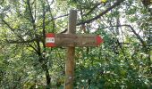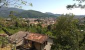

Sentiero dei marroni
SityTrail - itinéraires balisés pédestres
Tous les sentiers balisés d’Europe GUIDE+

Lengte
14,4 km

Max. hoogte
668 m

Positief hoogteverschil
972 m

Km-Effort
27 km

Min. hoogte
229 m

Negatief hoogteverschil
812 m
Boucle
Neen
Markering
Datum van aanmaak :
2022-02-15 04:55:58.85
Laatste wijziging :
2022-03-01 02:35:47.433
6h06
Moeilijkheid : Medium

Gratisgps-wandelapplicatie
Over ons
Tocht Te voet van 14,4 km beschikbaar op Lombardije, Brescia, Bovezzo. Deze tocht wordt voorgesteld door SityTrail - itinéraires balisés pédestres.
Beschrijving
Trail created by Comune di Bovezzo, Nave e Caino.
Symbol: white red flag
Plaatsbepaling
Land:
Italy
Regio :
Lombardije
Departement/Provincie :
Brescia
Gemeente :
Bovezzo
Locatie:
Unknown
Vertrek:(Dec)
Vertrek:(UTM)
597082 ; 5049837 (32T) N.
Opmerkingen
Wandeltochten in de omgeving
Via del Sacro


Te voet
Zeer moeilijk
Lumezzane,
Lombardije,
Brescia,
Italy

26 km | 47 km-effort
10h 34min
Neen
Sentiero delle creste


Te voet
Gemakkelijk
Collebeato,
Lombardije,
Brescia,
Italy

7,7 km | 13,2 km-effort
3h 0min
Neen
Concesio (Sant'Andrea) - Sant'Onofrio


Te voet
Gemakkelijk
Bovezzo,
Lombardije,
Brescia,
Italy

4,7 km | 7,2 km-effort
1h 37min
Neen
Bovezzo - Sant'Onofrio


Te voet
Gemakkelijk
Bovezzo,
Lombardije,
Brescia,
Italy

3,4 km | 10,5 km-effort
2h 23min
Neen
Cascina Margherita per la Colletera e Sentiero Gasusì


Te voet
Gemakkelijk
Brescia,
Lombardije,
Brescia,
Italy

4,5 km | 6 km-effort
1h 21min
Neen
Da Conicchio alla Valle di Mompiano


Te voet
Gemakkelijk
Brescia,
Lombardije,
Brescia,
Italy

5,5 km | 7,4 km-effort
1h 40min
Neen
Sentiero Domenico Cancarini e Antonio Giubileo


Te voet
Gemakkelijk
Villa Carcina,
Lombardije,
Brescia,
Italy

3,1 km | 9 km-effort
2h 3min
Neen
Concesio (Via Mandò) - Costa - Quarone di Sopra


Te voet
Gemakkelijk
Concesio,
Lombardije,
Brescia,
Italy

3,3 km | 8,6 km-effort
1h 57min
Neen
Concesio - Valsorda


Te voet
Gemakkelijk
Concesio,
Lombardije,
Brescia,
Italy

6,1 km | 8,9 km-effort
2h 1min
Ja


 SityTrail


