![](/images/other/stat-length.png)
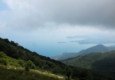
![Tocht Te voet Gargnano - Navazzo - Primo ponte Valvestino - Photo](https://media.geolcdn.com/t/1900/400/f4292022-a5f0-4bed-b0de-722d7f9dd57f.jpeg&format=pjpeg&maxdim=2)
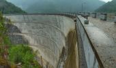
Navazzo - Primo ponte Valvestino
SityTrail - itinéraires balisés pédestres
Tous les sentiers balisés d’Europe GUIDE+
![Lengte](/images/other/stat-length.png)
Lengte
4,2 km
![Max. hoogte](https://static1.geolcdn.com/siteimages/upload/files/1508320355ic_sort_altitude_max_24dp.png)
Max. hoogte
711 m
![Positief hoogteverschil](https://static1.geolcdn.com/siteimages/upload/files/1508320355ic_sort_den_pos_24dp.png)
Positief hoogteverschil
232 m
![Km-Effort](/images/other/stat-length.png)
Km-Effort
7,2 km
![Min. hoogte](https://static1.geolcdn.com/siteimages/upload/files/1508320355ic_sort_altitude_min_24dp.png)
Min. hoogte
476 m
![Negatief hoogteverschil](https://static1.geolcdn.com/siteimages/upload/files/1508320355ic_sort_den_neg_24dp.png)
Negatief hoogteverschil
227 m
![Boucle](https://static1.geolcdn.com/siteimages/upload/files/16400158638029165_repeat_loop_refresh_sync_direction_icon.png)
Boucle
Neen
Markering
Datum van aanmaak :
2022-02-15 04:37:10.94
Laatste wijziging :
2022-03-01 01:57:34.342
![Te voet](https://static1.geolcdn.com/sitytour/trail-icons/100.png)
1h38
Moeilijkheid : Gemakkelijk
![Scan deze QR-code om de tocht te openen in de SityTrail-applicatie](https://capi.geolives.com/qq0zvz2zws4bq2lad0pu/sitytour/trails/3115198/qr.png?size=200)
Gratisgps-wandelapplicatie
Over ons
Tocht Te voet van 4,2 km beschikbaar op Lombardije, Brescia, Gargnano. Deze tocht wordt voorgesteld door SityTrail - itinéraires balisés pédestres.
Beschrijving
Trail created by Comune di Gargnano.
Plaatsbepaling
Land:
Italy
Regio :
Lombardije
Departement/Provincie :
Brescia
Gemeente :
Gargnano
Locatie:
Unknown
Vertrek:(Dec)
Vertrek:(UTM)
625865 ; 5062584 (32T) N.
Opmerkingen
Wandeltochten in de omgeving
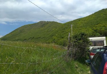
![Tocht Te voet Gargnano - Bivio Tampa (Tignale) - Bocca Premaur (Gargnano) - Photo](https://media.geolcdn.com/t/375/260/276b8609-8a87-471e-9bf9-c5458ed42553.jpeg&format=jpg&maxdim=2)
![Te voet Te voet](https://static1.geolcdn.com/sitytour/trail-icons/100.png)
Bivio Tampa (Tignale) - Bocca Premaur (Gargnano)
Te voet
Gemakkelijk
Gargnano,
Lombardije,
Brescia,
Italy
![](/images/other/stat-length.png)
4,5 km | 6,1 km-effort
1h 22min
![](https://static1.geolcdn.com/siteimages/upload/files/16400158638029165_repeat_loop_refresh_sync_direction_icon.png)
Neen
![Tocht Te voet Gargnano - Gaino - Navazzo - Photo](https://media.geolcdn.com/t/375/260/934cc377-9392-41c4-b11d-17efe1cefb0e.jpeg&format=jpg&maxdim=2)
![Te voet Te voet](https://static1.geolcdn.com/sitytour/trail-icons/100.png)
Gaino - Navazzo
Te voet
Gemakkelijk
Gargnano,
Lombardije,
Brescia,
Italy
![](/images/other/stat-length.png)
5 km | 6,8 km-effort
1h 33min
![](https://static1.geolcdn.com/siteimages/upload/files/16400158638029165_repeat_loop_refresh_sync_direction_icon.png)
Neen
![Tocht Te voet Gargnano - IT-292 - Photo](https://media.geolcdn.com/t/375/260/34264aab-8aa7-453f-92d5-6dfce8f15e60.jpeg&format=jpg&maxdim=2)
![Te voet Te voet](https://static1.geolcdn.com/sitytour/trail-icons/100.png)
IT-292
Te voet
Gemakkelijk
Gargnano,
Lombardije,
Brescia,
Italy
![](/images/other/stat-length.png)
5,3 km | 8,7 km-effort
1h 58min
![](https://static1.geolcdn.com/siteimages/upload/files/16400158638029165_repeat_loop_refresh_sync_direction_icon.png)
Neen
![Tocht Te voet Gargnano - Sasso, Monte Caminala - Photo](https://media.geolcdn.com/t/375/260/39bc16e0-38b7-472b-bddd-176dfc717935.jpeg&format=jpg&maxdim=2)
![Te voet Te voet](https://static1.geolcdn.com/sitytour/trail-icons/100.png)
Sasso, Monte Caminala
Te voet
Gemakkelijk
Gargnano,
Lombardije,
Brescia,
Italy
![](/images/other/stat-length.png)
3,5 km | 5,6 km-effort
1h 16min
![](https://static1.geolcdn.com/siteimages/upload/files/16400158638029165_repeat_loop_refresh_sync_direction_icon.png)
Neen
![Tocht Te voet Toscolano Maderno - Magnico - Sant'Urbano - Doss de le Prade - Photo](https://media.geolcdn.com/t/375/260/9faff77e-c82f-4168-89c3-033d1eda20f3.jpeg&format=jpg&maxdim=2)
![Te voet Te voet](https://static1.geolcdn.com/sitytour/trail-icons/100.png)
Magnico - Sant'Urbano - Doss de le Prade
Te voet
Gemakkelijk
Toscolano Maderno,
Lombardije,
Brescia,
Italy
![](/images/other/stat-length.png)
6,4 km | 10,1 km-effort
2h 17min
![](https://static1.geolcdn.com/siteimages/upload/files/16400158638029165_repeat_loop_refresh_sync_direction_icon.png)
Neen
![Tocht Te voet Gardone Riviera - Sanico, Ortello, Sant'Urbano, Pirello - Tocolano Maderno - Photo](https://media.geolcdn.com/t/375/260/9faff77e-c82f-4168-89c3-033d1eda20f3.jpeg&format=jpg&maxdim=2)
![Te voet Te voet](https://static1.geolcdn.com/sitytour/trail-icons/100.png)
Sanico, Ortello, Sant'Urbano, Pirello - Tocolano Maderno
Te voet
Gemakkelijk
Gardone Riviera,
Lombardije,
Brescia,
Italy
![](/images/other/stat-length.png)
6,2 km | 8,7 km-effort
1h 58min
![](https://static1.geolcdn.com/siteimages/upload/files/16400158638029165_repeat_loop_refresh_sync_direction_icon.png)
Neen
![Tocht Te voet Toscolano Maderno - Toscolano-Maderno (Sanico) - La Pozza - Photo](https://media.geolcdn.com/t/375/260/2d8f6305-7c39-419e-9b44-840231ae2cfe.jpeg&format=jpg&maxdim=2)
![Te voet Te voet](https://static1.geolcdn.com/sitytour/trail-icons/100.png)
Toscolano-Maderno (Sanico) - La Pozza
Te voet
Gemakkelijk
Toscolano Maderno,
Lombardije,
Brescia,
Italy
![](/images/other/stat-length.png)
3,8 km | 6,1 km-effort
1h 23min
![](https://static1.geolcdn.com/siteimages/upload/files/16400158638029165_repeat_loop_refresh_sync_direction_icon.png)
Neen
![Tocht Te voet Toscolano Maderno - Valle delle Camerate - Passo della Fobbiola - Photo](https://media.geolcdn.com/t/375/260/ext.jpg?maxdim=2&url=https%3A%2F%2Fstatic1.geolcdn.com%2Fsiteimages%2Fupload%2Ffiles%2F1545311037marcheuse_200dpi.jpg)
![Te voet Te voet](https://static1.geolcdn.com/sitytour/trail-icons/100.png)
Valle delle Camerate - Passo della Fobbiola
Te voet
Gemakkelijk
Toscolano Maderno,
Lombardije,
Brescia,
Italy
![](/images/other/stat-length.png)
7,4 km | 10,3 km-effort
2h 19min
![](https://static1.geolcdn.com/siteimages/upload/files/16400158638029165_repeat_loop_refresh_sync_direction_icon.png)
Neen
![Tocht Te voet Valvestino - Bollone Valvestino) - Monte Pallotto (Gargnano) - Photo](https://media.geolcdn.com/t/375/260/ext.jpg?maxdim=2&url=https%3A%2F%2Fstatic1.geolcdn.com%2Fsiteimages%2Fupload%2Ffiles%2F1545311037marcheuse_200dpi.jpg)
![Te voet Te voet](https://static1.geolcdn.com/sitytour/trail-icons/100.png)
Bollone Valvestino) - Monte Pallotto (Gargnano)
Te voet
Gemakkelijk
Valvestino,
Lombardije,
Brescia,
Italy
![](/images/other/stat-length.png)
5,6 km | 12,4 km-effort
2h 49min
![](https://static1.geolcdn.com/siteimages/upload/files/16400158638029165_repeat_loop_refresh_sync_direction_icon.png)
Neen