![](/images/other/stat-length.png)
![Tocht Te voet Lucca -](https://media.geolcdn.com/t/1900/400/b0a9df42-477d-40a9-87b8-246c99621fbc.jpeg&format=pjpeg&maxdim=2)
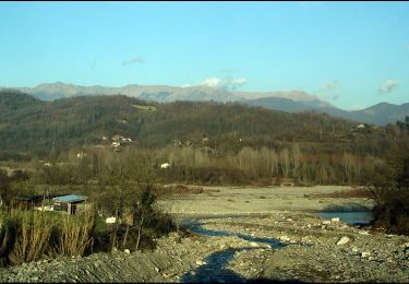
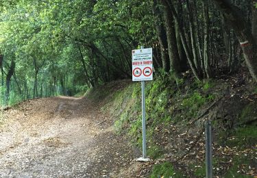
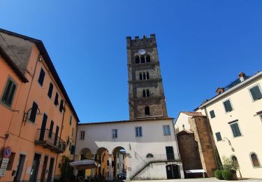
"Pozzuolo" da Gattaiola a Pozzuolo e ai Quattro Venti
SityTrail - itinéraires balisés pédestres
Tous les sentiers balisés d’Europe GUIDE+
![Lengte](/images/other/stat-length.png)
Lengte
3,6 km
![Max. hoogte](https://static1.geolcdn.com/siteimages/upload/files/1508320355ic_sort_altitude_max_24dp.png)
Max. hoogte
423 m
![Positief hoogteverschil](https://static1.geolcdn.com/siteimages/upload/files/1508320355ic_sort_den_pos_24dp.png)
Positief hoogteverschil
363 m
![Km-Effort](/images/other/stat-length.png)
Km-Effort
7,2 km
![Min. hoogte](https://static1.geolcdn.com/siteimages/upload/files/1508320355ic_sort_altitude_min_24dp.png)
Min. hoogte
59 m
![Negatief hoogteverschil](https://static1.geolcdn.com/siteimages/upload/files/1508320355ic_sort_den_neg_24dp.png)
Negatief hoogteverschil
1 m
![Boucle](https://static1.geolcdn.com/siteimages/upload/files/16400158638029165_repeat_loop_refresh_sync_direction_icon.png)
Boucle
Neen
Markering
Datum van aanmaak :
2022-02-15 03:48:24.775
Laatste wijziging :
2022-03-01 00:32:15.9
![Te voet](https://static1.geolcdn.com/sitytour/trail-icons/100.png)
1h38
Moeilijkheid : Gemakkelijk
![Scan deze QR-code om de tocht te openen in de SityTrail-applicatie](https://capi.geolives.com/qq0zvz2zws4bq2lad0pu/sitytour/trails/3114653/qr.png?size=200)
Gratisgps-wandelapplicatie
Over ons
Tocht Te voet van 3,6 km beschikbaar op Toscane, Lucca, Lucca. Deze tocht wordt voorgesteld door SityTrail - itinéraires balisés pédestres.
Beschrijving
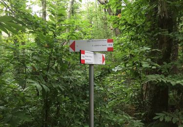
Trail created by Comune di Lucca.
Symbol: 110 on white red flag
Plaatsbepaling
Land:
Italy
Regio :
Toscane
Departement/Provincie :
Lucca
Gemeente :
Lucca
Locatie:
Unknown
Vertrek:(Dec)
Vertrek:(UTM)
618062 ; 4853569 (32T) N.
Opmerkingen
Wandeltochten in de omgeving
![Tocht Te voet Lucca - Variante Nord Via Francigena - Photo](https://media.geolcdn.com/t/375/260/45ec5329-93b2-46d8-8506-4b1e9cedeb33.jpeg&format=jpg&maxdim=2)
![Te voet Te voet](https://static1.geolcdn.com/sitytour/trail-icons/100.png)
Variante Nord Via Francigena
Te voet
Zeer moeilijk
Lucca,
Toscane,
Lucca,
Italy
![](/images/other/stat-length.png)
41 km | 52 km-effort
11h 45min
![](https://static1.geolcdn.com/siteimages/upload/files/16400158638029165_repeat_loop_refresh_sync_direction_icon.png)
Neen
![Tocht Te voet Lucca - Variante Sud Via Francigena - Photo](https://media.geolcdn.com/t/375/260/8c1eeb8c-9164-4827-9027-094c38fb2f43.jpeg&format=jpg&maxdim=2)
![Te voet Te voet](https://static1.geolcdn.com/sitytour/trail-icons/100.png)
Variante Sud Via Francigena
Te voet
Moeilijk
Lucca,
Toscane,
Lucca,
Italy
![](/images/other/stat-length.png)
30 km | 38 km-effort
8h 39min
![](https://static1.geolcdn.com/siteimages/upload/files/16400158638029165_repeat_loop_refresh_sync_direction_icon.png)
Neen
![Tocht Te voet Capannori -](https://media.geolcdn.com/t/375/260/9d5c8b14-eb17-4372-8997-95b3fc278cbb.jpeg&format=jpg&maxdim=2)
![Te voet Te voet](https://static1.geolcdn.com/sitytour/trail-icons/100.png)
"Anello di Vorno e Coselli"
Te voet
Gemakkelijk
Capannori,
Toscane,
Lucca,
Italy
![](/images/other/stat-length.png)
6,1 km | 10,1 km-effort
2h 17min
![](https://static1.geolcdn.com/siteimages/upload/files/16400158638029165_repeat_loop_refresh_sync_direction_icon.png)
Neen
![Tocht Te voet Lucca -](https://media.geolcdn.com/t/375/260/afe36829-8bd4-4198-a5c1-1eb320df1926.jpeg&format=jpg&maxdim=2)
![Te voet Te voet](https://static1.geolcdn.com/sitytour/trail-icons/100.png)
"Monte della Romagna" da Gattaiola a Casa Martello e ai Quattro Venti
Te voet
Gemakkelijk
Lucca,
Toscane,
Lucca,
Italy
![](/images/other/stat-length.png)
4 km | 8,8 km-effort
2h 0min
![](https://static1.geolcdn.com/siteimages/upload/files/16400158638029165_repeat_loop_refresh_sync_direction_icon.png)
Neen
![Tocht Stappen Lucca - CR_Francigena_CL_35_Lucques_Altopascio_20220619 - Photo](https://media.geolcdn.com/t/375/260/9c81f294-4d08-4e0d-b71c-c2ff0cfeff70.jpg&format=jpg&maxdim=2)
![Stappen Stappen](https://static1.geolcdn.com/sitytour/trail-icons/101.png)
CR_Francigena_CL_35_Lucques_Altopascio_20220619
Stappen
Heel gemakkelijk
Lucca,
Toscane,
Lucca,
Italy
![](/images/other/stat-length.png)
17,3 km | 18,7 km-effort
4h 24min
![](https://static1.geolcdn.com/siteimages/upload/files/16400158638029165_repeat_loop_refresh_sync_direction_icon.png)
Neen
![Tocht Te voet San Giuliano Terme -](https://media.geolcdn.com/t/375/260/bd1fe386-bd68-4337-a077-d731449a9a45.jpeg&format=jpg&maxdim=2)
![Te voet Te voet](https://static1.geolcdn.com/sitytour/trail-icons/100.png)
"Chiesino di Monte" da Molina di Quosa alle Croci di Vaccoli
Te voet
Gemakkelijk
San Giuliano Terme,
Toscane,
Pisa,
Italy
![](/images/other/stat-length.png)
3,2 km | 4,4 km-effort
1h 0min
![](https://static1.geolcdn.com/siteimages/upload/files/16400158638029165_repeat_loop_refresh_sync_direction_icon.png)
Neen
![Tocht Te voet Lucca -](https://media.geolcdn.com/t/375/260/afe36829-8bd4-4198-a5c1-1eb320df1926.jpeg&format=jpg&maxdim=2)
![Te voet Te voet](https://static1.geolcdn.com/sitytour/trail-icons/100.png)
"Castel Passerino" da Meati al Sacrario della Romagna
Te voet
Gemakkelijk
Lucca,
Toscane,
Lucca,
Italy
![](/images/other/stat-length.png)
5,4 km | 9,4 km-effort
2h 7min
![](https://static1.geolcdn.com/siteimages/upload/files/16400158638029165_repeat_loop_refresh_sync_direction_icon.png)
Neen
![Tocht Te voet Lucca -](https://media.geolcdn.com/t/375/260/ext.jpg?maxdim=2&url=https%3A%2F%2Fstatic1.geolcdn.com%2Fsiteimages%2Fupload%2Ffiles%2F1545311037marcheuse_200dpi.jpg)
![Te voet Te voet](https://static1.geolcdn.com/sitytour/trail-icons/100.png)
"San Cerbone" da Massa Pisana a Meati
Te voet
Gemakkelijk
Lucca,
Toscane,
Lucca,
Italy
![](/images/other/stat-length.png)
3,7 km | 6,2 km-effort
1h 24min
![](https://static1.geolcdn.com/siteimages/upload/files/16400158638029165_repeat_loop_refresh_sync_direction_icon.png)
Neen
![Tocht Stappen Lucca - variante-sud-via-francigena-lucca-altopascio-no-vorno - Photo](https://media.geolcdn.com/t/375/260/ext.jpg?maxdim=2&url=https%3A%2F%2Fstatic1.geolcdn.com%2Fsiteimages%2Fupload%2Ffiles%2F1553511878bg_sport_marche.png)
![Stappen Stappen](https://static1.geolcdn.com/sitytour/trail-icons/101.png)
variante-sud-via-francigena-lucca-altopascio-no-vorno
Stappen
Zeer moeilijk
Lucca,
Toscane,
Lucca,
Italy
![](/images/other/stat-length.png)
29 km | 37 km-effort
8h 25min
![](https://static1.geolcdn.com/siteimages/upload/files/16400158638029165_repeat_loop_refresh_sync_direction_icon.png)
Neen