![](/images/other/stat-length.png)
![Tocht Te voet La Spezia - Pegazzano – Biassa – S.Antonio – Schiara - Photo](https://media.geolcdn.com/t/1900/400/f5823fa0-46d8-488d-83ac-e0137eda51cf.jpeg&format=pjpeg&maxdim=2)
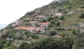
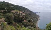
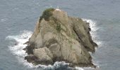
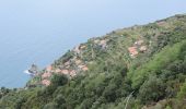
Pegazzano – Biassa – S.Antonio – Schiara
SityTrail - itinéraires balisés pédestres
Tous les sentiers balisés d’Europe GUIDE+
![Lengte](/images/other/stat-length.png)
Lengte
6 km
![Max. hoogte](https://static1.geolcdn.com/siteimages/upload/files/1508320355ic_sort_altitude_max_24dp.png)
Max. hoogte
522 m
![Positief hoogteverschil](https://static1.geolcdn.com/siteimages/upload/files/1508320355ic_sort_den_pos_24dp.png)
Positief hoogteverschil
367 m
![Km-Effort](/images/other/stat-length.png)
Km-Effort
11,2 km
![Min. hoogte](https://static1.geolcdn.com/siteimages/upload/files/1508320355ic_sort_altitude_min_24dp.png)
Min. hoogte
41 m
![Negatief hoogteverschil](https://static1.geolcdn.com/siteimages/upload/files/1508320355ic_sort_den_neg_24dp.png)
Negatief hoogteverschil
478 m
![Boucle](https://static1.geolcdn.com/siteimages/upload/files/16400158638029165_repeat_loop_refresh_sync_direction_icon.png)
Boucle
Neen
Markering
Datum van aanmaak :
2022-02-15 02:55:25.344
Laatste wijziging :
2022-02-28 23:52:37.294
![Te voet](https://static1.geolcdn.com/sitytour/trail-icons/100.png)
2h33
Moeilijkheid : Gemakkelijk
![Scan deze QR-code om de tocht te openen in de SityTrail-applicatie](https://capi.geolives.com/qq0zvz2zws4bq2lad0pu/sitytour/trails/3114328/qr.png?size=200)
Gratisgps-wandelapplicatie
Over ons
Tocht Te voet van 6 km beschikbaar op Ligurië, La Spezia, La Spezia. Deze tocht wordt voorgesteld door SityTrail - itinéraires balisés pédestres.
Beschrijving
relation mantained by AlfredoSP (CAI-SP)
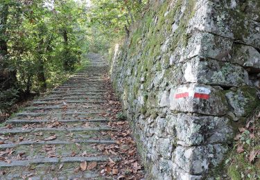
Symbol: some old white red flag
Website: https://www.cailaspezia.it/
Plaatsbepaling
Land:
Italy
Regio :
Ligurië
Departement/Provincie :
La Spezia
Gemeente :
La Spezia
Locatie:
Unknown
Vertrek:(Dec)
Vertrek:(UTM)
562962 ; 4880303 (32T) N.
Opmerkingen
Wandeltochten in de omgeving
![Tocht Te voet Riomaggiore - Sentiero Verde Azzurro: Riomaggiore - Monterosso - Photo](https://media.geolcdn.com/t/375/260/21e91162-0b70-4d8b-9c83-39f7fb798cc6.jpeg&format=jpg&maxdim=2)
![Te voet Te voet](https://static1.geolcdn.com/sitytour/trail-icons/100.png)
Sentiero Verde Azzurro: Riomaggiore - Monterosso
Te voet
Gemakkelijk
Riomaggiore,
Ligurië,
La Spezia,
Italy
![](/images/other/stat-length.png)
11,1 km | 19,5 km-effort
4h 25min
![](https://static1.geolcdn.com/siteimages/upload/files/16400158638029165_repeat_loop_refresh_sync_direction_icon.png)
Neen
![Tocht Te voet Riomaggiore - Alta Via delle 5 Terre: Portovenere - Monte Soviore - Foce di Dosso - Photo](https://media.geolcdn.com/t/375/260/456d2105-e49f-49c7-aec6-96ed27aa27d5.jpeg&format=jpg&maxdim=2)
![Te voet Te voet](https://static1.geolcdn.com/sitytour/trail-icons/100.png)
Alta Via delle 5 Terre: Portovenere - Monte Soviore - Foce di Dosso
Te voet
Medium
Riomaggiore,
Ligurië,
La Spezia,
Italy
![](/images/other/stat-length.png)
21 km | 30 km-effort
6h 53min
![](https://static1.geolcdn.com/siteimages/upload/files/16400158638029165_repeat_loop_refresh_sync_direction_icon.png)
Neen
![Tocht Te voet - Via Veneto – Vailunga – Toracca – Isola – Montalbano - Photo](https://media.geolcdn.com/t/375/260/99d9a183-7bc2-4487-a650-5aafb25f5f6b.jpeg&format=jpg&maxdim=2)
![Te voet Te voet](https://static1.geolcdn.com/sitytour/trail-icons/100.png)
Via Veneto – Vailunga – Toracca – Isola – Montalbano
Te voet
Gemakkelijk
,
Ligurië,
La Spezia,
Italy
![](/images/other/stat-length.png)
4,9 km | 8,8 km-effort
1h 59min
![](https://static1.geolcdn.com/siteimages/upload/files/16400158638029165_repeat_loop_refresh_sync_direction_icon.png)
Neen
![Tocht Te voet Portovenere - Isola Palmaria (giro dell'isola) - Photo](https://media.geolcdn.com/t/375/260/1c69b59e-f408-4789-9002-54b9defc08e9.jpeg&format=jpg&maxdim=2)
![Te voet Te voet](https://static1.geolcdn.com/sitytour/trail-icons/100.png)
Isola Palmaria (giro dell'isola)
Te voet
Gemakkelijk
Portovenere,
Ligurië,
La Spezia,
Italy
![](/images/other/stat-length.png)
6 km | 9,7 km-effort
2h 12min
![](https://static1.geolcdn.com/siteimages/upload/files/16400158638029165_repeat_loop_refresh_sync_direction_icon.png)
Ja
![Tocht Te voet La Spezia - Pegazzano - Mad. della Guardia – Cava d'Oro - Bivio Bramapane - Photo](https://media.geolcdn.com/t/375/260/9dac446e-79d3-4ca6-8d85-283e5c09b810.jpeg&format=jpg&maxdim=2)
![Te voet Te voet](https://static1.geolcdn.com/sitytour/trail-icons/100.png)
Pegazzano - Mad. della Guardia – Cava d'Oro - Bivio Bramapane
Te voet
Gemakkelijk
La Spezia,
Ligurië,
La Spezia,
Italy
![](/images/other/stat-length.png)
3,2 km | 9 km-effort
2h 2min
![](https://static1.geolcdn.com/siteimages/upload/files/16400158638029165_repeat_loop_refresh_sync_direction_icon.png)
Neen
![Tocht Te voet La Spezia - Fabiano – Mad.na dell'Olmo – Cà Pilloa – Sella Gesuela - Photo](https://media.geolcdn.com/t/375/260/64ba72ec-148f-4d90-a788-50975718b31b.jpeg&format=jpg&maxdim=2)
![Te voet Te voet](https://static1.geolcdn.com/sitytour/trail-icons/100.png)
Fabiano – Mad.na dell'Olmo – Cà Pilloa – Sella Gesuela
Te voet
Gemakkelijk
La Spezia,
Ligurië,
La Spezia,
Italy
![](/images/other/stat-length.png)
3,3 km | 5,1 km-effort
1h 10min
![](https://static1.geolcdn.com/siteimages/upload/files/16400158638029165_repeat_loop_refresh_sync_direction_icon.png)
Neen
![Tocht Te voet La Spezia - Fabiano - Coregna – Campiglia - Photo](https://media.geolcdn.com/t/375/260/9322ea24-9383-43e4-8931-62c9cd4041b0.jpeg&format=jpg&maxdim=2)
![Te voet Te voet](https://static1.geolcdn.com/sitytour/trail-icons/100.png)
Fabiano - Coregna – Campiglia
Te voet
Gemakkelijk
La Spezia,
Ligurië,
La Spezia,
Italy
![](/images/other/stat-length.png)
3,5 km | 7,5 km-effort
1h 42min
![](https://static1.geolcdn.com/siteimages/upload/files/16400158638029165_repeat_loop_refresh_sync_direction_icon.png)
Neen
![Tocht Te voet La Spezia - Acquasanta – Campiglia – P.ta Persico - Photo](https://media.geolcdn.com/t/375/260/f16ddc74-e4df-42e2-90d6-74322ced9089.jpeg&format=jpg&maxdim=2)
![Te voet Te voet](https://static1.geolcdn.com/sitytour/trail-icons/100.png)
Acquasanta – Campiglia – P.ta Persico
Te voet
Gemakkelijk
La Spezia,
Ligurië,
La Spezia,
Italy
![](/images/other/stat-length.png)
4,2 km | 9,3 km-effort
2h 6min
![](https://static1.geolcdn.com/siteimages/upload/files/16400158638029165_repeat_loop_refresh_sync_direction_icon.png)
Neen
![Tocht Te voet Riomaggiore - Campiglia - Fossola - S.P. 370 Litoranea - Photo](https://media.geolcdn.com/t/375/260/e0935cd3-7ec4-41f0-b418-114728662a38.jpeg&format=jpg&maxdim=2)
![Te voet Te voet](https://static1.geolcdn.com/sitytour/trail-icons/100.png)
Campiglia - Fossola - S.P. 370 Litoranea
Te voet
Gemakkelijk
Riomaggiore,
Ligurië,
La Spezia,
Italy
![](/images/other/stat-length.png)
3,7 km | 6,3 km-effort
1h 26min
![](https://static1.geolcdn.com/siteimages/upload/files/16400158638029165_repeat_loop_refresh_sync_direction_icon.png)
Neen