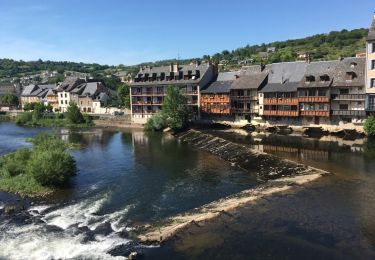
22 km | 32 km-effort
La Chapelle de Servières
SityTrail - itinéraires balisés pédestres
Tous les sentiers balisés d’Europe GUIDE+
Lengte
5,6 km
Max. hoogte
541 m
Positief hoogteverschil
69 m
Km-Effort
7,2 km
Min. hoogte
305 m
Negatief hoogteverschil
276 m
Boucle
Neen
Markering
Datum van aanmaak :
2022-02-15 02:45:53.24
Laatste wijziging :
2022-03-02 11:37:29.916
1h38
Moeilijkheid : Gemakkelijk
Gratisgps-wandelapplicatie
Over ons
Tocht Te voet van 5,6 km beschikbaar op Occitanië, Aveyron, Mouret. Deze tocht wordt voorgesteld door SityTrail - itinéraires balisés pédestres.
Plaatsbepaling
Land:
France
Regio :
Occitanië
Departement/Provincie :
Aveyron
Gemeente :
Mouret
Locatie:
Unknown
Vertrek:(Dec)
Vertrek:(UTM)
464635 ; 4933051 (31T) N.
Opmerkingen
Wandeltochten in de omgeving
Massip Conques Avril 2018
Stappen
Medium
Golinhac,
Occitanië,
Aveyron,
France
23 km | 31 km-effort
6h 6min
Neen
Le Plateau de Campuac
Te voet
Gemakkelijk
Campuac,
Occitanië,
Aveyron,
France
7,6 km | 9 km-effort
2h 2min
Neen
Villecomtal dans le 12
Elektrische fiets
Muret-le-Château,
Occitanië,
Aveyron,
France
5,7 km | 6,8 km-effort
21min
Neen
golinhac conques
Stappen
Medium
Golinhac,
Occitanië,
Aveyron,
France
25 km | 33 km-effort
8h 29min
Neen
Atlamed campuac - espalion
Andere activiteiten
Heel gemakkelijk
Campuac,
Occitanië,
Aveyron,
France
26 km | 35 km-effort
6h 6min
Neen
StJ-J21-Massip-Conques
Stappen
Zeer moeilijk
Golinhac,
Occitanië,
Aveyron,
France
23 km | 30 km-effort
6h 17min
Neen
Site VTT FFC - Gorges Lot et Truyère - Circuit n°1 Les Deux Clochers
Mountainbike
Moeilijk
Campuac,
Occitanië,
Aveyron,
France
25 km | 31 km-effort
1h 45min
Ja
Campuac à Conques
Stappen
Moeilijk
Campuac,
Occitanië,
Aveyron,
France
22 km | 30 km-effort
7h 5min
Neen