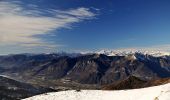
![](/images/other/stat-length.png)
![Tocht Te voet Bienno - Via del Silter - Photo](https://media.geolcdn.com/t/1900/400/ca658479-0a7e-45bd-853c-4ae530e0c98c.jpeg&format=pjpeg&maxdim=2)
Via del Silter
SityTrail - itinéraires balisés pédestres
Tous les sentiers balisés d’Europe GUIDE+
![Lengte](/images/other/stat-length.png)
Lengte
71 km
![Max. hoogte](https://static1.geolcdn.com/siteimages/upload/files/1508320355ic_sort_altitude_max_24dp.png)
Max. hoogte
2076 m
![Positief hoogteverschil](https://static1.geolcdn.com/siteimages/upload/files/1508320355ic_sort_den_pos_24dp.png)
Positief hoogteverschil
3708 m
![Km-Effort](/images/other/stat-length.png)
Km-Effort
121 km
![Min. hoogte](https://static1.geolcdn.com/siteimages/upload/files/1508320355ic_sort_altitude_min_24dp.png)
Min. hoogte
1155 m
![Negatief hoogteverschil](https://static1.geolcdn.com/siteimages/upload/files/1508320355ic_sort_den_neg_24dp.png)
Negatief hoogteverschil
3712 m
![Boucle](https://static1.geolcdn.com/siteimages/upload/files/16400158638029165_repeat_loop_refresh_sync_direction_icon.png)
Boucle
Ja
Markering
Datum van aanmaak :
2022-02-15 02:41:10.455
Laatste wijziging :
2022-02-28 23:30:43.208
![Te voet](https://static1.geolcdn.com/sitytour/trail-icons/100.png)
27h26
Moeilijkheid : Zeer moeilijk
![Scan deze QR-code om de tocht te openen in de SityTrail-applicatie](https://capi.geolives.com/qq0zvz2zws4bq2lad0pu/sitytour/trails/3114209/qr.png?size=200)
Gratisgps-wandelapplicatie
Over ons
Tocht Te voet van 71 km beschikbaar op Lombardije, Brescia, Bienno. Deze tocht wordt voorgesteld door SityTrail - itinéraires balisés pédestres.
Beschrijving
Trail created by Ente Regionale per i Servizi all'Agricoltura e alle Foreste.
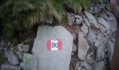
Symbol: VdS on white red flag
Plaatsbepaling
Land:
Italy
Regio :
Lombardije
Departement/Provincie :
Brescia
Gemeente :
Bienno
Locatie:
Unknown
Vertrek:(Dec)
Vertrek:(UTM)
606287 ; 5084703 (32T) N.
Opmerkingen
Wandeltochten in de omgeving
![Tocht Te voet Breno - Valle Dorizzo - Passo Croce Domini - Photo](https://media.geolcdn.com/t/375/260/b50262c8-420f-4ce3-88c3-6100bf4cbcd1.jpeg&format=jpg&maxdim=2)
![Te voet Te voet](https://static1.geolcdn.com/sitytour/trail-icons/100.png)
Valle Dorizzo - Passo Croce Domini
Te voet
Gemakkelijk
Breno,
Lombardije,
Brescia,
Italy
![](/images/other/stat-length.png)
5,4 km | 7,8 km-effort
1h 46min
![](https://static1.geolcdn.com/siteimages/upload/files/16400158638029165_repeat_loop_refresh_sync_direction_icon.png)
Neen
![Tocht Te voet Breno - Malga Cadino - Lago della Vacca - Photo](https://media.geolcdn.com/t/375/260/9db06b6d-0222-49d8-9132-6c232c3f85c7.jpeg&format=jpg&maxdim=2)
![Te voet Te voet](https://static1.geolcdn.com/sitytour/trail-icons/100.png)
Malga Cadino - Lago della Vacca
Te voet
Gemakkelijk
Breno,
Lombardije,
Brescia,
Italy
![](/images/other/stat-length.png)
6 km | 11,9 km-effort
2h 41min
![](https://static1.geolcdn.com/siteimages/upload/files/16400158638029165_repeat_loop_refresh_sync_direction_icon.png)
Neen
![Tocht Te voet Collio - Bienno (Sesa di Sotto) - Passo Dasdana - Photo](https://media.geolcdn.com/t/375/260/09adc4a9-9c52-4c5b-953b-07725bb1a4f8.jpeg&format=jpg&maxdim=2)
![Te voet Te voet](https://static1.geolcdn.com/sitytour/trail-icons/100.png)
Bienno (Sesa di Sotto) - Passo Dasdana
Te voet
Gemakkelijk
Collio,
Lombardije,
Brescia,
Italy
![](/images/other/stat-length.png)
4,6 km | 8,9 km-effort
2h 0min
![](https://static1.geolcdn.com/siteimages/upload/files/16400158638029165_repeat_loop_refresh_sync_direction_icon.png)
Neen
![Tocht Te voet Bienno - IT-5 - Photo](https://media.geolcdn.com/t/375/260/a782a186-e015-4aa3-bd2a-2a550144a78b.jpeg&format=jpg&maxdim=2)
![Te voet Te voet](https://static1.geolcdn.com/sitytour/trail-icons/100.png)
![Tocht Te voet Bienno - IT-4 - Photo](https://media.geolcdn.com/t/375/260/a782a186-e015-4aa3-bd2a-2a550144a78b.jpeg&format=jpg&maxdim=2)
![Te voet Te voet](https://static1.geolcdn.com/sitytour/trail-icons/100.png)
![Tocht Te voet Bienno - IT-2 - Photo](https://media.geolcdn.com/t/375/260/2f682b91-bc53-4420-aab2-8319949d1414.jpeg&format=jpg&maxdim=2)
![Te voet Te voet](https://static1.geolcdn.com/sitytour/trail-icons/100.png)
![Tocht Te voet Bienno - IT-1 - Photo](https://media.geolcdn.com/t/375/260/a782a186-e015-4aa3-bd2a-2a550144a78b.jpeg&format=jpg&maxdim=2)
![Te voet Te voet](https://static1.geolcdn.com/sitytour/trail-icons/100.png)
![Tocht Te voet Bienno - Bagolino (Ponte Destrone) - La Grapa di Vaia - Photo](https://media.geolcdn.com/t/375/260/760fa961-d0f3-4459-855f-703cd0f9af66.jpeg&format=jpg&maxdim=2)
![Te voet Te voet](https://static1.geolcdn.com/sitytour/trail-icons/100.png)
Bagolino (Ponte Destrone) - La Grapa di Vaia
Te voet
Gemakkelijk
Bienno,
Lombardije,
Brescia,
Italy
![](/images/other/stat-length.png)
9,6 km | 14,2 km-effort
3h 14min
![](https://static1.geolcdn.com/siteimages/upload/files/16400158638029165_repeat_loop_refresh_sync_direction_icon.png)
Neen
![Tocht Te voet Bienno - IT-795 - Photo](https://media.geolcdn.com/t/375/260/79c5a87c-1adf-4aec-9a08-fd8eaba7d500.jpeg&format=jpg&maxdim=2)
![Te voet Te voet](https://static1.geolcdn.com/sitytour/trail-icons/100.png)